Directions to Rust St / 56th (Queens) with public transportation
The following transit lines have routes that pass near Rust St / 56th
 Bus: Q18, Q39, Q59, Q60, Q67.
- Train: BABYLON BRANCH, FAR ROCKAWAY BRANCH, LONG BEACH BRANCH, PORT WASHINGTON BRANCH, WEST HEMPSTEAD BRANCH.
- Subway: 7, 7X, D, L.
How to get to Rust St / 56th by bus?
Click on the bus route to see step by step directions with maps, line arrival times and updated time schedules.
From New Amsterdam Theatre, Manhattan
72 minFrom St. John's University, Queens
82 minFrom East 80th Street, Manhattan
61 minFrom 165-08 88th Avenue, Queens
76 minFrom Jury Duty 111 Centre Street, Manhattan
69 minFrom Apollo Theater, Manhattan
101 minFrom NYC Diamond District, Manhattan
57 minFrom Hard Rock Hotel New York, Manhattan
68 minFrom The Bronx Zoo, Bronx
116 minFrom Hudson Street, Jersey City
131 min
How to get to Rust St / 56th by train?
Click on the train route to see step by step directions with maps, line arrival times and updated time schedules.
From New Amsterdam Theatre, Manhattan
61 minFrom 165-08 88th Avenue, Queens
71 minFrom Jury Duty 111 Centre Street, Manhattan
125 minFrom Hudson Street, Jersey City
88 minFrom Apollo Theater, Manhattan
93 minFrom NYC Diamond District, Manhattan
63 minFrom Hard Rock Hotel New York, Manhattan
69 minFrom The Bronx Zoo, Bronx
102 min
How to get to Rust St / 56th by subway?
Click on the subway route to see step by step directions with maps, line arrival times and updated time schedules.
From New Amsterdam Theatre, Manhattan
53 minFrom St. John's University, Queens
87 minFrom East 80th Street, Manhattan
67 minFrom 165-08 88th Avenue, Queens
66 minFrom Jury Duty 111 Centre Street, Manhattan
60 minFrom Apollo Theater, Manhattan
71 minFrom NYC Diamond District, Manhattan
57 minFrom Hard Rock Hotel New York, Manhattan
54 minFrom The Bronx Zoo, Bronx
82 min
Subway stations near Rust St / 56th in Queens
Bus stops near Rust St / 56th in Queens
Bus lines to Rust St / 56th in Queens
What are the closest stations to Rust St / 56th?
The closest stations to Rust St / 56th are:
- 46 St-Bliss St is 217 yards away, 3 min walk.
- Maurice Av/Maspeth Av is 306 yards away, 4 min walk.
- Grand Av/Rust St is 606 yards away, 8 min walk.
- Jefferson St is 723 yards away, 9 min walk.
- 55 Av/48 St is 874 yards away, 11 min walk.
Which bus lines stop near Rust St / 56th?
These bus lines stop near Rust St / 56th: Q18, Q39, Q59, Q60.
Which train lines stop near Rust St / 56th?
These train lines stop near Rust St / 56th: BABYLON BRANCH, FAR ROCKAWAY BRANCH, LONG BEACH BRANCH, PORT WASHINGTON BRANCH, WEST HEMPSTEAD BRANCH.
Which subway lines stop near Rust St / 56th?
These subway lines stop near Rust St / 56th: 7, 7X, D, L.
What’s the nearest subway station to Rust St / 56th in Queens?
The nearest subway station to Rust St / 56th in Queens is 46 St-Bliss St. It’s a 3 min walk away.
What’s the nearest bus station to Rust St / 56th in Queens?
The nearest bus station to Rust St / 56th in Queens is Maurice Av/Maspeth Av. It’s a 4 min walk away.
What time is the first subway to Rust St / 56th in Queens?
The L is the first subway that goes to Rust St / 56th in Queens. It stops nearby at 3:01 AM.
What time is the last subway to Rust St / 56th in Queens?
The 7 is the last subway that goes to Rust St / 56th in Queens. It stops nearby at 3:15 AM.
What time is the first bus to Rust St / 56th in Queens?
The Q39 is the first bus that goes to Rust St / 56th in Queens. It stops nearby at 3:03 AM.
What time is the last bus to Rust St / 56th in Queens?
The Q39 is the last bus that goes to Rust St / 56th in Queens. It stops nearby at 3:08 AM.
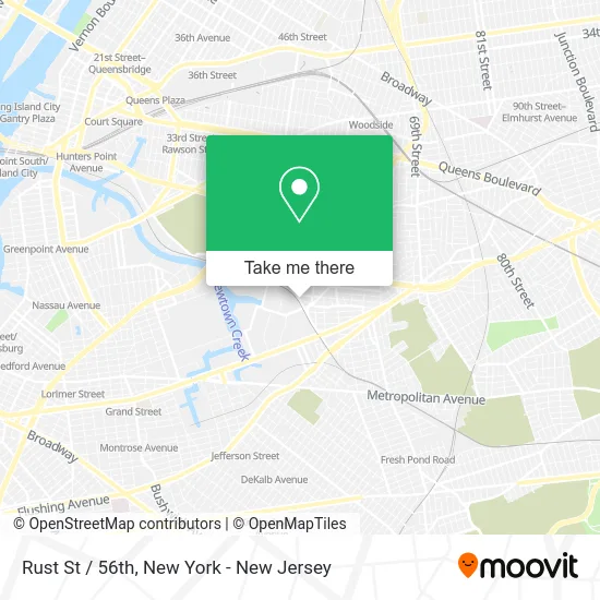
See Rust St / 56th, Queens, on the map
Public Transit to Rust St / 56th in Queens
Wondering how to get to Rust St / 56th in Queens? Moovit helps you find the best way to get to Rust St / 56th with step-by-step directions from the nearest public transit station.
Moovit provides free maps and live directions to help you navigate through your city. View schedules, routes, timetables, and find out how long does it take to get to Rust St / 56th in real time.
Looking for the nearest stop or station to Rust St / 56th? Check out this list of stops closest to your destination: 46 St-Bliss St; Maurice Av/Maspeth Av; Grand Av/Rust St; Jefferson St; 55 Av/48 St.
Bus: Q18, Q39, Q59, Q60, Q67.Train: BABYLON BRANCH, FAR ROCKAWAY BRANCH, LONG BEACH BRANCH, PORT WASHINGTON BRANCH, WEST HEMPSTEAD BRANCH.Subway: 7, 7X, D, L.
Want to see if there’s another route that gets you there at an earlier time? Moovit helps you find alternative routes or times. Get directions from and directions to Rust St / 56th easily from the Moovit App or Website.
We make riding to Rust St / 56th easy, which is why over 1.5 million users, including users in Queens, trust Moovit as the best app for public transit. You don’t need to download an individual bus app or train app, Moovit is your all-in-one transit app that helps you find the best bus time or train time available.
For information on prices of bus, subway and train, costs and ride fares to Rust St / 56th, please check the Moovit app.
Use the app to navigate to popular places including to the airport, hospital, stadium, grocery store, mall, coffee shop, school, college, and university.
Rust St / 56th Address: Maspeth, NY 11378 street in Queens
- Pran Foods America,
- Ontime Distribution Inc.,
- Asia Foods Distributors Inc.,
- Kas International Trading Corporation,
- Nyc American Steel Contracting,
- Top Grade Products Inc,
- Blenzia-,
- Goodfellas,
- Majestic Hall,
- Empire Smoke Distributors,
- Maspeth, NY,
- Maurice Ave (maurice ave maspeth),
- Sea Star Food Usa,
- Maspeth,
- Flushing,
- Gio Tires,
- New Hoque and Sons Corporation,
- Topgrade Products,
- Angelo's Pizza Y Mas,
- Angelo's Pizza on Maspeth Ave
Places Near Rust St / 56th (Queens)
- 3 Stone St, Manhattan,
- Times Square, Manhattan,
- Katz's Deli, Manhattan,
- Pier 83, Manhattan,
- Chinatown, Manhattan,
- 26 Federal Plaza, Manhattan,
- Bellevue Hospital, Manhattan,
- Queens Center Mall, Queens,
- Hudson Yards, Manhattan,
- qqqq, Manhattan,
- San Gennaro Feast, Manhattan,
- 66 John Street, Manhattan,
- 376 Hudson Street, Manhattan,
- 111 Centre New York City Supreme Court, Manhattan,
- Rockefeller Center, Manhattan,
- Mountainside Hospital, Glen Ridge,
- Wall Street, Manhattan,
- 911 Memorial, Manhattan,
- SoHo, Manhattan,
- 1 Police Plaza, Manhattan
How to get to popular places in New York - New Jersey with public transit
Get around Queens by public transit!
Traveling around Queens has never been so easy. See step by step directions as you travel to any attraction, street or major public transit station. View bus and train schedules, arrival times, service alerts and detailed routes on a map, so you know exactly how to get to anywhere in Queens.
When traveling to any destination around Queens use Moovit's Live Directions with Get Off Notifications to know exactly where and how far to walk, how long to wait for your line, and how many stops are left. Moovit will alert you when it's time to get off — no need to constantly re-check whether yours is the next stop.
Wondering how to use public transit in Queens or how to pay for public transit in Queens? Moovit public transit app can help you navigate your way with public transit easily, and at minimum cost. It includes public transit fees, ticket prices, and costs. Looking for a map of Queens public transit lines? Moovit public transit app shows all public transit maps in Queens with all Bus, Train, Subway, Light Rail, Ferry and Cable Car routes and stops on an interactive map.
New York - New Jersey has 6 transit type(s), including: Bus, Train, Subway, Light Rail, Ferry and Cable Car, operated by several transit agencies, including MTA Subway, Metro-North Railroad, LIRR, PATH, MTA New York City Transit - Express routes, MTA Bus, NJ Transit, NYC Ferry, NICE bus, Bee-Line Bus, NJ Transit Rail, Norwalk Transit District, Hartford Line, River Valley Transit and HART