How to get to Rusta by bus?
Click on the bus route to see step by step directions with maps, line arrival times and updated time schedules.
From Ravnedalen, Kristiansand
149 minFrom Sørlandet Sykehus Kristiansand, Kristiansand
135 minFrom Sparebanken Sør Arena, Kristiansand
141 minFrom Roligheden Camping, Kristiansand
144 minFrom Jens Arve Stray Konkursbo, Kristiansand
151 minFrom Color Line Ferry Terminal, Kristiansand
124 minFrom Scandic Hotell Bystranda, Kristiansand
126 minFrom Sukkevann Kunstgressbane, Kristiansand
144 minFrom Aquarama, Kristiansand
126 min
Bus stops near Rusta in Lyngdal
Bus lines to Rusta in Lyngdal
What are the closest stations to Rusta?
The closest stations to Rusta are:
- Oftebro is 366 meters away, 5 min walk.
- Presthølen is 506 meters away, 7 min walk.
- Rom Terminal is 762 meters away, 10 min walk.
Which bus line stops near Rusta?
200 (Mandal - Lyngdal)
What’s the nearest bus station to Rusta in Lyngdal?
The nearest bus station to Rusta in Lyngdal is Oftebro. It’s a 5 min walk away.
What time is the first bus to Rusta in Lyngdal?
The 200 is the first bus that goes to Rusta in Lyngdal. It stops nearby at 7:08 AM.
What time is the last bus to Rusta in Lyngdal?
The 200 is the last bus that goes to Rusta in Lyngdal. It stops nearby at 12:00 AM.
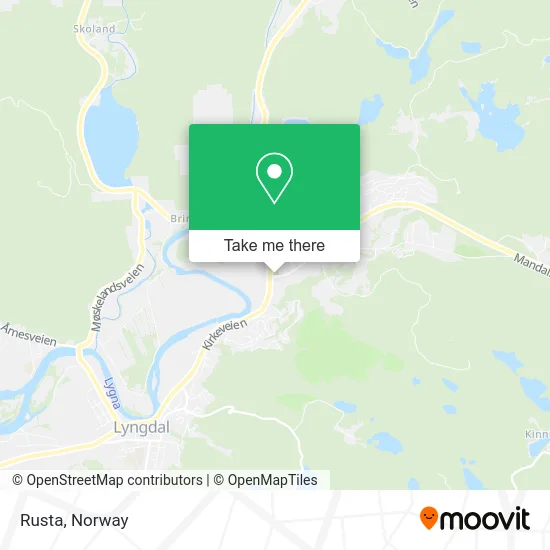
See Rusta, Lyngdal, on the map
Public Transit to Rusta in Lyngdal
Wondering how to get to Rusta in Lyngdal? Moovit helps you find the best way to get to Rusta with step-by-step directions from the nearest public transit station.
Moovit provides free maps and live directions to help you navigate through your city. View schedules, routes, timetables, and find out how long does it take to get to Rusta in real time.
Looking for the nearest stop or station to Rusta? Check out this list of stops closest to your destination: Oftebro; Presthølen; Rom Terminal.
Bus: 200, 230, 237, 250, 2330, 411, 417, F5, NW192, FX650.
Want to see if there’s another route that gets you there at an earlier time? Moovit helps you find alternative routes or times. Get directions from and directions to Rusta easily from the Moovit App or Website.
We make riding to Rusta easy, which is why over 1.5 million users, including users in Lyngdal, trust Moovit as the best app for public transit. You don’t need to download an individual bus app or train app, Moovit is your all-in-one transit app that helps you find the best bus time or train time available.
For information on prices of bus, costs and ride fares to Rusta, please check the Moovit app.
Use the app to navigate to popular places including to the airport, hospital, stadium, grocery store, mall, coffee shop, school, college, and university.
Rusta Address: Fiboveien 4580 Rom street in Lyngdal
- Eurosko Lyngdal,
- Lyngdal Misjonsmenighet,
- Jarl Solås,
- Gjenvinning Sør-Vest,
- Marita Kvinlaug,
- Spjelkaviknes Møbelfabrikk Tørner Sådland,
- Snarkjøp,
- Svinstad Sverre Magne,
- Lysebotn Fjord,
- Lyngdal Trafo,
- Eviny,
- Lindland Maskin,
- Wlg Media,
- Shell,
- Yx,
- Obs,
- Bevar Meg Vel H,
- Edgars Bakeri,
- Mx Sport Lyngdal AS,
- Sentrumsgården Lyngdal
Places Near Rusta (Lyngdal)
- Nylandsbrua, Oslo,
- Ikea Leangen, Trondheim,
- Jekta Storsenter, Tromsø,
- Voldsløkka, Oslo,
- Ullevål Stadion (T), Oslo,
- Haukeland Universitetssjukehus, Bergen,
- Quality Hotel Edvard Grieg, Bergen,
- IKEA, Oslo,
- Lovisenberg Diakonale Sykehus, Oslo,
- Bjerke Travbane, Oslo,
- Tyholttårnet, Trondheim,
- IKEA, Bergen,
- Vestby Outlet Store, Vestby,
- Ulriken, Bergen,
- Rikshospitalet (trikk), Oslo,
- Oslo S spor 19 (Trelastgata), Oslo,
- DFDS Seaways, Oslo,
- Drammen Sykehus, Drammen,
- Color Line Terminal, Oslo,
- Radiumhospitalet, Oslo
How to get to popular places in Norway with public transit
Get around Lyngdal by public transit!
Traveling around Lyngdal has never been so easy. See step by step directions as you travel to any attraction, street or major public transit station. View bus and train schedules, arrival times, service alerts and detailed routes on a map, so you know exactly how to get to anywhere in Lyngdal.
When traveling to any destination around Lyngdal use Moovit's Live Directions with Get Off Notifications to know exactly where and how far to walk, how long to wait for your line, and how many stops are left. Moovit will alert you when it's time to get off — no need to constantly re-check whether yours is the next stop.
Wondering how to use public transit in Lyngdal or how to pay for public transit in Lyngdal? Moovit public transit app can help you navigate your way with public transit easily, and at minimum cost. It includes public transit fees, ticket prices, and costs. Looking for a map of Lyngdal public transit lines? Moovit public transit app shows all public transit maps in Lyngdal with all Bus, Train, Subway, Light Rail, Ferry and Cable Car routes and stops on an interactive map.
Norway has 6 transit type(s), including: Bus, Train, Subway, Light Rail, Ferry and Cable Car, operated by several transit agencies, including Ruter, Skyss, AtB, Flytoget, Vy Tåg, SJ, Go-Ahead Norge AS, SJ Nord, Vestfold Kollektivtrafikk as, Snelandia, Innlandstrafikk, FRAM, FlixBus, Kolumbus and Brakar