How to get to Rustcraftrix by bus?
Click on the bus route to see step by step directions with maps, line arrival times and updated time schedules.
From Harlem, Manhattan
64 minFrom Glendale, NY, Queens
70 minFrom E 70th St and 2nd, Manhattan
47 minFrom Columbia University, Manhattan
80 minFrom 520 E 70th St, Manhattan
51 minFrom Macy's, Queens
44 minFrom Harlem Hospital, Manhattan
70 minFrom North Bergen, NJ, North Bergen
68 minFrom Hudson Mall, Jersey City
102 min
How to get to Rustcraftrix by train?
Click on the train route to see step by step directions with maps, line arrival times and updated time schedules.
How to get to Rustcraftrix by subway?
Click on the subway route to see step by step directions with maps, line arrival times and updated time schedules.
Subway stations near Rustcraftrix in Manhattan
Bus stops near Rustcraftrix in Manhattan
Bus lines to Rustcraftrix in Manhattan
- M1, Soho Centre St Via 5 Av/ Via Broadway,VIEW
- M55, South Ferry,VIEW
- SIM7, Eltvlle Trans Ctr Via Hylan Via Richmond,VIEW
- SIM9, Eltingville Via F Cap Via Hylan Bl,VIEW
- SIM33, Mariners Harbor Via N Gannon Av,VIEW
- SIM33C, Mariners Harbor Via N Gannon Av,VIEW
- M2, Washington Heights - East Village,VIEW
- M3, Fort George - East Village,VIEW
- M8, West Village - East Village,VIEW
- X27, Bay Ridge Shore Rd Via Broadway,VIEW
- X28, Coney Island Sea Gate Via Broadway,VIEW
- SIM1C, Eltngvlle Trans Ctr Via Hylan Via Rich,VIEW
- SIM3C, Pt Rchmnd Via Narrows Rd N Via Watchogue,VIEW
- SIM4C, Huguenot Via Richmond Av Via Arthur Kill,VIEW
- DOWNTOWN LOCAL, W Houston & Mercer St,VIEW
- SHORTLINE HUDSON, 500 - Monroe - Chester - Goshen,VIEW
- SHORTLINE HUDSON, 200 - Northern District – Nanuet,VIEW
- SHORTLINE HUDSON, 800 - Pennsylvania,VIEW
- SHORTLINE HUDSON, 700 - Newburgh - Poughkeepsie,VIEW
- SHORTLINE HUDSON, 300 - NYC - Middletown,VIEW
What are the closest stations to Rustcraftrix?
The closest stations to Rustcraftrix are:
- W 4 St-Wash Sq is 172 yards away, 3 min walk.
- Broadway/Waverly Pl is 245 yards away, 3 min walk.
- E 8 St/University Pl is 255 yards away, 3 min walk.
- Broadway & Waverly Pl is 271 yards away, 4 min walk.
- Broadway & W 3rd St is 351 yards away, 5 min walk.
- Astor Pl is 541 yards away, 7 min walk.
- 8 St-Nyu is 759 yards away, 9 min walk.
Which bus lines stop near Rustcraftrix?
These bus lines stop near Rustcraftrix: M1, M15, M2, M3, X27.
Which train lines stop near Rustcraftrix?
These train lines stop near Rustcraftrix: BLU, YEL.
Which subway lines stop near Rustcraftrix?
These subway lines stop near Rustcraftrix: B, D, M, R, W.
What’s the nearest subway station to Rustcraftrix in Manhattan?
The nearest subway station to Rustcraftrix in Manhattan is W 4 St-Wash Sq. It’s a 3 min walk away.
What’s the nearest bus station to Rustcraftrix in Manhattan?
The nearest bus stations to Rustcraftrix in Manhattan are Broadway/Waverly Pl and E 8 St/University Pl. The closest one is a 3 min walk away.
What time is the first subway to Rustcraftrix in Manhattan?
The E is the first subway that goes to Rustcraftrix in Manhattan. It stops nearby at 3:03 AM.
What time is the last subway to Rustcraftrix in Manhattan?
The F is the last subway that goes to Rustcraftrix in Manhattan. It stops nearby at 3:55 AM.
What time is the first bus to Rustcraftrix in Manhattan?
The M2 is the first bus that goes to Rustcraftrix in Manhattan. It stops nearby at 3:00 AM.
What time is the last bus to Rustcraftrix in Manhattan?
The M2 is the last bus that goes to Rustcraftrix in Manhattan. It stops nearby at 3:01 AM.
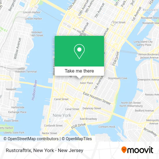
See Rustcraftrix, Manhattan, on the map
Public Transit to Rustcraftrix in Manhattan
Wondering how to get to Rustcraftrix in Manhattan? Moovit helps you find the best way to get to Rustcraftrix with step-by-step directions from the nearest public transit station.
Moovit provides free maps and live directions to help you navigate through your city. View schedules, routes, timetables, and find out how long does it take to get to Rustcraftrix in real time.
Looking for the nearest stop or station to Rustcraftrix? Check out this list of stops closest to your destination: W 4 St-Wash Sq; Broadway/Waverly Pl; E 8 St/University Pl; Broadway & Waverly Pl; Broadway & W 3rd St; Astor Pl; 8 St-Nyu.
Bus: M1, M15, M2, M3, X27, M55, SIM7, SIM9, SIM33, SIM33C, M8.Train: BLU, YEL.Subway: B, D, M, R, W, A, C, E, 4, 6, 6X, N, Q.
Want to see if there’s another route that gets you there at an earlier time? Moovit helps you find alternative routes or times. Get directions from and directions to Rustcraftrix easily from the Moovit App or Website.
We make riding to Rustcraftrix easy, which is why over 1.5 million users, including users in Manhattan, trust Moovit as the best app for public transit. You don’t need to download an individual bus app or train app, Moovit is your all-in-one transit app that helps you find the best bus time or train time available.
For information on prices of subway, bus and train, costs and ride fares to Rustcraftrix, please check the Moovit app.
Use the app to navigate to popular places including to the airport, hospital, stadium, grocery store, mall, coffee shop, school, college, and university.
Rustcraftrix Address: Brown Building, 29 Washington Pl street in Manhattan
- Psy Flux,
- Crheo - Center For Research on Higher Education Outcomes,
- Emily Brooks,
- Nyu Entrepreneurial Institute,
- Nyu Faces Lab,
- Wildx Usa,
- Wingo 777,
- Spokd,
- The Growth Lab,
- Nyu College Of Arts and Science Advising Center,
- Ybb Pr, Policy, Social Advisory & Public Strategy Firm.,
- Steinhardt Usg,
- Nyu Pless Hall,
- Nyu Steinhardt Office Of Global Programs and Study Abroad,
- Bark & Beyond,
- Infant Studies Of Language and Neurocognitive Development,
- Nyu Changemaker Center,
- New York University Art History,
- Nyu Silver Center Graduate Commons,
- NYU Kimball Hall
Places Near Rustcraftrix (Manhattan)
- San Gennaro Feast, Manhattan,
- 26 Federal Plaza, Manhattan,
- Wall Street, Manhattan,
- Times Square, Manhattan,
- Mountainside Hospital, Glen Ridge,
- qqqq, Manhattan,
- Hudson Yards, Manhattan,
- 66 John Street, Manhattan,
- Bellevue Hospital, Manhattan,
- SoHo, Manhattan,
- 1 Police Plaza, Manhattan,
- Katz's Deli, Manhattan,
- Queens Center Mall, Queens,
- 911 Memorial, Manhattan,
- Rockefeller Center, Manhattan,
- 111 Centre New York City Supreme Court, Manhattan,
- Chinatown, Manhattan,
- 3 Stone St, Manhattan,
- Pier 83, Manhattan,
- 376 Hudson Street, Manhattan
How to get to popular places in New York - New Jersey with public transit
Get around Manhattan by public transit!
Traveling around Manhattan has never been so easy. See step by step directions as you travel to any attraction, street or major public transit station. View bus and train schedules, arrival times, service alerts and detailed routes on a map, so you know exactly how to get to anywhere in Manhattan.
When traveling to any destination around Manhattan use Moovit's Live Directions with Get Off Notifications to know exactly where and how far to walk, how long to wait for your line, and how many stops are left. Moovit will alert you when it's time to get off — no need to constantly re-check whether yours is the next stop.
Wondering how to use public transit in Manhattan or how to pay for public transit in Manhattan? Moovit public transit app can help you navigate your way with public transit easily, and at minimum cost. It includes public transit fees, ticket prices, and costs. Looking for a map of Manhattan public transit lines? Moovit public transit app shows all public transit maps in Manhattan with all Bus, Train, Subway, Light Rail, Ferry and Cable Car routes and stops on an interactive map.
New York - New Jersey has 6 transit type(s), including: Bus, Train, Subway, Light Rail, Ferry and Cable Car, operated by several transit agencies, including MTA Subway, Metro-North Railroad, LIRR, PATH, MTA New York City Transit - Express routes, MTA Bus, NJ Transit, NYC Ferry, NICE bus, Bee-Line Bus, NJ Transit Rail, Norwalk Transit District, Hartford Line, River Valley Transit and HART