How to get to Rustmend Studio by bus?
Click on the bus route to see step by step directions with maps, line arrival times and updated time schedules.
From Astoria, NY, Queens
76 minFrom Jackson Heights, NY, Queens
95 minFrom Middle Village, NY, Queens
64 minFrom E 77th St / Lexington Ave, Manhattan
49 minFrom Elmhurst, NY, Queens
57 minFrom Resorts World Shuttle Bus, Queens
58 minFrom 425 East 67 St - M S K, Manhattan
50 minFrom Weill Cornell Greenberg Center 1305 York Avenue, Manhattan
51 min
How to get to Rustmend Studio by subway?
Click on the subway route to see step by step directions with maps, line arrival times and updated time schedules.
From Astoria, NY, Queens
51 minFrom Jackson Heights, NY, Queens
47 minFrom Middle Village, NY, Queens
49 minFrom E 77th St / Lexington Ave, Manhattan
30 minFrom Elmhurst, NY, Queens
41 minFrom Resorts World Shuttle Bus, Queens
40 minFrom 425 East 67 St - M S K, Manhattan
32 minFrom Weill Cornell Greenberg Center 1305 York Avenue, Manhattan
32 min
Bus stops near Rustmend Studio in Manhattan
Subway stations near Rustmend Studio in Manhattan
Train station near Rustmend Studio in Manhattan
- 9th Street, 7 min walk,VIEW
Bus lines to Rustmend Studio in Manhattan
- SHORTLINE HUDSON, Nanuet,VIEW
- SHORTLINE HUDSON, Circleville,VIEW
- M55, 44 St 6 Av,VIEW
- DOWNTOWN LOCAL, Midtown / W 39th Street,VIEW
- SIM1C, Eltingville - Manhattan Express,VIEW
- SIM3C, Pt. Richmond - Manhattan Express,VIEW
- SIM4C, Huguenot - Manhattan Express,VIEW
- SIM7, Eltingville - Greenwich Village Express,VIEW
- SIM9, Eltingville - Greenwich Village Express,VIEW
- SIM33, Mariners Harbor - Manhattan Express,VIEW
- SIM33C, Mariners Harbor - Greenwich Village Express,VIEW
- X27, Bay Ridge - Manhattan Express,VIEW
- X28, Sea Gate / Bensonhurst - Manhattan Express,VIEW
- M21, Soho Washington St Crosstown,VIEW
- SIM1, Eltingville - Lower Manhattan Express,VIEW
- SIM34, Mariners Harbor - Lower Manhattan Express,VIEW
- M8, Avenue D Crosstown,VIEW
- M20, South Ferry Via 7 Av Via Bat Pk City,VIEW
What are the closest stations to Rustmend Studio?
The closest stations to Rustmend Studio are:
- 6th Ave & W 3rd St is 164 yards away, 2 min walk.
- 6 Av/W 3 St is 182 yards away, 3 min walk.
- Houston St is 311 yards away, 5 min walk.
- 6 Av/Waverly Pl is 364 yards away, 5 min walk.
- Av Of The Americas/Waverly Pl is 369 yards away, 5 min walk.
- West Houston St/Avenue Of the Americas is 373 yards away, 5 min walk.
- 6 Av/West Houston St is 409 yards away, 5 min walk.
- W 8 St/6 Av is 425 yards away, 6 min walk.
- 7 Av South/Barrow St is 493 yards away, 6 min walk.
- Spring St is 514 yards away, 7 min walk.
- 9th Street is 540 yards away, 7 min walk.
- W 4 St-Wash Sq is 960 yards away, 12 min walk.
Which bus lines stop near Rustmend Studio?
These bus lines stop near Rustmend Studio: M1, M2, M3, M55, X27.
Which subway lines stop near Rustmend Studio?
These subway lines stop near Rustmend Studio: B, D, F, M.
What’s the nearest subway station to Rustmend Studio in Manhattan?
The nearest subway station to Rustmend Studio in Manhattan is Houston St. It’s a 5 min walk away.
What’s the nearest train station to Rustmend Studio in Manhattan?
The nearest train station to Rustmend Studio in Manhattan is 9th Street. It’s a 7 min walk away.
What’s the nearest bus station to Rustmend Studio in Manhattan?
The nearest bus station to Rustmend Studio in Manhattan is 6th Ave & W 3rd St. It’s a 2 min walk away.
What time is the first subway to Rustmend Studio in Manhattan?
The 1 is the first subway that goes to Rustmend Studio in Manhattan. It stops nearby at 3:02 AM.
What time is the last subway to Rustmend Studio in Manhattan?
The 2 is the last subway that goes to Rustmend Studio in Manhattan. It stops nearby at 4:03 AM.
What time is the first train to Rustmend Studio in Manhattan?
The ATW is the first train that goes to Rustmend Studio in Manhattan. It stops nearby at 3:16 AM.
What time is the last train to Rustmend Studio in Manhattan?
The ATW is the last train that goes to Rustmend Studio in Manhattan. It stops nearby at 3:16 AM.
What time is the first bus to Rustmend Studio in Manhattan?
The SIM1C is the first bus that goes to Rustmend Studio in Manhattan. It stops nearby at 3:54 AM.
What time is the last bus to Rustmend Studio in Manhattan?
The SIM1C is the last bus that goes to Rustmend Studio in Manhattan. It stops nearby at 2:54 AM.
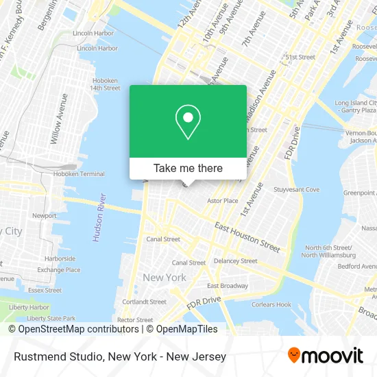
See Rustmend Studio, Manhattan, on the map
Public Transit to Rustmend Studio in Manhattan
Wondering how to get to Rustmend Studio in Manhattan? Moovit helps you find the best way to get to Rustmend Studio with step-by-step directions from the nearest public transit station.
Moovit provides free maps and live directions to help you navigate through your city. View schedules, routes, timetables, and find out how long does it take to get to Rustmend Studio in real time.
Looking for the nearest stop or station to Rustmend Studio? Check out this list of stops closest to your destination: 6th Ave & W 3rd St; 6 Av/W 3 St; Houston St; 6 Av/Waverly Pl; Av Of The Americas/Waverly Pl; West Houston St/Avenue Of the Americas; 6 Av/West Houston St; W 8 St/6 Av; 7 Av South/Barrow St; Spring St; 9th Street; W 4 St-Wash Sq.
Bus: M1, M2, M3, M55, X27, SHORTLINE HUDSON, SHORTLINE HUDSON.Train: ATW, BLU, YEL.Subway: B, D, F, M, 1, 2, A, C, E, FX.
Want to see if there’s another route that gets you there at an earlier time? Moovit helps you find alternative routes or times. Get directions from and directions to Rustmend Studio easily from the Moovit App or Website.
We make riding to Rustmend Studio easy, which is why over 1.5 million users, including users in Manhattan, trust Moovit as the best app for public transit. You don’t need to download an individual bus app or train app, Moovit is your all-in-one transit app that helps you find the best bus time or train time available.
For information on prices of subway and bus, costs and ride fares to Rustmend Studio, please check the Moovit app.
Use the app to navigate to popular places including to the airport, hospital, stadium, grocery store, mall, coffee shop, school, college, and university.
Rustmend Studio Address: Wilf Hall 133 Macdougal St, New York, NY 10012, USA street in Manhattan
- Nyu Law - Furman Center For Real Estate and Urban Policy,
- 129 Macdougal Street,
- The Listening Room,
- The Reiss Center on Law and Security,
- Nyu Furman Center For Real Estate and Urban Policy,
- Center on Race, Inequality, and the Law at Nyu Law,
- Village Presents,
- D'Agostino 14th Floor Terrace,
- Greenberg Lounge,
- Engelberg Center on Innovation Law & Policy at Nyu School Of Law,
- Cineversexx,
- 歡囍麻將,
- Brickman's Ace West Village,
- Dub Pies,
- Library School Of Law,
- Nyu School Of Law - Macdougal,
- Mazzucchelli1849,
- NYU Law School - JFK Jr. Bench,
- Blue Note,
- Caffe Reggio
Places Near Rustmend Studio (Manhattan)
- Queens Center Mall, Queens,
- Chinatown, Manhattan,
- Hudson Yards, Manhattan,
- qqqq, Manhattan,
- Pier 83, Manhattan,
- Katz's Deli, Manhattan,
- San Gennaro Feast, Manhattan,
- Times Square, Manhattan,
- 376 Hudson Street, Manhattan,
- SoHo, Manhattan,
- 26 Federal Plaza, Manhattan,
- 111 Centre New York City Supreme Court, Manhattan,
- 3 Stone St, Manhattan,
- 911 Memorial, Manhattan,
- Bellevue Hospital, Manhattan,
- Rockefeller Center, Manhattan,
- Mountainside Hospital, Glen Ridge,
- 66 John Street, Manhattan,
- 1 Police Plaza, Manhattan,
- Wall Street, Manhattan
How to get to popular places in New York - New Jersey with public transit
Get around Manhattan by public transit!
Traveling around Manhattan has never been so easy. See step by step directions as you travel to any attraction, street or major public transit station. View bus and train schedules, arrival times, service alerts and detailed routes on a map, so you know exactly how to get to anywhere in Manhattan.
When traveling to any destination around Manhattan use Moovit's Live Directions with Get Off Notifications to know exactly where and how far to walk, how long to wait for your line, and how many stops are left. Moovit will alert you when it's time to get off — no need to constantly re-check whether yours is the next stop.
Wondering how to use public transit in Manhattan or how to pay for public transit in Manhattan? Moovit public transit app can help you navigate your way with public transit easily, and at minimum cost. It includes public transit fees, ticket prices, and costs. Looking for a map of Manhattan public transit lines? Moovit public transit app shows all public transit maps in Manhattan with all Bus, Train, Subway, Light Rail, Ferry and Cable Car routes and stops on an interactive map.
New York - New Jersey has 6 transit type(s), including: Bus, Train, Subway, Light Rail, Ferry and Cable Car, operated by several transit agencies, including MTA Subway, Metro-North Railroad, LIRR, PATH, MTA New York City Transit - Express routes, MTA Bus, NJ Transit, NYC Ferry, NICE bus, Bee-Line Bus, NJ Transit Rail, Norwalk Transit District, Hartford Line, River Valley Transit and HART