Directions to Ruta Oaxaca (New York - New Jersey) with public transportation
The following transit lines have routes that pass near Ruta Oaxaca
 Bus: B26, B44-SBS, B25, B44, B43.
- Train: CITY TERMINAL ZONE, HEMPSTEAD BRANCH, BABYLON BRANCH, FAR ROCKAWAY BRANCH, LONG BEACH BRANCH.
- Subway: A, C, SF.
How to get to Ruta Oaxaca by bus?
Click on the bus route to see step by step directions with maps, line arrival times and updated time schedules.
From The Morgan Library & Museum, Manhattan
64 minFrom Ink 48 Hotel, Manhattan
103 minFrom 14th St & 8th Ave, Manhattan
62 minFrom Bubby's, Manhattan
66 minFrom Pier 79, W 39th St, Manhattan
106 minFrom MTA Subway - 59th St/Columbus Circle (A/B/C/D/1), Manhattan
94 minFrom Circle Line Pier 83, Manhattan
103 minFrom 625 8th Avenue, Manhattan
71 minFrom Mall del Sol Guayaquil,Ecuador, Queens
90 minFrom 880 Third Avenue, Manhattan
69 min
How to get to Ruta Oaxaca by train?
Click on the train route to see step by step directions with maps, line arrival times and updated time schedules.
From The Morgan Library & Museum, Manhattan
56 minFrom Ink 48 Hotel, Manhattan
76 minFrom 14th St & 8th Ave, Manhattan
58 minFrom Bubby's, Manhattan
88 minFrom Pier 79, W 39th St, Manhattan
62 minFrom MTA Subway - 59th St/Columbus Circle (A/B/C/D/1), Manhattan
68 minFrom Circle Line Pier 83, Manhattan
67 minFrom 625 8th Avenue, Manhattan
42 minFrom 880 Third Avenue, Manhattan
55 min
How to get to Ruta Oaxaca by subway?
Click on the subway route to see step by step directions with maps, line arrival times and updated time schedules.
From The Morgan Library & Museum, Manhattan
40 minFrom Ink 48 Hotel, Manhattan
46 minFrom 14th St & 8th Ave, Manhattan
24 minFrom Bubby's, Manhattan
24 minFrom Pier 79, W 39th St, Manhattan
47 minFrom MTA Subway - 59th St/Columbus Circle (A/B/C/D/1), Manhattan
32 minFrom Circle Line Pier 83, Manhattan
45 minFrom 625 8th Avenue, Manhattan
39 minFrom Mall del Sol Guayaquil,Ecuador, Queens
59 minFrom 880 Third Avenue, Manhattan
39 min
Bus stops near Ruta Oaxaca in New York - New Jersey
Subway station near Ruta Oaxaca in New York - New Jersey
- Franklin Av, 5 min walk,VIEW
Train station near Ruta Oaxaca in New York - New Jersey
- Nostrand Avenue, 11 min walk,VIEW
Bus lines to Ruta Oaxaca in New York - New Jersey
What are the closest stations to Ruta Oaxaca?
The closest stations to Ruta Oaxaca are:
- Fulton St/New York Av is 105 yards away, 2 min walk.
- Nostrand Av/Fulton St is 225 yards away, 3 min walk.
- Halsey St/Nostrand Av is 327 yards away, 4 min walk.
- Brooklyn Av/Fulton St is 407 yards away, 5 min walk.
- Franklin Av is 421 yards away, 5 min walk.
- Nostrand Avenue is 915 yards away, 11 min walk.
Which bus lines stop near Ruta Oaxaca?
These bus lines stop near Ruta Oaxaca: B26, B44-SBS.
Which train lines stop near Ruta Oaxaca?
These train lines stop near Ruta Oaxaca: CITY TERMINAL ZONE, HEMPSTEAD BRANCH.
Which subway lines stop near Ruta Oaxaca?
These subway lines stop near Ruta Oaxaca: A, C.
What’s the nearest subway station to Ruta Oaxaca in New York - New Jersey?
The nearest subway station to Ruta Oaxaca in New York - New Jersey is Franklin Av. It’s a 5 min walk away.
What’s the nearest train station to Ruta Oaxaca in New York - New Jersey?
The nearest train station to Ruta Oaxaca in New York - New Jersey is Nostrand Avenue. It’s a 11 min walk away.
What’s the nearest bus station to Ruta Oaxaca in New York - New Jersey?
The nearest bus station to Ruta Oaxaca in New York - New Jersey is Fulton St/New York Av. It’s a 2 min walk away.
What time is the first subway to Ruta Oaxaca in New York - New Jersey?
The SF is the first subway that goes to Ruta Oaxaca in New York - New Jersey. It stops nearby at 3:00 AM.
What time is the last subway to Ruta Oaxaca in New York - New Jersey?
The A is the last subway that goes to Ruta Oaxaca in New York - New Jersey. It stops nearby at 3:54 AM.
What time is the first train to Ruta Oaxaca in New York - New Jersey?
The CITY TERMINAL ZONE is the first train that goes to Ruta Oaxaca in New York - New Jersey. It stops nearby at 4:44 AM.
What time is the last train to Ruta Oaxaca in New York - New Jersey?
The CITY TERMINAL ZONE is the last train that goes to Ruta Oaxaca in New York - New Jersey. It stops nearby at 2:03 AM.
What time is the first bus to Ruta Oaxaca in New York - New Jersey?
The B44 is the first bus that goes to Ruta Oaxaca in New York - New Jersey. It stops nearby at 3:11 AM.
What time is the last bus to Ruta Oaxaca in New York - New Jersey?
The B43 is the last bus that goes to Ruta Oaxaca in New York - New Jersey. It stops nearby at 2:52 AM.
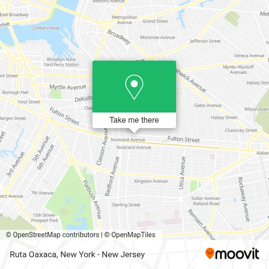
See Ruta Oaxaca, New York - New Jersey, on the map
Public Transit to Ruta Oaxaca in New York - New Jersey
Wondering how to get to Ruta Oaxaca in New York - New Jersey? Moovit helps you find the best way to get to Ruta Oaxaca with step-by-step directions from the nearest public transit station.
Moovit provides free maps and live directions to help you navigate through your city. View schedules, routes, timetables, and find out how long does it take to get to Ruta Oaxaca in real time.
Looking for the nearest stop or station to Ruta Oaxaca? Check out this list of stops closest to your destination: Fulton St/New York Av; Nostrand Av/Fulton St; Halsey St/Nostrand Av; Brooklyn Av/Fulton St; Franklin Av; Nostrand Avenue.
Bus: B26, B44-SBS, B25, B44, B43.Train: CITY TERMINAL ZONE, HEMPSTEAD BRANCH, BABYLON BRANCH, FAR ROCKAWAY BRANCH, LONG BEACH BRANCH.Subway: A, C, SF.
Want to see if there’s another route that gets you there at an earlier time? Moovit helps you find alternative routes or times. Get directions from and directions to Ruta Oaxaca easily from the Moovit App or Website.
We make riding to Ruta Oaxaca easy, which is why over 1.5 million users, including users in New York - New Jersey, trust Moovit as the best app for public transit. You don’t need to download an individual bus app or train app, Moovit is your all-in-one transit app that helps you find the best bus time or train time available.
For information on prices of subway, bus and train, costs and ride fares to Ruta Oaxaca, please check the Moovit app.
Use the app to navigate to popular places including to the airport, hospital, stadium, grocery store, mall, coffee shop, school, college, and university.
Ruta Oaxaca Address: 1337 Fulton St street in New York - New Jersey
- A&A Bake Doubles and Roti,
- The Golan Team,
- Elizabeth V. Alicea, Esq. Associate Real Estate Broker,
- The Mordy Werde Team,
- Cristhiam Pena,
- Kristen Jock,
- Psychic Astrologer, Spiritual Healer, Palm Reader,
- Rodney Shannon,
- Copacabana Seafood and Brunch,
- Eye Like Clothing,
- Rose Beauty Supply,
- Fulton Home Center & Hardware Corp.,
- Pandithshivashankarji,
- Ronit Abraham at Compass Real Estate,
- Casey Soloff - Real Estate Agent at Compass,
- Daniel Dipasquale, Realtor at Compass,
- Greenspacenyc,
- Shiva Krishnaji Psychic Center Llc Astrologer & Psychic Reader,
- 30 Minute Hit Brooklyn,
- Santander Bank Atm
Places Near Ruta Oaxaca (New York - New Jersey)
- Bellevue Hospital, Manhattan,
- qqqq, Manhattan,
- 1 Police Plaza, Manhattan,
- Katz's Deli, Manhattan,
- 3 Stone St, Manhattan,
- Times Square, Manhattan,
- San Gennaro Feast, Manhattan,
- 26 Federal Plaza, Manhattan,
- Mountainside Hospital, Glen Ridge,
- Chinatown, Manhattan,
- Queens Center Mall, Queens,
- 911 Memorial, Manhattan,
- Rockefeller Center, Manhattan,
- Hudson Yards, Manhattan,
- Pier 83, Manhattan,
- 66 John Street, Manhattan,
- Wall Street, Manhattan,
- SoHo, Manhattan,
- 111 Centre New York City Supreme Court, Manhattan,
- 376 Hudson Street, Manhattan
How to get to popular places in New York - New Jersey with public transit
Get around New York - New Jersey by public transit!
Traveling around New York - New Jersey has never been so easy. See step by step directions as you travel to any attraction, street or major public transit station. View bus and train schedules, arrival times, service alerts and detailed routes on a map, so you know exactly how to get to anywhere in New York - New Jersey.
When traveling to any destination around New York - New Jersey use Moovit's Live Directions with Get Off Notifications to know exactly where and how far to walk, how long to wait for your line, and how many stops are left. Moovit will alert you when it's time to get off — no need to constantly re-check whether yours is the next stop.
Wondering how to use public transit in New York - New Jersey or how to pay for public transit in New York - New Jersey? Moovit public transit app can help you navigate your way with public transit easily, and at minimum cost. It includes public transit fees, ticket prices, and costs. Looking for a map of New York - New Jersey public transit lines? Moovit public transit app shows all public transit maps in New York - New Jersey with all Bus, Train, Subway, Light Rail, Ferry and Cable Car routes and stops on an interactive map.
New York - New Jersey has 6 transit type(s), including: Bus, Train, Subway, Light Rail, Ferry and Cable Car, operated by several transit agencies, including MTA Subway, Metro-North Railroad, LIRR, PATH, MTA New York City Transit - Express routes, MTA Bus, NJ Transit, NYC Ferry, NICE bus, Bee-Line Bus, NJ Transit Rail, Norwalk Transit District, Hartford Line, River Valley Transit and HART