How to get to Rutata.Com by bus?
Click on the bus route to see step by step directions with maps, line arrival times and updated time schedules.
From Saint Barnabas Medical Center, Livingston
44 minFrom The Mills At Jersey Gardens, Elizabeth
85 minFrom Nutley, NJ, Nutley
56 minFrom Ikea, Elizabeth
69 minFrom Walmart, Kearny
60 minFrom Kearny, NJ, Kearny
53 minFrom NJ 440, Jersey City
80 minFrom Jersey Gardens, Elizabeth
86 minFrom Jersey Gardens Metro Mall, Elizabeth
84 minFrom Hudson Mall, Jersey City
69 min
Bus stops near Rutata.Com in East Orange
Train station near Rutata.Com in East Orange
- Orange, 18 min walk,VIEW
What are the closest stations to Rutata.Com?
The closest stations to Rutata.Com are:
- Rhode Island Ave at Shepard Ave is 57 yards away, 1 min walk.
- South Clinton St At Rhode Island Ave is 335 yards away, 5 min walk.
- Orange is 1546 yards away, 18 min walk.
Which bus lines stop near Rutata.Com?
These bus lines stop near Rutata.Com: 24, 44, 94.
What’s the nearest train station to Rutata.Com in East Orange?
The nearest train station to Rutata.Com in East Orange is Orange. It’s a 18 min walk away.
What’s the nearest bus station to Rutata.Com in East Orange?
The nearest bus station to Rutata.Com in East Orange is Rhode Island Ave at Shepard Ave. It’s a 1 min walk away.
What time is the first train to Rutata.Com in East Orange?
The MEL is the first train that goes to Rutata.Com in East Orange. It stops nearby at 5:02 AM.
What time is the last train to Rutata.Com in East Orange?
The MEL is the last train that goes to Rutata.Com in East Orange. It stops nearby at 1:30 AM.
What time is the first bus to Rutata.Com in East Orange?
The 94 is the first bus that goes to Rutata.Com in East Orange. It stops nearby at 5:02 AM.
What time is the last bus to Rutata.Com in East Orange?
The 44 is the last bus that goes to Rutata.Com in East Orange. It stops nearby at 12:22 AM.
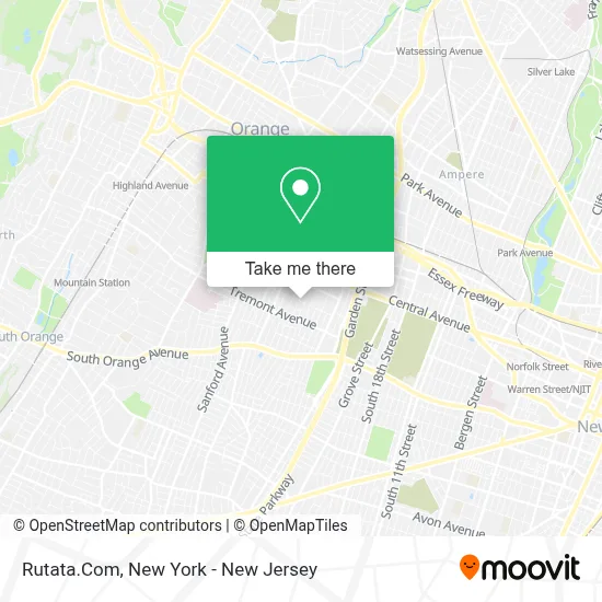
See Rutata.Com, East Orange, on the map
Public Transit to Rutata.Com in East Orange
Wondering how to get to Rutata.Com in East Orange? Moovit helps you find the best way to get to Rutata.Com with step-by-step directions from the nearest public transit station.
Moovit provides free maps and live directions to help you navigate through your city. View schedules, routes, timetables, and find out how long does it take to get to Rutata.Com in real time.
Looking for the nearest stop or station to Rutata.Com? Check out this list of stops closest to your destination: Rhode Island Ave at Shepard Ave; South Clinton St At Rhode Island Ave; Orange.
Bus: 24, 44, 94.Train: GB, MEL.
Want to see if there’s another route that gets you there at an earlier time? Moovit helps you find alternative routes or times. Get directions from and directions to Rutata.Com easily from the Moovit App or Website.
We make riding to Rutata.Com easy, which is why over 1.5 million users, including users in East Orange, trust Moovit as the best app for public transit. You don’t need to download an individual bus app or train app, Moovit is your all-in-one transit app that helps you find the best bus time or train time available.
For information on prices of bus and train, costs and ride fares to Rutata.Com, please check the Moovit app.
Use the app to navigate to popular places including to the airport, hospital, stadium, grocery store, mall, coffee shop, school, college, and university.
Rutata.Com Address: 120 Rhode Island Ave street in East Orange
- Legendary Kutz Barbershop,
- Beach Locksmith,
- SJ Concrete,
- Street Maintenance, Inc,
- Promoting Progress For Youth, Inc.,
- East Orange School District,
- Xiaomi Boutique Burkina,
- Forbes Transport,
- Evangelical Headlight Church,
- Goshi-Shun Karate Dojo,
- American Air Duct,
- King Carter,
- Pure Auto Customs,
- Amherst Rhode Island Ave,
- Muslim Outreach For Anti-Violence,
- Zifah Usa,
- Ever Clean Laundromat and Dry Cleaner,
- Powell Home Improvement,
- Mbr Transportation & Logistics Llc,
- Aminata
Places Near Rutata.Com (East Orange)
- 376 Hudson Street, Manhattan,
- Bellevue Hospital, Manhattan,
- Wall Street, Manhattan,
- SoHo, Manhattan,
- 911 Memorial, Manhattan,
- Mountainside Hospital, Glen Ridge,
- 111 Centre New York City Supreme Court, Manhattan,
- Chinatown, Manhattan,
- 1 Police Plaza, Manhattan,
- Times Square, Manhattan,
- 66 John Street, Manhattan,
- 26 Federal Plaza, Manhattan,
- qqqq, Manhattan,
- 3 Stone St, Manhattan,
- Queens Center Mall, Queens,
- Hudson Yards, Manhattan,
- San Gennaro Feast, Manhattan,
- Katz's Deli, Manhattan,
- Pier 83, Manhattan,
- Rockefeller Center, Manhattan
How to get to popular places in New York - New Jersey with public transit
Get around East Orange by public transit!
Traveling around East Orange has never been so easy. See step by step directions as you travel to any attraction, street or major public transit station. View bus and train schedules, arrival times, service alerts and detailed routes on a map, so you know exactly how to get to anywhere in East Orange.
When traveling to any destination around East Orange use Moovit's Live Directions with Get Off Notifications to know exactly where and how far to walk, how long to wait for your line, and how many stops are left. Moovit will alert you when it's time to get off — no need to constantly re-check whether yours is the next stop.
Wondering how to use public transit in East Orange or how to pay for public transit in East Orange? Moovit public transit app can help you navigate your way with public transit easily, and at minimum cost. It includes public transit fees, ticket prices, and costs. Looking for a map of East Orange public transit lines? Moovit public transit app shows all public transit maps in East Orange with all Bus, Train, Subway, Light Rail, Ferry and Cable Car routes and stops on an interactive map.
New York - New Jersey has 6 transit type(s), including: Bus, Train, Subway, Light Rail, Ferry and Cable Car, operated by several transit agencies, including MTA Subway, Metro-North Railroad, LIRR, PATH, MTA New York City Transit - Express routes, MTA Bus, NJ Transit, NYC Ferry, NICE bus, Bee-Line Bus, NJ Transit Rail, Norwalk Transit District, Hartford Line, River Valley Transit and HART