How to get to Rutgers Health by bus?
Click on the bus route to see step by step directions with maps, line arrival times and updated time schedules.
From Hudson Mall, Jersey City
54 minFrom Elizabeth, NJ, Elizabeth
55 minFrom Medieval Times Dinner & Tournament, Lyndhurst
58 minFrom Community Lines, Jersey City
63 minFrom Newport Mall Bus, Jersey City
49 minFrom Community Coach Bus 77, West Orange
28 minFrom Bayonne, NJ, Bayonne
93 minFrom Bayonne, NJ, Bayonne
85 minFrom Jersey Gardens, Elizabeth
68 minFrom Medieval Times, Lyndhurst
58 min
How to get to Rutgers Health by train?
Click on the train route to see step by step directions with maps, line arrival times and updated time schedules.
Bus stops near Rutgers Health in Newark
Light Rail stations near Rutgers Health in Newark
- Warren Street Light Rail Station, 17 min walk,VIEW
Train station near Rutgers Health in Newark
- Newark Broad St, 28 min walk,VIEW
Bus lines to Rutgers Health in Newark
What are the closest stations to Rutgers Health?
The closest stations to Rutgers Health are:
- Bergen St 1200' N Of South Orange Ave. is 82 yards away, 2 min walk.
- Bergen St 85' S Of West Market St is 270 yards away, 4 min walk.
- W Market St at Bergen St is 388 yards away, 5 min walk.
- W Market St at 1st St is 414 yards away, 5 min walk.
- Warren Street Light Rail Station is 1400 yards away, 17 min walk.
- Newark Broad St is 2329 yards away, 28 min walk.
Which bus lines stop near Rutgers Health?
These bus lines stop near Rutgers Health: 34, 73.
Which train lines stop near Rutgers Health?
These train lines stop near Rutgers Health: MEL, NJCL, RED.
What’s the nearest light rail station to Rutgers Health in Newark?
The nearest light rail station to Rutgers Health in Newark is Warren Street Light Rail Station. It’s a 17 min walk away.
What’s the nearest train station to Rutgers Health in Newark?
The nearest train station to Rutgers Health in Newark is Newark Broad St. It’s a 28 min walk away.
What’s the nearest bus station to Rutgers Health in Newark?
The nearest bus station to Rutgers Health in Newark is Bergen St 1200' N Of South Orange Ave.. It’s a 2 min walk away.
What time is the first light rail to Rutgers Health in Newark?
The NLR is the first light rail that goes to Rutgers Health in Newark. It stops nearby at 4:24 AM.
What time is the last light rail to Rutgers Health in Newark?
The NLR is the last light rail that goes to Rutgers Health in Newark. It stops nearby at 1:21 AM.
What time is the first train to Rutgers Health in Newark?
The MEL is the first train that goes to Rutgers Health in Newark. It stops nearby at 4:57 AM.
What time is the last train to Rutgers Health in Newark?
The MEL is the last train that goes to Rutgers Health in Newark. It stops nearby at 1:15 AM.
What time is the first bus to Rutgers Health in Newark?
The 34 is the first bus that goes to Rutgers Health in Newark. It stops nearby at 4:29 AM.
What time is the last bus to Rutgers Health in Newark?
The 34 is the last bus that goes to Rutgers Health in Newark. It stops nearby at 2:37 AM.
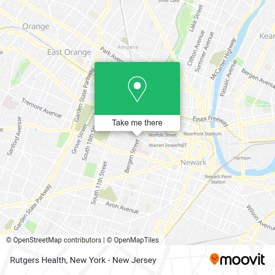
See Rutgers Health, Newark, on the map
Public Transit to Rutgers Health in Newark
Wondering how to get to Rutgers Health in Newark? Moovit helps you find the best way to get to Rutgers Health with step-by-step directions from the nearest public transit station.
Moovit provides free maps and live directions to help you navigate through your city. View schedules, routes, timetables, and find out how long does it take to get to Rutgers Health in real time.
Looking for the nearest stop or station to Rutgers Health? Check out this list of stops closest to your destination: Bergen St 1200' N Of South Orange Ave.; Bergen St 85' S Of West Market St; W Market St at Bergen St; W Market St at 1st St; Warren Street Light Rail Station; Newark Broad St.
Bus: 34, 73, 99, 21, 71, 79.Train: MEL, NJCL, RED, GB, ML.
Want to see if there’s another route that gets you there at an earlier time? Moovit helps you find alternative routes or times. Get directions from and directions to Rutgers Health easily from the Moovit App or Website.
We make riding to Rutgers Health easy, which is why over 1.5 million users, including users in Newark, trust Moovit as the best app for public transit. You don’t need to download an individual bus app or train app, Moovit is your all-in-one transit app that helps you find the best bus time or train time available.
For information on prices of bus and train, costs and ride fares to Rutgers Health, please check the Moovit app.
Use the app to navigate to popular places including to the airport, hospital, stadium, grocery store, mall, coffee shop, school, college, and university.
Rutgers Health Address: 65 Bergen St street in Newark
- Rutgers Biomedical Health Sciences Police Department,
- Save Cancer Screening Program,
- School Of Nursing,
- Rutgers Biopharma Educational Initiative,
- Garage Door Newark,
- University Hospital Ems - Remcs,
- François-Xavier Bagnoud Center,
- National Aetc Support Center,
- Rutgers Shp - Department Of Clinical and Preventive Nutrition Sciences,
- Bergen Jr Stanley S Md,
- Bruno's Lunch Truck,
- Bank Of America Walk-Up Atm | 12th Avenue,
- Rutgers Biomedical and Health Sciences,
- University Hospital Community Training Center,
- Green Room Cigars,
- Western Union,
- Virak Tan,
- Georgia King Village,
- Rachid Assina, M.D.,
- Adham Kamel, M.D.
Places Near Rutgers Health (Newark)
- Wall Street, Manhattan,
- Katz's Deli, Manhattan,
- San Gennaro Feast, Manhattan,
- 376 Hudson Street, Manhattan,
- Chinatown, Manhattan,
- Times Square, Manhattan,
- Rockefeller Center, Manhattan,
- Pier 83, Manhattan,
- 911 Memorial, Manhattan,
- Mountainside Hospital, Glen Ridge,
- Queens Center Mall, Queens,
- Hudson Yards, Manhattan,
- 3 Stone St, Manhattan,
- 1 Police Plaza, Manhattan,
- qqqq, Manhattan,
- 66 John Street, Manhattan,
- 26 Federal Plaza, Manhattan,
- SoHo, Manhattan,
- Bellevue Hospital, Manhattan,
- 111 Centre New York City Supreme Court, Manhattan
How to get to popular places in New York - New Jersey with public transit
Get around Newark by public transit!
Traveling around Newark has never been so easy. See step by step directions as you travel to any attraction, street or major public transit station. View bus and train schedules, arrival times, service alerts and detailed routes on a map, so you know exactly how to get to anywhere in Newark.
When traveling to any destination around Newark use Moovit's Live Directions with Get Off Notifications to know exactly where and how far to walk, how long to wait for your line, and how many stops are left. Moovit will alert you when it's time to get off — no need to constantly re-check whether yours is the next stop.
Wondering how to use public transit in Newark or how to pay for public transit in Newark? Moovit public transit app can help you navigate your way with public transit easily, and at minimum cost. It includes public transit fees, ticket prices, and costs. Looking for a map of Newark public transit lines? Moovit public transit app shows all public transit maps in Newark with all Bus, Train, Subway, Light Rail, Ferry and Cable Car routes and stops on an interactive map.
New York - New Jersey has 6 transit type(s), including: Bus, Train, Subway, Light Rail, Ferry and Cable Car, operated by several transit agencies, including MTA Subway, Metro-North Railroad, LIRR, PATH, MTA New York City Transit - Express routes, MTA Bus, NJ Transit, NYC Ferry, NICE bus, Bee-Line Bus, NJ Transit Rail, Norwalk Transit District, Hartford Line, River Valley Transit and HART