Directions to Rutgers Health Center Pharmacy (New Brunswick) with public transportation
The following transit lines have routes that pass near Rutgers Health Center Pharmacy
 Bus: 810, 814, 815, SUBURBAN TRANSIT, 811.
- Train: NC, CAROLINIAN, KEYSTONE SERVICE, NORTHEAST REGIONAL.
How to get to Rutgers Health Center Pharmacy by bus?
Click on the bus route to see step by step directions with maps, line arrival times and updated time schedules.
From HUUHHHH??, Woodbridge
108 minFrom Plainfield, NJ, Plainfield
81 minFrom Union County College - Cranford Campus, Cranford
159 minFrom Perth Amboy, NJ, Perth Amboy
86 minFrom Linden, NJ, Linden
129 minFrom South Ave, Staten Island
166 minFrom Staten Island Mall, Staten Island
145 minFrom Baps Shri Swaminarayan Mandir, Edison, NJ, USA, Edison
29 minFrom Walmart, Linden
145 min
How to get to Rutgers Health Center Pharmacy by train?
Click on the train route to see step by step directions with maps, line arrival times and updated time schedules.
Bus stops near Rutgers Health Center Pharmacy in New Brunswick
Train station near Rutgers Health Center Pharmacy in New Brunswick
- New Brunswick, 20 min walk,VIEW
Bus lines to Rutgers Health Center Pharmacy in New Brunswick
- 810, New Brunswick - Woodbridge Center,VIEW
- 811, New Brunswick - South River,VIEW
- 814, N. Brunswick - New Brunswick - Middlesex C. C.,VIEW
- 815, New Brunswick-East Brunswick-Woodbridge Ctr,VIEW
- 818, New Brunswick - East Brunswick - Old Bridge,VIEW
- FLIXBUS 2601, Washington Union Station,VIEW
- FLIXBUS 2609, Brooklyn (3 Av/38th St),VIEW
- SUBURBAN TRANSIT, 100 - Princeton - NYC,VIEW
- SUBURBAN TRANSIT, 600 - Wall Street,VIEW
- SUBURBAN TRANSIT, 500 - Crosstown,VIEW
What are the closest stations to Rutgers Health Center Pharmacy?
The closest stations to Rutgers Health Center Pharmacy are:
- Somerset St at George St is 826 yards away, 10 min walk.
- New Brunswick (Downtown) is 1277 yards away, 16 min walk.
- Albany St & Spring St is 1277 yards away, 16 min walk.
- New Brunswick is 1634 yards away, 20 min walk.
Which bus lines stop near Rutgers Health Center Pharmacy?
These bus lines stop near Rutgers Health Center Pharmacy: 810, 814, 815, SUBURBAN TRANSIT.
Which train line stops near Rutgers Health Center Pharmacy?
NC (Trenton Transit Center)
What’s the nearest train station to Rutgers Health Center Pharmacy in New Brunswick?
The nearest train station to Rutgers Health Center Pharmacy in New Brunswick is New Brunswick. It’s a 20 min walk away.
What’s the nearest bus station to Rutgers Health Center Pharmacy in New Brunswick?
The nearest bus station to Rutgers Health Center Pharmacy in New Brunswick is Somerset St at George St. It’s a 10 min walk away.
What time is the first train to Rutgers Health Center Pharmacy in New Brunswick?
The NC is the first train that goes to Rutgers Health Center Pharmacy in New Brunswick. It stops nearby at 4:13 AM.
What time is the last train to Rutgers Health Center Pharmacy in New Brunswick?
The NC is the last train that goes to Rutgers Health Center Pharmacy in New Brunswick. It stops nearby at 2:26 AM.
What time is the first bus to Rutgers Health Center Pharmacy in New Brunswick?
The SUBURBAN TRANSIT is the first bus that goes to Rutgers Health Center Pharmacy in New Brunswick. It stops nearby at 4:45 AM.
What time is the last bus to Rutgers Health Center Pharmacy in New Brunswick?
The SUBURBAN TRANSIT is the last bus that goes to Rutgers Health Center Pharmacy in New Brunswick. It stops nearby at 12:50 AM.
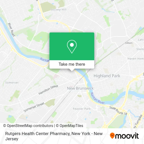
See Rutgers Health Center Pharmacy, New Brunswick, on the map
Public Transit to Rutgers Health Center Pharmacy in New Brunswick
Wondering how to get to Rutgers Health Center Pharmacy in New Brunswick? Moovit helps you find the best way to get to Rutgers Health Center Pharmacy with step-by-step directions from the nearest public transit station.
Moovit provides free maps and live directions to help you navigate through your city. View schedules, routes, timetables, and find out how long does it take to get to Rutgers Health Center Pharmacy in real time.
Looking for the nearest stop or station to Rutgers Health Center Pharmacy? Check out this list of stops closest to your destination: Somerset St at George St; New Brunswick (Downtown); Albany St & Spring St; New Brunswick.
Bus: 810, 814, 815, SUBURBAN TRANSIT, 811, 818, FLIXBUS 2601, FLIXBUS 2609.Train: NC, CAROLINIAN, KEYSTONE SERVICE, NORTHEAST REGIONAL.
Want to see if there’s another route that gets you there at an earlier time? Moovit helps you find alternative routes or times. Get directions from and directions to Rutgers Health Center Pharmacy easily from the Moovit App or Website.
We make riding to Rutgers Health Center Pharmacy easy, which is why over 1.5 million users, including users in New Brunswick, trust Moovit as the best app for public transit. You don’t need to download an individual bus app or train app, Moovit is your all-in-one transit app that helps you find the best bus time or train time available.
For information on prices of bus and train, costs and ride fares to Rutgers Health Center Pharmacy, please check the Moovit app.
Use the app to navigate to popular places including to the airport, hospital, stadium, grocery store, mall, coffee shop, school, college, and university.
Rutgers Health Center Pharmacy Address: 11 Bishop Pl street in New Brunswick
- The Graduate School,
- Rutgers University Honors College,
- Rutgers University New Brunswick,
- Ru Progressive / Our Revolution Rutgers,
- Globemed at Rutgers University-New Brunswick,
- Sigma Delta Tau - Rutgers University,
- School Of Graduate Studies,
- Rutgers University,
- Center For Historical Analysis,
- Department Of Germanic, Russian and East European Languages and Literature,
- 罗格斯大学,
- Universidad Rutgers,
- College Avenue (Rutgers University),
- Rutgers College Avenue Campus,
- Rutgers Sac Convenience Store,
- Rutgers S.A.C. Convenience Store,
- Ru Alzheimer's Buddies,
- NJ Italian Heritage Commission,
- Rutgers Hillel,
- Graceway Presbyterian Church
Places Near Rutgers Health Center Pharmacy (New Brunswick)
- Rockefeller Center, Manhattan,
- Queens Center Mall, Queens,
- Katz's Deli, Manhattan,
- Hudson Yards, Manhattan,
- Bellevue Hospital, Manhattan,
- Wall Street, Manhattan,
- 111 Centre New York City Supreme Court, Manhattan,
- 3 Stone St, Manhattan,
- 26 Federal Plaza, Manhattan,
- 66 John Street, Manhattan,
- Pier 83, Manhattan,
- Chinatown, Manhattan,
- Times Square, Manhattan,
- qqqq, Manhattan,
- Mountainside Hospital, Glen Ridge,
- 911 Memorial, Manhattan,
- 1 Police Plaza, Manhattan,
- SoHo, Manhattan,
- San Gennaro Feast, Manhattan,
- 376 Hudson Street, Manhattan
How to get to popular places in New York - New Jersey with public transit
Get around New Brunswick by public transit!
Traveling around New Brunswick has never been so easy. See step by step directions as you travel to any attraction, street or major public transit station. View bus and train schedules, arrival times, service alerts and detailed routes on a map, so you know exactly how to get to anywhere in New Brunswick.
When traveling to any destination around New Brunswick use Moovit's Live Directions with Get Off Notifications to know exactly where and how far to walk, how long to wait for your line, and how many stops are left. Moovit will alert you when it's time to get off — no need to constantly re-check whether yours is the next stop.
Wondering how to use public transit in New Brunswick or how to pay for public transit in New Brunswick? Moovit public transit app can help you navigate your way with public transit easily, and at minimum cost. It includes public transit fees, ticket prices, and costs. Looking for a map of New Brunswick public transit lines? Moovit public transit app shows all public transit maps in New Brunswick with all Bus, Train, Subway, Light Rail, Ferry and Cable Car routes and stops on an interactive map.
New York - New Jersey has 6 transit type(s), including: Bus, Train, Subway, Light Rail, Ferry and Cable Car, operated by several transit agencies, including MTA Subway, Metro-North Railroad, LIRR, PATH, MTA New York City Transit - Express routes, MTA Bus, NJ Transit, NYC Ferry, NICE bus, Bee-Line Bus, NJ Transit Rail, Norwalk Transit District, Hartford Line, River Valley Transit and HART