How to get to Rutgers Health Infectious Disease by bus?
Click on the bus route to see step by step directions with maps, line arrival times and updated time schedules.
From Secaucus Junction, Secaucus
94 minFrom Kearny, NJ, Kearny
40 minFrom Medieval Times, Lyndhurst
62 minFrom Hudson Mall, Jersey City
57 minFrom Newport Mall Bus, Jersey City
52 minFrom Bayonne, NJ, Bayonne
92 minFrom Community Coach Bus 77, West Orange
36 minFrom Community Lines, Jersey City
62 minFrom Hillside, NJ, Hillside
39 minFrom Bayonne, NJ, Bayonne
85 min
How to get to Rutgers Health Infectious Disease by train?
Click on the train route to see step by step directions with maps, line arrival times and updated time schedules.
Bus stops near Rutgers Health Infectious Disease in Newark
Light Rail stations near Rutgers Health Infectious Disease in Newark
- Orange Street Light Rail Station, 22 min walk,VIEW
Bus lines to Rutgers Health Infectious Disease in Newark
What are the closest stations to Rutgers Health Infectious Disease?
The closest stations to Rutgers Health Infectious Disease are:
- Bergen St 1200' N Of South Orange Ave. is 115 yards away, 2 min walk.
- South Orange Ave at Bergen St is 248 yards away, 4 min walk.
- 12th Ave at Bergen St is 284 yards away, 4 min walk.
- Orange Street Light Rail Station is 1829 yards away, 22 min walk.
Which bus lines stop near Rutgers Health Infectious Disease?
These bus lines stop near Rutgers Health Infectious Disease: 1, 31, 34, 73, 99.
Which train lines stop near Rutgers Health Infectious Disease?
These train lines stop near Rutgers Health Infectious Disease: MEL, RED.
What’s the nearest light rail station to Rutgers Health Infectious Disease in Newark?
The nearest light rail station to Rutgers Health Infectious Disease in Newark is Orange Street Light Rail Station. It’s a 22 min walk away.
What’s the nearest bus station to Rutgers Health Infectious Disease in Newark?
The nearest bus station to Rutgers Health Infectious Disease in Newark is Bergen St 1200' N Of South Orange Ave.. It’s a 2 min walk away.
What time is the first light rail to Rutgers Health Infectious Disease in Newark?
The NLR is the first light rail that goes to Rutgers Health Infectious Disease in Newark. It stops nearby at 4:24 AM.
What time is the last light rail to Rutgers Health Infectious Disease in Newark?
The NLR is the last light rail that goes to Rutgers Health Infectious Disease in Newark. It stops nearby at 1:21 AM.
What time is the first bus to Rutgers Health Infectious Disease in Newark?
The 34 is the first bus that goes to Rutgers Health Infectious Disease in Newark. It stops nearby at 4:30 AM.
What time is the last bus to Rutgers Health Infectious Disease in Newark?
The 34 is the last bus that goes to Rutgers Health Infectious Disease in Newark. It stops nearby at 2:37 AM.
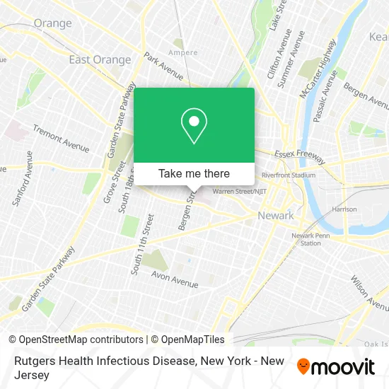
See Rutgers Health Infectious Disease, Newark, on the map
Public Transit to Rutgers Health Infectious Disease in Newark
Wondering how to get to Rutgers Health Infectious Disease in Newark? Moovit helps you find the best way to get to Rutgers Health Infectious Disease with step-by-step directions from the nearest public transit station.
Moovit provides free maps and live directions to help you navigate through your city. View schedules, routes, timetables, and find out how long does it take to get to Rutgers Health Infectious Disease in real time.
Looking for the nearest stop or station to Rutgers Health Infectious Disease? Check out this list of stops closest to your destination: Bergen St 1200' N Of South Orange Ave.; South Orange Ave at Bergen St; 12th Ave at Bergen St; Orange Street Light Rail Station.
Bus: 1, 31, 34, 73, 99.Train: MEL, RED.
Want to see if there’s another route that gets you there at an earlier time? Moovit helps you find alternative routes or times. Get directions from and directions to Rutgers Health Infectious Disease easily from the Moovit App or Website.
We make riding to Rutgers Health Infectious Disease easy, which is why over 1.5 million users, including users in Newark, trust Moovit as the best app for public transit. You don’t need to download an individual bus app or train app, Moovit is your all-in-one transit app that helps you find the best bus time or train time available.
For information on prices of bus and train, costs and ride fares to Rutgers Health Infectious Disease, please check the Moovit app.
Use the app to navigate to popular places including to the airport, hospital, stadium, grocery store, mall, coffee shop, school, college, and university.
Rutgers Health Infectious Disease Address: 140 Bergen St, D Level street in Newark
- Rutgers Health Nephrology,
- Steak 'N Take,
- Rutgers University Trans Health,
- Pediatric,
- University Hospital's Healthy Heart Program,
- Mary Eliza Mahoney Health Center @ 140 Bergen Street,
- Jenna Zechmeister Marcus, M.D.,
- Emre Kayaalp, M.D.,
- Arlene Bardeguez,
- Subhashini Ayloo, M.D., M.P.H.,
- Alluru Reddi, M.D.,
- Lauren Barlog, M.D.,
- Rutgers Health Pediatric Neurology,
- Anabella Moharita, M.D.,
- NJ Poison Control,
- Yasmin Abedin,
- Rutgers, Department Of Radiology,
- Jung Ki Park, M.D.,
- Bank of America,
- Steak -N-Take(Fish Truck)
Places Near Rutgers Health Infectious Disease (Newark)
- 911 Memorial, Manhattan,
- 111 Centre New York City Supreme Court, Manhattan,
- Katz's Deli, Manhattan,
- Wall Street, Manhattan,
- Queens Center Mall, Queens,
- San Gennaro Feast, Manhattan,
- qqqq, Manhattan,
- 66 John Street, Manhattan,
- 1 Police Plaza, Manhattan,
- Bellevue Hospital, Manhattan,
- 376 Hudson Street, Manhattan,
- Hudson Yards, Manhattan,
- Mountainside Hospital, Glen Ridge,
- Chinatown, Manhattan,
- SoHo, Manhattan,
- Times Square, Manhattan,
- Pier 83, Manhattan,
- 26 Federal Plaza, Manhattan,
- Rockefeller Center, Manhattan,
- 3 Stone St, Manhattan
How to get to popular places in New York - New Jersey with public transit
Get around Newark by public transit!
Traveling around Newark has never been so easy. See step by step directions as you travel to any attraction, street or major public transit station. View bus and train schedules, arrival times, service alerts and detailed routes on a map, so you know exactly how to get to anywhere in Newark.
When traveling to any destination around Newark use Moovit's Live Directions with Get Off Notifications to know exactly where and how far to walk, how long to wait for your line, and how many stops are left. Moovit will alert you when it's time to get off — no need to constantly re-check whether yours is the next stop.
Wondering how to use public transit in Newark or how to pay for public transit in Newark? Moovit public transit app can help you navigate your way with public transit easily, and at minimum cost. It includes public transit fees, ticket prices, and costs. Looking for a map of Newark public transit lines? Moovit public transit app shows all public transit maps in Newark with all Bus, Train, Subway, Light Rail, Ferry and Cable Car routes and stops on an interactive map.
New York - New Jersey has 6 transit type(s), including: Bus, Train, Subway, Light Rail, Ferry and Cable Car, operated by several transit agencies, including MTA Subway, Metro-North Railroad, LIRR, PATH, MTA New York City Transit - Express routes, MTA Bus, NJ Transit, NYC Ferry, NICE bus, Bee-Line Bus, NJ Transit Rail, Norwalk Transit District, Hartford Line, River Valley Transit and HART