Directions to Rutgers Purple Lot (Piscataway) with public transportation
The following transit lines have routes that pass near Rutgers Purple Lot
 Bus: 810, 814, 815, SUBURBAN TRANSIT.
- Train: NC, CAROLINIAN, KEYSTONE SERVICE, NORTHEAST REGIONAL.
How to get to Rutgers Purple Lot by bus?
Click on the bus route to see step by step directions with maps, line arrival times and updated time schedules.
From Perth Amboy, NJ, Perth Amboy
120 minFrom HUUHHHH??, Woodbridge
142 minFrom South Ave, Staten Island
199 minFrom Plainfield, NJ, Plainfield
115 minFrom Baps Shri Swaminarayan Mandir, Edison, NJ, USA, Edison
63 minFrom Edison NJ, Edison
58 minFrom Linden, NJ, Linden
161 minFrom Walmart, Linden
178 minFrom Union County College - Cranford Campus, Cranford
191 min
How to get to Rutgers Purple Lot by train?
Click on the train route to see step by step directions with maps, line arrival times and updated time schedules.
Train station near Rutgers Purple Lot in Piscataway
- New Brunswick, 36 min walk,VIEW
What are the closest stations to Rutgers Purple Lot?
The closest stations to Rutgers Purple Lot are:
- New Brunswick is 2996 yards away, 36 min walk.
Which bus lines stop near Rutgers Purple Lot?
These bus lines stop near Rutgers Purple Lot: 810, 814, 815, SUBURBAN TRANSIT.
Which train line stops near Rutgers Purple Lot?
NC (Trenton Transit Center)
What time is the first train to Rutgers Purple Lot in Piscataway?
The NC is the first train that goes to Rutgers Purple Lot in Piscataway. It stops nearby at 4:13 AM.
What time is the last train to Rutgers Purple Lot in Piscataway?
The NC is the last train that goes to Rutgers Purple Lot in Piscataway. It stops nearby at 2:21 AM.
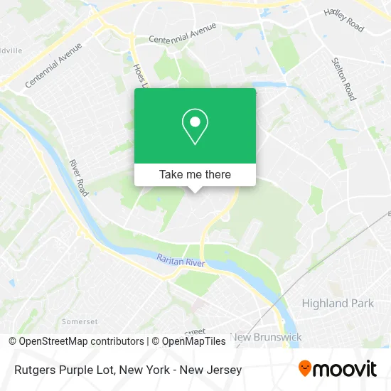
See Rutgers Purple Lot, Piscataway, on the map
Public Transit to Rutgers Purple Lot in Piscataway
Wondering how to get to Rutgers Purple Lot in Piscataway? Moovit helps you find the best way to get to Rutgers Purple Lot with step-by-step directions from the nearest public transit station.
Moovit provides free maps and live directions to help you navigate through your city. View schedules, routes, timetables, and find out how long does it take to get to Rutgers Purple Lot in real time.
Looking for the nearest stop or station to Rutgers Purple Lot? Check out this list of stops closest to your destination: New Brunswick.
Bus: 810, 814, 815, SUBURBAN TRANSIT.Train: NC, CAROLINIAN, KEYSTONE SERVICE, NORTHEAST REGIONAL.
Want to see if there’s another route that gets you there at an earlier time? Moovit helps you find alternative routes or times. Get directions from and directions to Rutgers Purple Lot easily from the Moovit App or Website.
We make riding to Rutgers Purple Lot easy, which is why over 1.5 million users, including users in Piscataway, trust Moovit as the best app for public transit. You don’t need to download an individual bus app or train app, Moovit is your all-in-one transit app that helps you find the best bus time or train time available.
For information on prices of bus and train, costs and ride fares to Rutgers Purple Lot, please check the Moovit app.
Use the app to navigate to popular places including to the airport, hospital, stadium, grocery store, mall, coffee shop, school, college, and university.
Location: Piscataway, New York - New Jersey
- Rutgers University School Of Engineering,
- Core Building (Busch Campus),
- Sonny A. Werblin Recreation Center,
- Scarlet Aquatic Club Alumni Association,
- Rutgers Recreation,
- Rutgers University Pool,
- Rutgers University Busch Campus Wright Reiman Chemistry Laboratory,
- Rutgers University (Busch Campus),
- Center For Advanced Energy Systems (Caes),
- Rutgers,
- Asce - Rutgers University,
- Csops,
- Rutgers Formula Racing,
- Ru Civil and Environmental Engg Grad Program,
- Department Of Mathematics,
- Rutgers University Waksman Institute,
- Waksman Institute of Microbiology-Rutgers University,
- Waksman Genomics Core Facility,
- The Cave,
- Rutgers University Park Soccer Fields
Places Near Rutgers Purple Lot (Piscataway)
- Queens Center Mall, Queens,
- Chinatown, Manhattan,
- Hudson Yards, Manhattan,
- qqqq, Manhattan,
- Pier 83, Manhattan,
- Katz's Deli, Manhattan,
- San Gennaro Feast, Manhattan,
- Times Square, Manhattan,
- 376 Hudson Street, Manhattan,
- SoHo, Manhattan,
- 26 Federal Plaza, Manhattan,
- 111 Centre New York City Supreme Court, Manhattan,
- 3 Stone St, Manhattan,
- 911 Memorial, Manhattan,
- Bellevue Hospital, Manhattan,
- Rockefeller Center, Manhattan,
- Mountainside Hospital, Glen Ridge,
- 66 John Street, Manhattan,
- 1 Police Plaza, Manhattan,
- Wall Street, Manhattan
How to get to popular places in New York - New Jersey with public transit
Get around Piscataway by public transit!
Traveling around Piscataway has never been so easy. See step by step directions as you travel to any attraction, street or major public transit station. View bus and train schedules, arrival times, service alerts and detailed routes on a map, so you know exactly how to get to anywhere in Piscataway.
When traveling to any destination around Piscataway use Moovit's Live Directions with Get Off Notifications to know exactly where and how far to walk, how long to wait for your line, and how many stops are left. Moovit will alert you when it's time to get off — no need to constantly re-check whether yours is the next stop.
Wondering how to use public transit in Piscataway or how to pay for public transit in Piscataway? Moovit public transit app can help you navigate your way with public transit easily, and at minimum cost. It includes public transit fees, ticket prices, and costs. Looking for a map of Piscataway public transit lines? Moovit public transit app shows all public transit maps in Piscataway with all Bus, Train, Subway, Light Rail, Ferry and Cable Car routes and stops on an interactive map.
New York - New Jersey has 6 transit type(s), including: Bus, Train, Subway, Light Rail, Ferry and Cable Car, operated by several transit agencies, including MTA Subway, Metro-North Railroad, LIRR, PATH, MTA New York City Transit - Express routes, MTA Bus, NJ Transit, NYC Ferry, NICE bus, Bee-Line Bus, NJ Transit Rail, Norwalk Transit District, Hartford Line, River Valley Transit and HART