How to get to Rutgers University by bus?
Click on the bus route to see step by step directions with maps, line arrival times and updated time schedules.
From Linden, NJ, Linden
46 minFrom IKEA Elizabeth Shuttle Bus To Manhattan, Elizabeth
35 minFrom Jersery Gardens Mall, Elizabeth
47 minFrom Hillside, NJ, Hillside
35 minFrom Plainfield, NJ, Plainfield
35 minFrom HUUHHHH??, Woodbridge
78 minFrom Elizabeth, NJ, Elizabeth
40 minFrom Saint Barnabas Medical Center, Livingston
124 minFrom Walmart, Linden
81 min
How to get to Rutgers University by train?
Click on the train route to see step by step directions with maps, line arrival times and updated time schedules.
Bus stops near Rutgers University in Westfield
Train station near Rutgers University in Westfield
- Garwood, 8 min walk,VIEW
What are the closest stations to Rutgers University?
The closest stations to Rutgers University are:
- Orchard St at Elm St is 296 yards away, 4 min walk.
- South Ave at West Broad St# is 492 yards away, 7 min walk.
- Garwood is 640 yards away, 8 min walk.
Which bus lines stop near Rutgers University?
These bus lines stop near Rutgers University: 113, 59.
Which train line stops near Rutgers University?
RVL (Raritan / High Bridge)
What’s the nearest train station to Rutgers University in Westfield?
The nearest train station to Rutgers University in Westfield is Garwood. It’s a 8 min walk away.
What’s the nearest bus station to Rutgers University in Westfield?
The nearest bus station to Rutgers University in Westfield is Orchard St at Elm St. It’s a 4 min walk away.
What time is the first train to Rutgers University in Westfield?
The RVL is the first train that goes to Rutgers University in Westfield. It stops nearby at 4:57 AM.
What time is the last train to Rutgers University in Westfield?
The RVL is the last train that goes to Rutgers University in Westfield. It stops nearby at 1:54 AM.
What time is the first bus to Rutgers University in Westfield?
The 113 is the first bus that goes to Rutgers University in Westfield. It stops nearby at 5:20 AM.
What time is the last bus to Rutgers University in Westfield?
The 113 is the last bus that goes to Rutgers University in Westfield. It stops nearby at 1:03 AM.
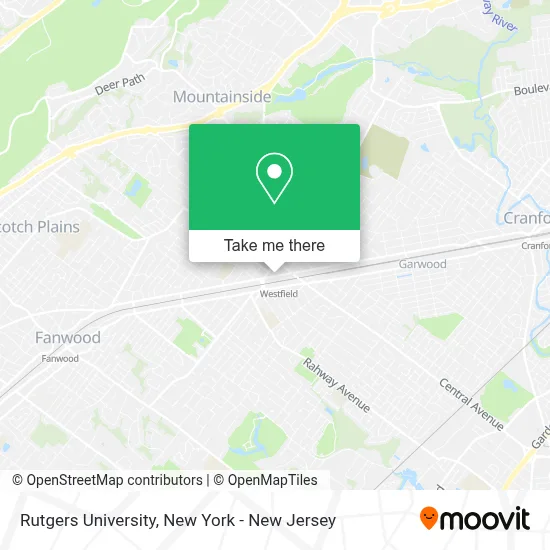
See Rutgers University, Westfield, on the map
Public Transit to Rutgers University in Westfield
Wondering how to get to Rutgers University in Westfield? Moovit helps you find the best way to get to Rutgers University with step-by-step directions from the nearest public transit station.
Moovit provides free maps and live directions to help you navigate through your city. View schedules, routes, timetables, and find out how long does it take to get to Rutgers University in real time.
Looking for the nearest stop or station to Rutgers University? Check out this list of stops closest to your destination: Orchard St at Elm St; South Ave at West Broad St#; Garwood.
Bus: 113, 59.Train: RVL.
Want to see if there’s another route that gets you there at an earlier time? Moovit helps you find alternative routes or times. Get directions from and directions to Rutgers University easily from the Moovit App or Website.
We make riding to Rutgers University easy, which is why over 1.5 million users, including users in Westfield, trust Moovit as the best app for public transit. You don’t need to download an individual bus app or train app, Moovit is your all-in-one transit app that helps you find the best bus time or train time available.
For information on prices of bus and train, costs and ride fares to Rutgers University, please check the Moovit app.
Use the app to navigate to popular places including to the airport, hospital, stadium, grocery store, mall, coffee shop, school, college, and university.
Rutgers University Address: 300 North Ave W street in Westfield
- Susan Massa Crs Sres Real Estate Broker,
- Diane Goodwin - Realtor - New Jersey,
- Karen Pollack,
- Marissa Basso Keller Williams Realty,
- Michael Casso - Michael Martinetti Group NJ,
- Ask Tammie About Real Estate,
- Vince Difilippo Group,
- Robert Howell Real Estate Agent,
- Davin Harris Realtor, Keller Williams Premier Properties,
- Mia Sorber,
- Cinnaholic,
- Besfort Chermenika,
- Julia Quinones Real Estate,
- Ryan Fleming, Realtor,
- Sold Sisters,
- The Mavins Group,
- Angelina Banina,
- Wonders Of Westfield,
- Realtor Paula Monteiro,
- Davinsellshomes
Places Near Rutgers University (Westfield)
- Times Square, Manhattan,
- Katz's Deli, Manhattan,
- 376 Hudson Street, Manhattan,
- Rockefeller Center, Manhattan,
- qqqq, Manhattan,
- 1 Police Plaza, Manhattan,
- 3 Stone St, Manhattan,
- Queens Center Mall, Queens,
- 911 Memorial, Manhattan,
- 26 Federal Plaza, Manhattan,
- SoHo, Manhattan,
- Hudson Yards, Manhattan,
- Pier 83, Manhattan,
- Mountainside Hospital, Glen Ridge,
- San Gennaro Feast, Manhattan,
- Wall Street, Manhattan,
- 111 Centre New York City Supreme Court, Manhattan,
- Chinatown, Manhattan,
- 66 John Street, Manhattan,
- Bellevue Hospital, Manhattan
How to get to popular places in New York - New Jersey with public transit
Get around Westfield by public transit!
Traveling around Westfield has never been so easy. See step by step directions as you travel to any attraction, street or major public transit station. View bus and train schedules, arrival times, service alerts and detailed routes on a map, so you know exactly how to get to anywhere in Westfield.
When traveling to any destination around Westfield use Moovit's Live Directions with Get Off Notifications to know exactly where and how far to walk, how long to wait for your line, and how many stops are left. Moovit will alert you when it's time to get off — no need to constantly re-check whether yours is the next stop.
Wondering how to use public transit in Westfield or how to pay for public transit in Westfield? Moovit public transit app can help you navigate your way with public transit easily, and at minimum cost. It includes public transit fees, ticket prices, and costs. Looking for a map of Westfield public transit lines? Moovit public transit app shows all public transit maps in Westfield with all Bus, Train, Subway, Light Rail, Ferry and Cable Car routes and stops on an interactive map.
New York - New Jersey has 6 transit type(s), including: Bus, Train, Subway, Light Rail, Ferry and Cable Car, operated by several transit agencies, including MTA Subway, Metro-North Railroad, LIRR, PATH, MTA New York City Transit - Express routes, MTA Bus, NJ Transit, NYC Ferry, NICE bus, Bee-Line Bus, NJ Transit Rail, Norwalk Transit District, Hartford Line, River Valley Transit and HART