How to get to Rutgers University @ Umdnj by bus?
Click on the bus route to see step by step directions with maps, line arrival times and updated time schedules.
From Saint Barnabas Medical Center, Livingston
41 minFrom Medieval Times, Lyndhurst
59 minFrom West Orange, NJ, West Orange
33 minFrom Newport Mall Bus, Jersey City
45 minFrom Medieval Times Dinner & Tournament, Lyndhurst
59 minFrom 51, Jersey City
58 minFrom Mountainside Hospital, Glen Ridge
54 minFrom Bayonne, NJ, Bayonne
81 minFrom Journal Square, Jersey City
59 minFrom Hillside, NJ, Hillside
34 min
How to get to Rutgers University @ Umdnj by train?
Click on the train route to see step by step directions with maps, line arrival times and updated time schedules.
Bus stops near Rutgers University @ Umdnj in Newark
Light Rail stations near Rutgers University @ Umdnj in Newark
- Warren Street Light Rail Station, 2 min walk,VIEW
Bus lines to Rutgers University @ Umdnj in Newark
What are the closest stations to Rutgers University @ Umdnj?
The closest stations to Rutgers University @ Umdnj are:
- W Market St at Norfolk St is 30 yards away, 1 min walk.
- Norfolk St at West Market St is 89 yards away, 2 min walk.
- Warren Street Light Rail Station is 121 yards away, 2 min walk.
- Warren St at Cornerstone Ln is 155 yards away, 2 min walk.
- S Orange Ave at Norfolk St/Jones St is 533 yards away, 7 min walk.
Which bus lines stop near Rutgers University @ Umdnj?
These bus lines stop near Rutgers University @ Umdnj: 21, 34, 99.
Which train lines stop near Rutgers University @ Umdnj?
These train lines stop near Rutgers University @ Umdnj: ML, RED.
What’s the nearest light rail station to Rutgers University @ Umdnj in Newark?
The nearest light rail station to Rutgers University @ Umdnj in Newark is Warren Street Light Rail Station. It’s a 2 min walk away.
What’s the nearest bus station to Rutgers University @ Umdnj in Newark?
The nearest bus station to Rutgers University @ Umdnj in Newark is W Market St at Norfolk St. It’s a 1 min walk away.
What time is the first light rail to Rutgers University @ Umdnj in Newark?
The NLR is the first light rail that goes to Rutgers University @ Umdnj in Newark. It stops nearby at 4:24 AM.
What time is the last light rail to Rutgers University @ Umdnj in Newark?
The NLR is the last light rail that goes to Rutgers University @ Umdnj in Newark. It stops nearby at 1:21 AM.
What time is the first bus to Rutgers University @ Umdnj in Newark?
The 34 is the first bus that goes to Rutgers University @ Umdnj in Newark. It stops nearby at 4:32 AM.
What time is the last bus to Rutgers University @ Umdnj in Newark?
The 34 is the last bus that goes to Rutgers University @ Umdnj in Newark. It stops nearby at 2:34 AM.
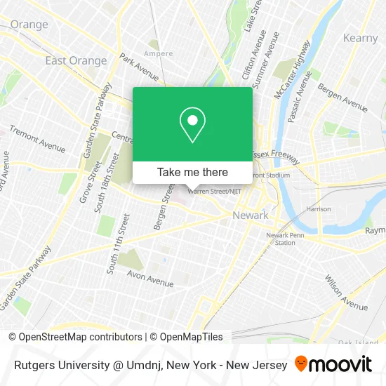
See Rutgers University @ Umdnj, Newark, on the map
Public Transit to Rutgers University @ Umdnj in Newark
Wondering how to get to Rutgers University @ Umdnj in Newark? Moovit helps you find the best way to get to Rutgers University @ Umdnj with step-by-step directions from the nearest public transit station.
Moovit provides free maps and live directions to help you navigate through your city. View schedules, routes, timetables, and find out how long does it take to get to Rutgers University @ Umdnj in real time.
Looking for the nearest stop or station to Rutgers University @ Umdnj? Check out this list of stops closest to your destination: W Market St at Norfolk St; Norfolk St at West Market St; Warren Street Light Rail Station; Warren St at Cornerstone Ln; S Orange Ave at Norfolk St/Jones St.
Bus: 21, 34, 99, 71, 73, 79, 31.Train: ML, RED.
Want to see if there’s another route that gets you there at an earlier time? Moovit helps you find alternative routes or times. Get directions from and directions to Rutgers University @ Umdnj easily from the Moovit App or Website.
We make riding to Rutgers University @ Umdnj easy, which is why over 1.5 million users, including users in Newark, trust Moovit as the best app for public transit. You don’t need to download an individual bus app or train app, Moovit is your all-in-one transit app that helps you find the best bus time or train time available.
For information on prices of bus and train, costs and ride fares to Rutgers University @ Umdnj, please check the Moovit app.
Use the app to navigate to popular places including to the airport, hospital, stadium, grocery store, mall, coffee shop, school, college, and university.
Rutgers University @ Umdnj Address: July 1, 2013 street in Newark
- Tea RX Cafe,
- Rutger University Newark,
- Rutger University Newark Office of Housing & Residence Life,
- 180 West Market,
- Variation Headstart Center,
- Norfolk Parking Deck,
- University Centre by Found Study,
- Newark Debate Academy,
- Mobile Machine,
- Atmosphere Healing,
- Aunty Lizzy's Oseikrom Restaurant and African Market,
- Western Union,
- North Jersey Federal Credit Union,
- All Health Services PC,
- Science Park High School,
- Manhattan Podiatry Group : Mark Sharobeem, DPM,
- Rutgers School of Health Professions (Rutgers School of Health Related Professions Newark),
- Wawa Best African Hair Braiding,
- Newark Science Park High School,
- Majestic Appliance Rep
Places Near Rutgers University @ Umdnj (Newark)
- 911 Memorial, Manhattan,
- Chinatown, Manhattan,
- Wall Street, Manhattan,
- Mountainside Hospital, Glen Ridge,
- Times Square, Manhattan,
- qqqq, Manhattan,
- Pier 83, Manhattan,
- Hudson Yards, Manhattan,
- SoHo, Manhattan,
- 376 Hudson Street, Manhattan,
- 26 Federal Plaza, Manhattan,
- San Gennaro Feast, Manhattan,
- 1 Police Plaza, Manhattan,
- Queens Center Mall, Queens,
- 3 Stone St, Manhattan,
- 111 Centre New York City Supreme Court, Manhattan,
- 66 John Street, Manhattan,
- Katz's Deli, Manhattan,
- Rockefeller Center, Manhattan,
- Bellevue Hospital, Manhattan
How to get to popular places in New York - New Jersey with public transit
Get around Newark by public transit!
Traveling around Newark has never been so easy. See step by step directions as you travel to any attraction, street or major public transit station. View bus and train schedules, arrival times, service alerts and detailed routes on a map, so you know exactly how to get to anywhere in Newark.
When traveling to any destination around Newark use Moovit's Live Directions with Get Off Notifications to know exactly where and how far to walk, how long to wait for your line, and how many stops are left. Moovit will alert you when it's time to get off — no need to constantly re-check whether yours is the next stop.
Wondering how to use public transit in Newark or how to pay for public transit in Newark? Moovit public transit app can help you navigate your way with public transit easily, and at minimum cost. It includes public transit fees, ticket prices, and costs. Looking for a map of Newark public transit lines? Moovit public transit app shows all public transit maps in Newark with all Bus, Train, Subway, Light Rail, Ferry and Cable Car routes and stops on an interactive map.
New York - New Jersey has 6 transit type(s), including: Bus, Train, Subway, Light Rail, Ferry and Cable Car, operated by several transit agencies, including MTA Subway, Metro-North Railroad, LIRR, PATH, MTA New York City Transit - Express routes, MTA Bus, NJ Transit, NYC Ferry, NICE bus, Bee-Line Bus, NJ Transit Rail, Norwalk Transit District, Hartford Line, River Valley Transit and HART