Directions to Rutgers Wildlife Conservation and Management (New Brunswick) with public transportation
The following transit lines have routes that pass near Rutgers Wildlife Conservation and Management
 Bus: 811, 815, 818, SUBURBAN TRANSIT.
- Train: NC, CAROLINIAN, KEYSTONE SERVICE, NORTHEAST REGIONAL.
How to get to Rutgers Wildlife Conservation and Management by bus?
Click on the bus route to see step by step directions with maps, line arrival times and updated time schedules.
From South Ave, Staten Island
167 minFrom PNC Bank Arts Center, Holmdel
182 minFrom Linden, NJ, Linden
165 minFrom Union County College - Cranford Campus, Cranford
180 minFrom Walmart, Linden
165 minFrom HUUHHHH??, Woodbridge
127 minFrom Plainfield, NJ, Plainfield
99 minFrom Staten Island Mall, Staten Island
162 minFrom Baps Shri Swaminarayan Mandir, Edison, NJ, USA, Edison
45 minFrom Perth Amboy, NJ, Perth Amboy
87 min
How to get to Rutgers Wildlife Conservation and Management by train?
Click on the train route to see step by step directions with maps, line arrival times and updated time schedules.
Bus stops near Rutgers Wildlife Conservation and Management in New Brunswick
Train stations near Rutgers Wildlife Conservation and Management in New Brunswick
Bus lines to Rutgers Wildlife Conservation and Management in New Brunswick
What are the closest stations to Rutgers Wildlife Conservation and Management?
The closest stations to Rutgers Wildlife Conservation and Management are:
- Douglas Campus George St 150' N Of Chapel Dr. is 1288 yards away, 16 min walk.
- George's Rd at Sandford St is 1449 yards away, 17 min walk.
- Jersey Avenue is 2909 yards away, 34 min walk.
- New Brunswick is 2980 yards away, 35 min walk.
Which bus lines stop near Rutgers Wildlife Conservation and Management?
These bus lines stop near Rutgers Wildlife Conservation and Management: 811, 815, 818, SUBURBAN TRANSIT.
Which train line stops near Rutgers Wildlife Conservation and Management?
NC (Trenton Transit Center)
What time is the first train to Rutgers Wildlife Conservation and Management in New Brunswick?
The NC is the first train that goes to Rutgers Wildlife Conservation and Management in New Brunswick. It stops nearby at 4:13 AM.
What time is the last train to Rutgers Wildlife Conservation and Management in New Brunswick?
The NC is the last train that goes to Rutgers Wildlife Conservation and Management in New Brunswick. It stops nearby at 2:26 AM.
What time is the first bus to Rutgers Wildlife Conservation and Management in New Brunswick?
The 815 is the first bus that goes to Rutgers Wildlife Conservation and Management in New Brunswick. It stops nearby at 5:00 AM.
What time is the last bus to Rutgers Wildlife Conservation and Management in New Brunswick?
The 815 is the last bus that goes to Rutgers Wildlife Conservation and Management in New Brunswick. It stops nearby at 11:31 PM.
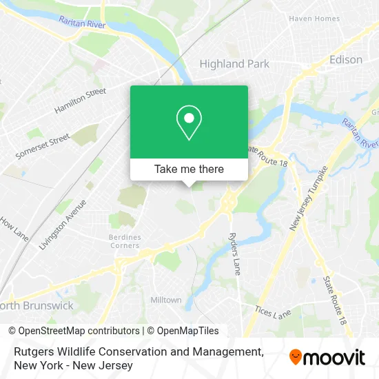
See Rutgers Wildlife Conservation and Management, New Brunswick, on the map
Public Transit to Rutgers Wildlife Conservation and Management in New Brunswick
Wondering how to get to Rutgers Wildlife Conservation and Management in New Brunswick? Moovit helps you find the best way to get to Rutgers Wildlife Conservation and Management with step-by-step directions from the nearest public transit station.
Moovit provides free maps and live directions to help you navigate through your city. View schedules, routes, timetables, and find out how long does it take to get to Rutgers Wildlife Conservation and Management in real time.
Looking for the nearest stop or station to Rutgers Wildlife Conservation and Management? Check out this list of stops closest to your destination: Douglas Campus George St 150' N Of Chapel Dr.; George's Rd at Sandford St; Jersey Avenue; New Brunswick.
Bus: 811, 815, 818, SUBURBAN TRANSIT.Train: NC, CAROLINIAN, KEYSTONE SERVICE, NORTHEAST REGIONAL.
Want to see if there’s another route that gets you there at an earlier time? Moovit helps you find alternative routes or times. Get directions from and directions to Rutgers Wildlife Conservation and Management easily from the Moovit App or Website.
We make riding to Rutgers Wildlife Conservation and Management easy, which is why over 1.5 million users, including users in New Brunswick, trust Moovit as the best app for public transit. You don’t need to download an individual bus app or train app, Moovit is your all-in-one transit app that helps you find the best bus time or train time available.
For information on prices of bus and train, costs and ride fares to Rutgers Wildlife Conservation and Management, please check the Moovit app.
Use the app to navigate to popular places including to the airport, hospital, stadium, grocery store, mall, coffee shop, school, college, and university.
Rutgers Wildlife Conservation and Management Address: 14 College Farm Rd street in New Brunswick
- Department Of Ecology, Evolution and Natural Resources,
- Bioenvironmental Engineering and Science at Rutgers,
- Department Of Environmental Sciences,
- Rutgers Farm Store,
- Rutgers Center For Ocean Observing Leadership,
- Rutgers Scuba Divers,
- Cook Douglass Health Center,
- Skelley Field,
- Gibex - the Global Institute For Bioexploration,
- Annie's Project NJ,
- Ru Cool,
- Department Of Animal Sciences,
- Nicholas Residence Hall,
- New Jersey Institute For Food, Nutrition & Health,
- Rutgers Ifnh Building,
- Rutgers Equine Science Center,
- Rutgers University Bio Tech,
- Sebs Little Free Library,
- New Jersey Agricultural Experiment Station,
- Rutgers Agriculture and Natural Resources
Places Near Rutgers Wildlife Conservation and Management (New Brunswick)
- Chinatown, Manhattan,
- 911 Memorial, Manhattan,
- 1 Police Plaza, Manhattan,
- Rockefeller Center, Manhattan,
- Bellevue Hospital, Manhattan,
- Mountainside Hospital, Glen Ridge,
- Wall Street, Manhattan,
- 376 Hudson Street, Manhattan,
- 66 John Street, Manhattan,
- Hudson Yards, Manhattan,
- Pier 83, Manhattan,
- SoHo, Manhattan,
- Times Square, Manhattan,
- 111 Centre New York City Supreme Court, Manhattan,
- 26 Federal Plaza, Manhattan,
- qqqq, Manhattan,
- Queens Center Mall, Queens,
- 3 Stone St, Manhattan,
- Katz's Deli, Manhattan,
- San Gennaro Feast, Manhattan
How to get to popular places in New York - New Jersey with public transit
Get around New Brunswick by public transit!
Traveling around New Brunswick has never been so easy. See step by step directions as you travel to any attraction, street or major public transit station. View bus and train schedules, arrival times, service alerts and detailed routes on a map, so you know exactly how to get to anywhere in New Brunswick.
When traveling to any destination around New Brunswick use Moovit's Live Directions with Get Off Notifications to know exactly where and how far to walk, how long to wait for your line, and how many stops are left. Moovit will alert you when it's time to get off — no need to constantly re-check whether yours is the next stop.
Wondering how to use public transit in New Brunswick or how to pay for public transit in New Brunswick? Moovit public transit app can help you navigate your way with public transit easily, and at minimum cost. It includes public transit fees, ticket prices, and costs. Looking for a map of New Brunswick public transit lines? Moovit public transit app shows all public transit maps in New Brunswick with all Bus, Train, Subway, Light Rail, Ferry and Cable Car routes and stops on an interactive map.
New York - New Jersey has 6 transit type(s), including: Bus, Train, Subway, Light Rail, Ferry and Cable Car, operated by several transit agencies, including MTA Subway, Metro-North Railroad, LIRR, PATH, MTA New York City Transit - Express routes, MTA Bus, NJ Transit, NYC Ferry, NICE bus, Bee-Line Bus, NJ Transit Rail, Norwalk Transit District, Hartford Line, River Valley Transit and HART