Directions to Ruth A. Borchardt, Md (Manhattan) with public transportation
The following transit lines have routes that pass near Ruth A. Borchardt, Md
 Bus: M15-SBS, M42, M66, M15.
- Train: 2, 3, BABYLON BRANCH, PORT WASHINGTON BRANCH.
- Subway: N, Q, F, M, R.
- Cable Car: ROOSEVELT ISLAND TRAM.
How to get to Ruth A. Borchardt, Md by bus?
Click on the bus route to see step by step directions with maps, line arrival times and updated time schedules.
From Flushing Meadows-Corona Park, Queens
60 minFrom Crotona Park, Bronx
72 minFrom 961 E 174th St, Bronx
72 minFrom Franklin Ave, Bronx
74 minFrom Pier 40 - Hudson River Park, Manhattan
44 minFrom Estatua de la libertad, Manhattan
35 minFrom Mitsuwa Marketplace, Edgewater
59 minFrom Secaucus Junction, Secaucus
88 min
How to get to Ruth A. Borchardt, Md by train?
Click on the train route to see step by step directions with maps, line arrival times and updated time schedules.
How to get to Ruth A. Borchardt, Md by subway?
Click on the subway route to see step by step directions with maps, line arrival times and updated time schedules.
Bus stops near Ruth A. Borchardt, Md in Manhattan
Cable Car station near Ruth A. Borchardt, Md in Manhattan
- Manhattan Tram Station, 4 min walk,VIEW
Subway stations near Ruth A. Borchardt, Md in Manhattan
Bus lines to Ruth A. Borchardt, Md in Manhattan
What are the closest stations to Ruth A. Borchardt, Md?
The closest stations to Ruth A. Borchardt, Md are:
- E 68 St/1 Av is 7 yards away, 1 min walk.
- 1 Av/E 67 St is 91 yards away, 2 min walk.
- Manhattan Tram Station is 249 yards away, 4 min walk.
- York Av/E 69 St is 269 yards away, 4 min walk.
- Lexington Av/63 St is 311 yards away, 5 min walk.
- 68 St-Hunter College is 688 yards away, 9 min walk.
Which bus lines stop near Ruth A. Borchardt, Md?
These bus lines stop near Ruth A. Borchardt, Md: M15-SBS, M42, M66.
Which train lines stop near Ruth A. Borchardt, Md?
These train lines stop near Ruth A. Borchardt, Md: 2, 3, BABYLON BRANCH, PORT WASHINGTON BRANCH.
Which subway lines stop near Ruth A. Borchardt, Md?
These subway lines stop near Ruth A. Borchardt, Md: N, Q.
What’s the nearest subway station to Ruth A. Borchardt, Md in Manhattan?
The nearest subway station to Ruth A. Borchardt, Md in Manhattan is Lexington Av/63 St. It’s a 5 min walk away.
What’s the nearest bus station to Ruth A. Borchardt, Md in Manhattan?
The nearest bus station to Ruth A. Borchardt, Md in Manhattan is E 68 St/1 Av. It’s a 1 min walk away.
What’s the nearest cable car station to Ruth A. Borchardt, Md in Manhattan?
The nearest cable car station to Ruth A. Borchardt, Md in Manhattan is Manhattan Tram Station. It’s a 4 min walk away.
What time is the first subway to Ruth A. Borchardt, Md in Manhattan?
The F is the first subway that goes to Ruth A. Borchardt, Md in Manhattan. It stops nearby at 3:00 AM.
What time is the last subway to Ruth A. Borchardt, Md in Manhattan?
The 4 is the last subway that goes to Ruth A. Borchardt, Md in Manhattan. It stops nearby at 3:43 AM.
What time is the first bus to Ruth A. Borchardt, Md in Manhattan?
The M15 is the first bus that goes to Ruth A. Borchardt, Md in Manhattan. It stops nearby at 3:15 AM.
What time is the last bus to Ruth A. Borchardt, Md in Manhattan?
The M15 is the last bus that goes to Ruth A. Borchardt, Md in Manhattan. It stops nearby at 2:59 AM.
What time is the first cable car to Ruth A. Borchardt, Md in Manhattan?
The ROOSEVELT ISLAND TRAM is the first cable car that goes to Ruth A. Borchardt, Md in Manhattan. It stops nearby at 5:52 AM.
What time is the last cable car to Ruth A. Borchardt, Md in Manhattan?
The ROOSEVELT ISLAND TRAM is the last cable car that goes to Ruth A. Borchardt, Md in Manhattan. It stops nearby at 2:10 AM.
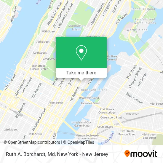
See Ruth A. Borchardt, Md, Manhattan, on the map
Public Transit to Ruth A. Borchardt, Md in Manhattan
Wondering how to get to Ruth A. Borchardt, Md in Manhattan? Moovit helps you find the best way to get to Ruth A. Borchardt, Md with step-by-step directions from the nearest public transit station.
Moovit provides free maps and live directions to help you navigate through your city. View schedules, routes, timetables, and find out how long does it take to get to Ruth A. Borchardt, Md in real time.
Looking for the nearest stop or station to Ruth A. Borchardt, Md? Check out this list of stops closest to your destination: E 68 St/1 Av; 1 Av/E 67 St; Manhattan Tram Station; York Av/E 69 St; Lexington Av/63 St; 68 St-Hunter College.
Bus: M15-SBS, M42, M66, M15.Train: 2, 3, BABYLON BRANCH, PORT WASHINGTON BRANCH.Subway: N, Q, F, M, R, 4, 5, 6, 6X.Cable Car: ROOSEVELT ISLAND TRAM.
Want to see if there’s another route that gets you there at an earlier time? Moovit helps you find alternative routes or times. Get directions from and directions to Ruth A. Borchardt, Md easily from the Moovit App or Website.
We make riding to Ruth A. Borchardt, Md easy, which is why over 1.5 million users, including users in Manhattan, trust Moovit as the best app for public transit. You don’t need to download an individual bus app or train app, Moovit is your all-in-one transit app that helps you find the best bus time or train time available.
For information on prices of bus, subway and train, costs and ride fares to Ruth A. Borchardt, Md, please check the Moovit app.
Use the app to navigate to popular places including to the airport, hospital, stadium, grocery store, mall, coffee shop, school, college, and university.
Ruth A. Borchardt, Md Address: 1275 York Ave street in Manhattan
- Memorial Sloan Kettering Cancer Center Schwartz Cancer Research Building,
- Mskcc -Arnold and Marie Schwartz Building,
- Citibank Atm 1st Ave & 68th St,
- Miracle Apartment Cleaning Service,
- The Church Of Saint Catherine Of Siena,
- Taco Bell,
- Msk Schwartz Cancer Research Building,
- E 68th St / 1st Ave,
- E 68th St (68th street and 1st Ave),
- Msk Blood Donation Room,
- Center For Learning & Living -Nyc,
- Chung-Han Lee, Md, Phd,
- Gregory J. Riely, Md, Phd,
- 1st Avenue Gourmet Deli,
- Zuckerman Research Center,
- Dona Bugov, Md,
- Little Italy Pizza,
- Valerie W. Rusch, Md, Facs,
- 425 East 67 St - M S K,
- New 1st Ave Gourmet
Places Near Ruth A. Borchardt, Md (Manhattan)
- 111 Centre New York City Supreme Court, Manhattan,
- San Gennaro Feast, Manhattan,
- Hudson Yards, Manhattan,
- SoHo, Manhattan,
- Wall Street, Manhattan,
- 26 Federal Plaza, Manhattan,
- qqqq, Manhattan,
- 3 Stone St, Manhattan,
- Chinatown, Manhattan,
- Pier 83, Manhattan,
- 376 Hudson Street, Manhattan,
- Times Square, Manhattan,
- Mountainside Hospital, Glen Ridge,
- Katz's Deli, Manhattan,
- Bellevue Hospital, Manhattan,
- 66 John Street, Manhattan,
- Queens Center Mall, Queens,
- 1 Police Plaza, Manhattan,
- 911 Memorial, Manhattan,
- Rockefeller Center, Manhattan
How to get to popular places in New York - New Jersey with public transit
Get around Manhattan by public transit!
Traveling around Manhattan has never been so easy. See step by step directions as you travel to any attraction, street or major public transit station. View bus and train schedules, arrival times, service alerts and detailed routes on a map, so you know exactly how to get to anywhere in Manhattan.
When traveling to any destination around Manhattan use Moovit's Live Directions with Get Off Notifications to know exactly where and how far to walk, how long to wait for your line, and how many stops are left. Moovit will alert you when it's time to get off — no need to constantly re-check whether yours is the next stop.
Wondering how to use public transit in Manhattan or how to pay for public transit in Manhattan? Moovit public transit app can help you navigate your way with public transit easily, and at minimum cost. It includes public transit fees, ticket prices, and costs. Looking for a map of Manhattan public transit lines? Moovit public transit app shows all public transit maps in Manhattan with all Bus, Train, Subway, Light Rail, Ferry and Cable Car routes and stops on an interactive map.
New York - New Jersey has 6 transit type(s), including: Bus, Train, Subway, Light Rail, Ferry and Cable Car, operated by several transit agencies, including MTA Subway, Metro-North Railroad, LIRR, PATH, MTA New York City Transit - Express routes, MTA Bus, NJ Transit, NYC Ferry, NICE bus, Bee-Line Bus, NJ Transit Rail, Norwalk Transit District, Hartford Line, River Valley Transit and HART