How to get to Ruth A. Campo Md by bus?
Click on the bus route to see step by step directions with maps, line arrival times and updated time schedules.
From Hillside, NJ, Hillside
89 minFrom IKEA Elizabeth Shuttle Bus To Manhattan, Elizabeth
92 minFrom Community Coach 77 Bus Stop, Livingston
89 minFrom Plainfield, NJ, Plainfield
54 minFrom Elizabeth, NJ, Elizabeth
89 minFrom Saint Barnabas Medical Center, Livingston
207 minFrom Linden, NJ, Linden
117 minFrom Union County College - Cranford Campus, Cranford
84 min
How to get to Ruth A. Campo Md by train?
Click on the train route to see step by step directions with maps, line arrival times and updated time schedules.
Bus stop near Ruth A. Campo Md in Berkeley Heights
- K-Line Access Rd at Bus Stop#, 9 min walk,VIEW
Train station near Ruth A. Campo Md in Berkeley Heights
- Murray Hill, 10 min walk,VIEW
Bus lines to Ruth A. Campo Md in Berkeley Heights
- 986, Summit Via N Providence Center,VIEW
What are the closest stations to Ruth A. Campo Md?
The closest stations to Ruth A. Campo Md are:
- K-Line Access Rd at Bus Stop# is 745 yards away, 9 min walk.
- Murray Hill is 785 yards away, 10 min walk.
Which bus lines stop near Ruth A. Campo Md?
These bus lines stop near Ruth A. Campo Md: 65, 986.
Which train line stops near Ruth A. Campo Md?
GB (Gladstone)
What’s the nearest train station to Ruth A. Campo Md in Berkeley Heights?
The nearest train station to Ruth A. Campo Md in Berkeley Heights is Murray Hill. It’s a 10 min walk away.
What’s the nearest bus station to Ruth A. Campo Md in Berkeley Heights?
The nearest bus station to Ruth A. Campo Md in Berkeley Heights is K-Line Access Rd at Bus Stop#. It’s a 9 min walk away.
What time is the first train to Ruth A. Campo Md in Berkeley Heights?
The GB is the first train that goes to Ruth A. Campo Md in Berkeley Heights. It stops nearby at 4:58 AM.
What time is the last train to Ruth A. Campo Md in Berkeley Heights?
The GB is the last train that goes to Ruth A. Campo Md in Berkeley Heights. It stops nearby at 1:05 AM.
What time is the first bus to Ruth A. Campo Md in Berkeley Heights?
The 986 is the first bus that goes to Ruth A. Campo Md in Berkeley Heights. It stops nearby at 6:28 AM.
What time is the last bus to Ruth A. Campo Md in Berkeley Heights?
The 986 is the last bus that goes to Ruth A. Campo Md in Berkeley Heights. It stops nearby at 7:26 PM.
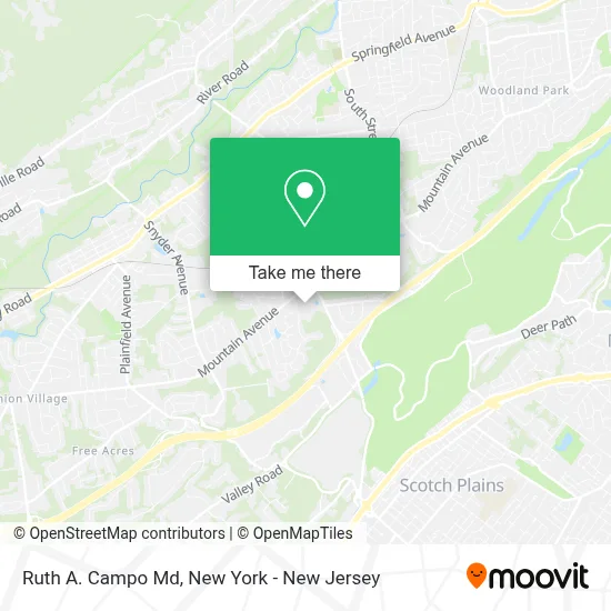
See Ruth A. Campo Md, Berkeley Heights, on the map
Public Transit to Ruth A. Campo Md in Berkeley Heights
Wondering how to get to Ruth A. Campo Md in Berkeley Heights? Moovit helps you find the best way to get to Ruth A. Campo Md with step-by-step directions from the nearest public transit station.
Moovit provides free maps and live directions to help you navigate through your city. View schedules, routes, timetables, and find out how long does it take to get to Ruth A. Campo Md in real time.
Looking for the nearest stop or station to Ruth A. Campo Md? Check out this list of stops closest to your destination: K-Line Access Rd at Bus Stop#; Murray Hill.
Bus: 65, 986.Train: GB.
Want to see if there’s another route that gets you there at an earlier time? Moovit helps you find alternative routes or times. Get directions from and directions to Ruth A. Campo Md easily from the Moovit App or Website.
We make riding to Ruth A. Campo Md easy, which is why over 1.5 million users, including users in Berkeley Heights, trust Moovit as the best app for public transit. You don’t need to download an individual bus app or train app, Moovit is your all-in-one transit app that helps you find the best bus time or train time available.
For information on prices of bus and train, costs and ride fares to Ruth A. Campo Md, please check the Moovit app.
Use the app to navigate to popular places including to the airport, hospital, stadium, grocery store, mall, coffee shop, school, college, and university.
Ruth A. Campo Md Address: 1 Diamond Hill Rd street in Berkeley Heights
- Ronald Benitez Md,
- William Brown, Md,
- Peter Colucio, Md,
- Lloyd H. Alterman Md, Facp,
- Paul Girardi, Do,
- Jack Cappitelli, Md,
- Jamie L. Reedy Md, Mph,
- Lowell Gurey, Md,
- Ayesha Ayub, Md,
- Gary L. Kohn Md, Faap, Fccp,
- Virginia Comer,
- Gary Kohn, Md, Faap, Faccp,
- Anna Dibona Md,
- Lauren B. Vanover Pa,
- Mary J. Bliss Md,
- Jeffrey Bauman, Md,
- Steven B. Rosenbaum Md, Faaem,
- David Schreiber, Md,
- Farshad Abir, Md,
- Alberto R. Rivera Md
Places Near Ruth A. Campo Md (Berkeley Heights)
- 3 Stone St, Manhattan,
- Mountainside Hospital, Glen Ridge,
- Queens Center Mall, Queens,
- Rockefeller Center, Manhattan,
- Bellevue Hospital, Manhattan,
- 111 Centre New York City Supreme Court, Manhattan,
- Chinatown, Manhattan,
- Times Square, Manhattan,
- 26 Federal Plaza, Manhattan,
- San Gennaro Feast, Manhattan,
- 1 Police Plaza, Manhattan,
- 376 Hudson Street, Manhattan,
- qqqq, Manhattan,
- Hudson Yards, Manhattan,
- SoHo, Manhattan,
- Katz's Deli, Manhattan,
- 911 Memorial, Manhattan,
- Pier 83, Manhattan,
- 66 John Street, Manhattan,
- Wall Street, Manhattan
How to get to popular places in New York - New Jersey with public transit
Get around Berkeley Heights by public transit!
Traveling around Berkeley Heights has never been so easy. See step by step directions as you travel to any attraction, street or major public transit station. View bus and train schedules, arrival times, service alerts and detailed routes on a map, so you know exactly how to get to anywhere in Berkeley Heights.
When traveling to any destination around Berkeley Heights use Moovit's Live Directions with Get Off Notifications to know exactly where and how far to walk, how long to wait for your line, and how many stops are left. Moovit will alert you when it's time to get off — no need to constantly re-check whether yours is the next stop.
Wondering how to use public transit in Berkeley Heights or how to pay for public transit in Berkeley Heights? Moovit public transit app can help you navigate your way with public transit easily, and at minimum cost. It includes public transit fees, ticket prices, and costs. Looking for a map of Berkeley Heights public transit lines? Moovit public transit app shows all public transit maps in Berkeley Heights with all Bus, Train, Subway, Light Rail, Ferry and Cable Car routes and stops on an interactive map.
New York - New Jersey has 6 transit type(s), including: Bus, Train, Subway, Light Rail, Ferry and Cable Car, operated by several transit agencies, including MTA Subway, Metro-North Railroad, LIRR, PATH, MTA New York City Transit - Express routes, MTA Bus, NJ Transit, NYC Ferry, NICE bus, Bee-Line Bus, NJ Transit Rail, Norwalk Transit District, Hartford Line, River Valley Transit and HART