How to get to Ruth Davidson by bus?
Click on the bus route to see step by step directions with maps, line arrival times and updated time schedules.
How to get to Ruth Davidson by train?
Click on the train route to see step by step directions with maps, line arrival times and updated time schedules.
How to get to Ruth Davidson by subway?
Click on the subway route to see step by step directions with maps, line arrival times and updated time schedules.
Bus stops near Ruth Davidson in Manhattan
Subway stations near Ruth Davidson in Manhattan
Train station near Ruth Davidson in Manhattan
- 33rd Street, 9 min walk,VIEW
Bus lines to Ruth Davidson in Manhattan
- BXM6, Parkchester - Midtown,VIEW
- BXM7, Co-Op City - Midtown,VIEW
- BXM8, Pelham Bay/City Island - Midtown,VIEW
- BXM18, Riverdale - Downtown,VIEW
- SHORTLINE HUDSON, 200 - Northern District – Nanuet,VIEW
- SHORTLINE HUDSON, 700 - Newburgh - Poughkeepsie,VIEW
- GREENWICH, Midtown / W 39th Street,VIEW
- M34-SBS, Select Bus East Side Fdr Dr Crosstown,VIEW
- M34A-SBS, Select Bus Pa Bus Trm Via 34 St Via 8 Av,VIEW
- SIM23, Annadale Via Arden Av,VIEW
- SIM24, Midtown Via 34 St Via Madison Av,VIEW
- 34TH ST, Midtown / W 39th Street,VIEW
- X27, Bay Ridge Shore Rd Via Broadway,VIEW
- X28, Coney Island Sea Gate Via Broadway,VIEW
- X37, Bay Ridge Shore Rd Via 23 St Via Fdr Dr,VIEW
- X38, Coney Isl Sea Gte Via 23 St-Fdr Via Crop,VIEW
- BXM9, Throgs Neck - Midtown Express,VIEW
- BXM10, Williamsbridge/Morris Park - Midtown,VIEW
- BXM11, Wakefield - Midtown,VIEW
- M1, Harlem - East Village,VIEW
What are the closest stations to Ruth Davidson?
The closest stations to Ruth Davidson are:
- 5th Ave & W 34th St is 74 yards away, 2 min walk.
- 5th Ave & W 32nd St is 85 yards away, 2 min walk.
- 33 St is 90 yards away, 2 min walk.
- E 34 St/5 Av is 97 yards away, 2 min walk.
- E 34th St & 5th Ave is 97 yards away, 2 min walk.
- 5 Av/W 35 St is 108 yards away, 2 min walk.
- 5 Av/W 33 St is 116 yards away, 2 min walk.
- E 34 St /5 Av is 277 yards away, 4 min walk.
- W 34 St/5 Av is 358 yards away, 5 min walk.
- 34 St-Herald Sq is 659 yards away, 8 min walk.
- 33rd Street is 706 yards away, 9 min walk.
Which bus lines stop near Ruth Davidson?
These bus lines stop near Ruth Davidson: 28, BM2, BXM4, M34A-SBS, M55, QM18, QM24.
Which train lines stop near Ruth Davidson?
These train lines stop near Ruth Davidson: 1, 2, BABYLON BRANCH, PORT JEFFERSON BRANCH, YEL.
Which subway lines stop near Ruth Davidson?
These subway lines stop near Ruth Davidson: 5, 6, 6X, B, D, M, R.
What’s the nearest subway station to Ruth Davidson in Manhattan?
The nearest subway station to Ruth Davidson in Manhattan is 33 St. It’s a 2 min walk away.
What’s the nearest train station to Ruth Davidson in Manhattan?
The nearest train station to Ruth Davidson in Manhattan is 33rd Street. It’s a 9 min walk away.
What’s the nearest bus station to Ruth Davidson in Manhattan?
The nearest bus stations to Ruth Davidson in Manhattan are 5th Ave & W 34th St, 5th Ave & W 32nd St, E 34 St/5 Av, E 34th St & 5th Ave, 5 Av/W 35 St and 5 Av/W 33 St. The closest one is a 2 min walk away.
What time is the first subway to Ruth Davidson in Manhattan?
The 4 is the first subway that goes to Ruth Davidson in Manhattan. It stops nearby at 3:00 AM.
What time is the last subway to Ruth Davidson in Manhattan?
The N is the last subway that goes to Ruth Davidson in Manhattan. It stops nearby at 3:59 AM.
What time is the first train to Ruth Davidson in Manhattan?
The ATW is the first train that goes to Ruth Davidson in Manhattan. It stops nearby at 3:21 AM.
What time is the last train to Ruth Davidson in Manhattan?
The ATW is the last train that goes to Ruth Davidson in Manhattan. It stops nearby at 3:21 AM.
What time is the first bus to Ruth Davidson in Manhattan?
The M2 is the first bus that goes to Ruth Davidson in Manhattan. It stops nearby at 3:52 AM.
What time is the last bus to Ruth Davidson in Manhattan?
The M2 is the last bus that goes to Ruth Davidson in Manhattan. It stops nearby at 2:52 AM.
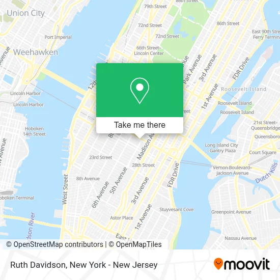
See Ruth Davidson, Manhattan, on the map
Public Transit to Ruth Davidson in Manhattan
Wondering how to get to Ruth Davidson in Manhattan? Moovit helps you find the best way to get to Ruth Davidson with step-by-step directions from the nearest public transit station.
Moovit provides free maps and live directions to help you navigate through your city. View schedules, routes, timetables, and find out how long does it take to get to Ruth Davidson in real time.
Looking for the nearest stop or station to Ruth Davidson? Check out this list of stops closest to your destination: 5th Ave & W 34th St; 5th Ave & W 32nd St; 33 St; E 34 St/5 Av; E 34th St & 5th Ave; 5 Av/W 35 St; 5 Av/W 33 St; E 34 St /5 Av; W 34 St/5 Av; 34 St-Herald Sq; 33rd Street.
Bus: 28, BM2, BXM4, M34A-SBS, M55, QM18, QM24, GREENWICH, BXM6, BXM7, BXM8, BXM18, SHORTLINE HUDSON, M34-SBS.Train: 1, 2, BABYLON BRANCH, PORT JEFFERSON BRANCH, YEL, ATW, BLU.Subway: 5, 6, 6X, B, D, M, R, 4, F, FX.
Want to see if there’s another route that gets you there at an earlier time? Moovit helps you find alternative routes or times. Get directions from and directions to Ruth Davidson easily from the Moovit App or Website.
We make riding to Ruth Davidson easy, which is why over 1.5 million users, including users in Manhattan, trust Moovit as the best app for public transit. You don’t need to download an individual bus app or train app, Moovit is your all-in-one transit app that helps you find the best bus time or train time available.
For information on prices of bus, subway and train, costs and ride fares to Ruth Davidson, please check the Moovit app.
Use the app to navigate to popular places including to the airport, hospital, stadium, grocery store, mall, coffee shop, school, college, and university.
Ruth Davidson Address: 350 5th Ave street in Manhattan
- Dr Nora Bellamy,
- Smart Comfort Footwear,
- Baby Care Notes,
- Empire State Building Store,
- Heels,
- Samart Ai,
- Ghirelli Rosaries Usa,
- Erica Walker,
- Zentelier,
- Burn Vitality,
- Siya's Quotes,
- Healing Path,
- Zayron Luxes,
- Blemory,
- From Ground Up,
- At&T,
- \R\Nelectricianmusk Usa,
- Pixelmania,
- Thun Ct,
- Cornerstone Services
Places Near Ruth Davidson (Manhattan)
- Mountainside Hospital, Glen Ridge,
- 911 Memorial, Manhattan,
- Chinatown, Manhattan,
- SoHo, Manhattan,
- Katz's Deli, Manhattan,
- 376 Hudson Street, Manhattan,
- Pier 83, Manhattan,
- Bellevue Hospital, Manhattan,
- 111 Centre New York City Supreme Court, Manhattan,
- 66 John Street, Manhattan,
- San Gennaro Feast, Manhattan,
- Times Square, Manhattan,
- 3 Stone St, Manhattan,
- 26 Federal Plaza, Manhattan,
- Rockefeller Center, Manhattan,
- qqqq, Manhattan,
- Hudson Yards, Manhattan,
- Wall Street, Manhattan,
- 1 Police Plaza, Manhattan,
- Queens Center Mall, Queens
How to get to popular places in New York - New Jersey with public transit
Get around Manhattan by public transit!
Traveling around Manhattan has never been so easy. See step by step directions as you travel to any attraction, street or major public transit station. View bus and train schedules, arrival times, service alerts and detailed routes on a map, so you know exactly how to get to anywhere in Manhattan.
When traveling to any destination around Manhattan use Moovit's Live Directions with Get Off Notifications to know exactly where and how far to walk, how long to wait for your line, and how many stops are left. Moovit will alert you when it's time to get off — no need to constantly re-check whether yours is the next stop.
Wondering how to use public transit in Manhattan or how to pay for public transit in Manhattan? Moovit public transit app can help you navigate your way with public transit easily, and at minimum cost. It includes public transit fees, ticket prices, and costs. Looking for a map of Manhattan public transit lines? Moovit public transit app shows all public transit maps in Manhattan with all Bus, Train, Subway, Light Rail, Ferry and Cable Car routes and stops on an interactive map.
New York - New Jersey has 6 transit type(s), including: Bus, Train, Subway, Light Rail, Ferry and Cable Car, operated by several transit agencies, including MTA Subway, Metro-North Railroad, LIRR, PATH, MTA New York City Transit - Express routes, MTA Bus, NJ Transit, NYC Ferry, NICE bus, Bee-Line Bus, NJ Transit Rail, Norwalk Transit District, Hartford Line, River Valley Transit and HART