Directions to Ruth Garden Apartments (Lynbrook) with public transportation
The following transit lines have routes that pass near Ruth Garden Apartments
 Bus: N25, N31X/M, N4, N4X, N31.
- Train: BABYLON BRANCH, LONG BEACH BRANCH, WEST HEMPSTEAD BRANCH.
How to get to Ruth Garden Apartments by bus?
Click on the bus route to see step by step directions with maps, line arrival times and updated time schedules.
From Far Rockaway, NY, Queens
44 minFrom Long island Jewish Hospital, Queens
63 minFrom Walmart, Queens
41 minFrom Plattduetsche Park, Franklin Square
38 minFrom Social Security Office, Queens
47 minFrom Zucker Hillside Hospital, Queens
61 minFrom Garden City, NY, Garden City
65 minFrom Uniondale, NY, Uniondale
65 minFrom Queens Village, Queens
62 minFrom Roosevelt Field Mall Bus Terminal, East Garden City
55 min
How to get to Ruth Garden Apartments by train?
Click on the train route to see step by step directions with maps, line arrival times and updated time schedules.
Bus stop near Ruth Garden Apartments in Lynbrook
- Columbus Dr / Merrick, 2 min walk,VIEW
Train stations near Ruth Garden Apartments in Lynbrook
Bus lines to Ruth Garden Apartments in Lynbrook
What are the closest stations to Ruth Garden Apartments?
The closest stations to Ruth Garden Apartments are:
- Columbus Dr / Merrick is 114 yards away, 2 min walk.
- Rockville Centre is 147 yards away, 2 min walk.
- Westwood is 1951 yards away, 23 min walk.
- East Rockaway is 2753 yards away, 33 min walk.
Which bus lines stop near Ruth Garden Apartments?
These bus lines stop near Ruth Garden Apartments: N25, N31X/M, N4.
Which train lines stop near Ruth Garden Apartments?
These train lines stop near Ruth Garden Apartments: BABYLON BRANCH, LONG BEACH BRANCH.
What’s the nearest train station to Ruth Garden Apartments in Lynbrook?
The nearest train station to Ruth Garden Apartments in Lynbrook is Rockville Centre. It’s a 2 min walk away.
What’s the nearest bus station to Ruth Garden Apartments in Lynbrook?
The nearest bus station to Ruth Garden Apartments in Lynbrook is Columbus Dr / Merrick. It’s a 2 min walk away.
What time is the first train to Ruth Garden Apartments in Lynbrook?
The BABYLON BRANCH is the first train that goes to Ruth Garden Apartments in Lynbrook. It stops nearby at 3:23 AM.
What time is the last train to Ruth Garden Apartments in Lynbrook?
The BABYLON BRANCH is the last train that goes to Ruth Garden Apartments in Lynbrook. It stops nearby at 3:23 AM.
What time is the first bus to Ruth Garden Apartments in Lynbrook?
The N4 is the first bus that goes to Ruth Garden Apartments in Lynbrook. It stops nearby at 3:10 AM.
What time is the last bus to Ruth Garden Apartments in Lynbrook?
The N4 is the last bus that goes to Ruth Garden Apartments in Lynbrook. It stops nearby at 3:10 AM.
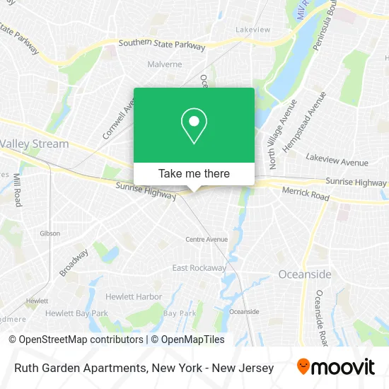
See Ruth Garden Apartments, Lynbrook, on the map
Public Transit to Ruth Garden Apartments in Lynbrook
Wondering how to get to Ruth Garden Apartments in Lynbrook? Moovit helps you find the best way to get to Ruth Garden Apartments with step-by-step directions from the nearest public transit station.
Moovit provides free maps and live directions to help you navigate through your city. View schedules, routes, timetables, and find out how long does it take to get to Ruth Garden Apartments in real time.
Looking for the nearest stop or station to Ruth Garden Apartments? Check out this list of stops closest to your destination: Columbus Dr / Merrick; Rockville Centre; Westwood; East Rockaway.
Bus: N25, N31X/M, N4, N4X, N31.Train: BABYLON BRANCH, LONG BEACH BRANCH, WEST HEMPSTEAD BRANCH.
Want to see if there’s another route that gets you there at an earlier time? Moovit helps you find alternative routes or times. Get directions from and directions to Ruth Garden Apartments easily from the Moovit App or Website.
We make riding to Ruth Garden Apartments easy, which is why over 1.7 million users, including users in Lynbrook, trust Moovit as the best app for public transit. You don’t need to download an individual bus app or train app, Moovit is your all-in-one transit app that helps you find the best bus time or train time available.
For information on prices of bus and train, costs and ride fares to Ruth Garden Apartments, please check the Moovit app.
Use the app to navigate to popular places including to the airport, hospital, stadium, grocery store, mall, coffee shop, school, college, and university.
Ruth Garden Apartments Address: 121 Vincent Ave (Shipherd Ave) street in Lynbrook
- Capital Tire Of Lynbrook,
- Bp,
- Lynbrook Gas Inc, Gulf Gas Station,
- Bp,
- Art Of Dentistry - Sunrise Hwy,
- Goosehead Insurance,
- Crown Ford,
- Ryu's Martial Arts,
- The Plunge Place,
- Tubee,
- The Car Key Store Locksmith Lynbrook,
- Sunrise Wine and Liquor One,
- The K9 Shop (Lynbrook),
- Rlb Safety and Hardware,
- Western Union,
- Checkline • Electromatic Equipment Co., Inc.,
- Firefighters Memorial Park,
- Electromatic Equipment - Checkline.Com,
- Advance Auto Parts,
- Infiniti Of Lynbrook Service and Parts
Places Near Ruth Garden Apartments (Lynbrook)
- Bellevue Hospital, Manhattan,
- Hudson Yards, Manhattan,
- Times Square, Manhattan,
- Queens Center Mall, Queens,
- 26 Federal Plaza, Manhattan,
- Rockefeller Center, Manhattan,
- 3 Stone St, Manhattan,
- Pier 83, Manhattan,
- SoHo, Manhattan,
- 376 Hudson Street, Manhattan,
- 111 Centre New York City Supreme Court, Manhattan,
- Katz's Deli, Manhattan,
- Wall Street, Manhattan,
- 66 John Street, Manhattan,
- qqqq, Manhattan,
- San Gennaro Feast, Manhattan,
- Mountainside Hospital, Glen Ridge,
- 911 Memorial, Manhattan,
- Chinatown, Manhattan,
- 1 Police Plaza, Manhattan
How to get to popular places in New York - New Jersey with public transit
Get around Lynbrook by public transit!
Traveling around Lynbrook has never been so easy. See step by step directions as you travel to any attraction, street or major public transit station. View bus and train schedules, arrival times, service alerts and detailed routes on a map, so you know exactly how to get to anywhere in Lynbrook.
When traveling to any destination around Lynbrook use Moovit's Live Directions with Get Off Notifications to know exactly where and how far to walk, how long to wait for your line, and how many stops are left. Moovit will alert you when it's time to get off — no need to constantly re-check whether yours is the next stop.
Wondering how to use public transit in Lynbrook or how to pay for public transit in Lynbrook? Moovit public transit app can help you navigate your way with public transit easily, and at minimum cost. It includes public transit fees, ticket prices, and costs. Looking for a map of Lynbrook public transit lines? Moovit public transit app shows all public transit maps in Lynbrook with all Bus, Train, Subway, Light Rail, Ferry and Cable Car routes and stops on an interactive map.
New York - New Jersey has 6 transit type(s), including: Bus, Train, Subway, Light Rail, Ferry and Cable Car, operated by several transit agencies, including MTA Subway, Metro-North Railroad, LIRR, PATH, MTA New York City Transit - Express routes, MTA Bus, NJ Transit, NYC Ferry, NICE bus, Bee-Line Bus, NJ Transit Rail, Norwalk Transit District, Hartford Line, River Valley Transit and HART