Directions to Ruth Neely, Crnp (New York - New Jersey) with public transportation
The following transit lines have routes that pass near Ruth Neely, Crnp
 Bus: FLIXBUS 2686, GREYHOUND US0340S, 34, 35, 72.
How to get to Ruth Neely, Crnp by bus?
Click on the bus route to see step by step directions with maps, line arrival times and updated time schedules.
Bus stops near Ruth Neely, Crnp in New York - New Jersey
Bus lines to Ruth Neely, Crnp in New York - New Jersey
What are the closest stations to Ruth Neely, Crnp?
The closest stations to Ruth Neely, Crnp are:
- Wright Center, Scranton is 12 yards away, 1 min walk.
- S Wash Hickry O is 155 yards away, 2 min walk.
- Cedar Birch O is 588 yards away, 7 min walk.
Which bus lines stop near Ruth Neely, Crnp?
These bus lines stop near Ruth Neely, Crnp: FLIXBUS 2686, GREYHOUND US0340S.
What’s the nearest bus station to Ruth Neely, Crnp in New York - New Jersey?
The nearest bus station to Ruth Neely, Crnp in New York - New Jersey is Wright Center, Scranton. It’s a 1 min walk away.
What time is the first bus to Ruth Neely, Crnp in New York - New Jersey?
The 35 is the first bus that goes to Ruth Neely, Crnp in New York - New Jersey. It stops nearby at 6:29 AM.
What time is the last bus to Ruth Neely, Crnp in New York - New Jersey?
The 72 is the last bus that goes to Ruth Neely, Crnp in New York - New Jersey. It stops nearby at 12:03 AM.
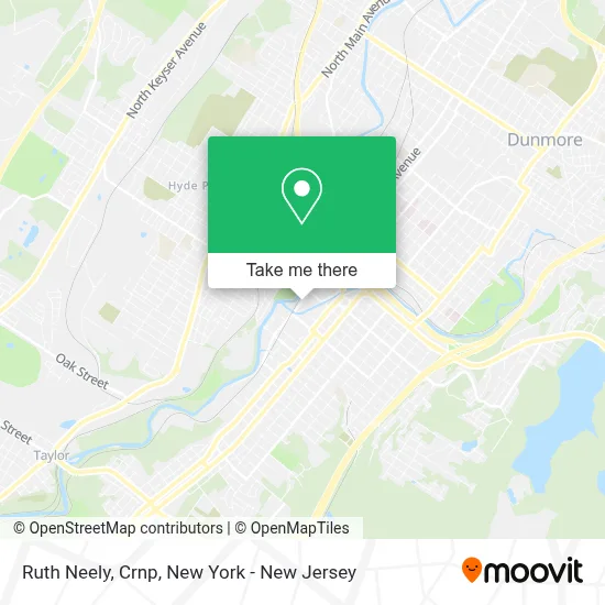
See Ruth Neely, Crnp, New York - New Jersey, on the map
Public Transit to Ruth Neely, Crnp in New York - New Jersey
Wondering how to get to Ruth Neely, Crnp in New York - New Jersey? Moovit helps you find the best way to get to Ruth Neely, Crnp with step-by-step directions from the nearest public transit station.
Moovit provides free maps and live directions to help you navigate through your city. View schedules, routes, timetables, and find out how long does it take to get to Ruth Neely, Crnp in real time.
Looking for the nearest stop or station to Ruth Neely, Crnp? Check out this list of stops closest to your destination: Wright Center; S Wash Hickry O; Cedar Birch O.
Bus: FLIXBUS 2686, GREYHOUND US0340S, 34, 35, 72, 73, 26.
Want to see if there’s another route that gets you there at an earlier time? Moovit helps you find alternative routes or times. Get directions from and directions to Ruth Neely, Crnp easily from the Moovit App or Website.
We make riding to Ruth Neely, Crnp easy, which is why over 1.5 million users, including users in New York - New Jersey, trust Moovit as the best app for public transit. You don’t need to download an individual bus app or train app, Moovit is your all-in-one transit app that helps you find the best bus time or train time available.
For information on prices of bus and train, costs and ride fares to Ruth Neely, Crnp, please check the Moovit app.
Use the app to navigate to popular places including to the airport, hospital, stadium, grocery store, mall, coffee shop, school, college, and university.
Ruth Neely, Crnp Address: 501 S Washington Ave street in New York - New Jersey
- Erin Mcfadden, M.D.,
- Caitlin Mccarthy, D.M.D.,
- Angelo Brutico,
- Right at Home,
- Scranton Adult Rehabilitation Center,
- The Wright Center For Community Health,
- The Salvation Army Adult Rehabilitation Center,
- Hnl Lab Medicine - Scranton - Wright Center,
- The Wright Center for Community Health Scranton Practice,
- The Wright Center For Graduate Medical Education,
- Northeast Veal,
- The Salvation Army Scranton Citadel Corps - Service & Worship Center,
- Penn Foster,
- Pella Windows and Doors Showroom Of Scranton, Pa,
- A R C,
- Rabbits Ink Gallery,
- Academy Of Asian Martial Arts,
- Sba Properties,
- Nepali Restaurant Scranton,
- Southside Tattoo
Places Near Ruth Neely, Crnp (New York - New Jersey)
- Pier 83, Manhattan,
- 911 Memorial, Manhattan,
- Katz's Deli, Manhattan,
- Rockefeller Center, Manhattan,
- 376 Hudson Street, Manhattan,
- San Gennaro Feast, Manhattan,
- Hudson Yards, Manhattan,
- Wall Street, Manhattan,
- Queens Center Mall, Queens,
- 26 Federal Plaza, Manhattan,
- 66 John Street, Manhattan,
- qqqq, Manhattan,
- 111 Centre New York City Supreme Court, Manhattan,
- 1 Police Plaza, Manhattan,
- Mountainside Hospital, Glen Ridge,
- Times Square, Manhattan,
- 3 Stone St, Manhattan,
- Bellevue Hospital, Manhattan,
- SoHo, Manhattan,
- Chinatown, Manhattan
How to get to popular places in New York - New Jersey with public transit
Get around New York - New Jersey by public transit!
Traveling around New York - New Jersey has never been so easy. See step by step directions as you travel to any attraction, street or major public transit station. View bus and train schedules, arrival times, service alerts and detailed routes on a map, so you know exactly how to get to anywhere in New York - New Jersey.
When traveling to any destination around New York - New Jersey use Moovit's Live Directions with Get Off Notifications to know exactly where and how far to walk, how long to wait for your line, and how many stops are left. Moovit will alert you when it's time to get off — no need to constantly re-check whether yours is the next stop.
Wondering how to use public transit in New York - New Jersey or how to pay for public transit in New York - New Jersey? Moovit public transit app can help you navigate your way with public transit easily, and at minimum cost. It includes public transit fees, ticket prices, and costs. Looking for a map of New York - New Jersey public transit lines? Moovit public transit app shows all public transit maps in New York - New Jersey with all Bus, Train, Subway, Light Rail, Ferry and Cable Car routes and stops on an interactive map.
New York - New Jersey has 6 transit type(s), including: Bus, Train, Subway, Light Rail, Ferry and Cable Car, operated by several transit agencies, including MTA Subway, Metro-North Railroad, LIRR, PATH, MTA New York City Transit - Express routes, MTA Bus, NJ Transit, NYC Ferry, NICE bus, Bee-Line Bus, NJ Transit Rail, Norwalk Transit District, Hartford Line, River Valley Transit and HART