How to get to Ruth Newman Shapiro Cancer & Heart Fund by bus?
Click on the bus route to see step by step directions with maps, line arrival times and updated time schedules.
From Monster Truck Ice Cream Truck, Pacific Ave, Wildwood Crest, Nj
119 minFrom Rutgers, New Brunswick
267 minFrom Toms River, NJ, Toms River
143 minFrom PNC Bank Arts Center, Holmdel
260 minFrom Long Branch Beach & Boardwalk, Long Branch
306 minFrom Freehold, NJ, Freehold
242 minFrom Gunnison Beach, Highlands
319 min
Bus stop near Ruth Newman Shapiro Cancer & Heart Fund in Ventnor City
- Ventnor Ave at Portland Ave, 2 min walk,VIEW
Bus lines to Ruth Newman Shapiro Cancer & Heart Fund in Ventnor City
What are the closest stations to Ruth Newman Shapiro Cancer & Heart Fund?
The closest stations to Ruth Newman Shapiro Cancer & Heart Fund are:
- Ventnor Ave at Portland Ave is 124 yards away, 2 min walk.
Which bus lines stop near Ruth Newman Shapiro Cancer & Heart Fund?
These bus lines stop near Ruth Newman Shapiro Cancer & Heart Fund: 504, 505.
What’s the nearest bus station to Ruth Newman Shapiro Cancer & Heart Fund in Ventnor City?
The nearest bus station to Ruth Newman Shapiro Cancer & Heart Fund in Ventnor City is Ventnor Ave at Portland Ave. It’s a 2 min walk away.
What time is the first bus to Ruth Newman Shapiro Cancer & Heart Fund in Ventnor City?
The 505 is the first bus that goes to Ruth Newman Shapiro Cancer & Heart Fund in Ventnor City. It stops nearby at 3:07 AM.
What time is the last bus to Ruth Newman Shapiro Cancer & Heart Fund in Ventnor City?
The 505 is the last bus that goes to Ruth Newman Shapiro Cancer & Heart Fund in Ventnor City. It stops nearby at 3:24 AM.
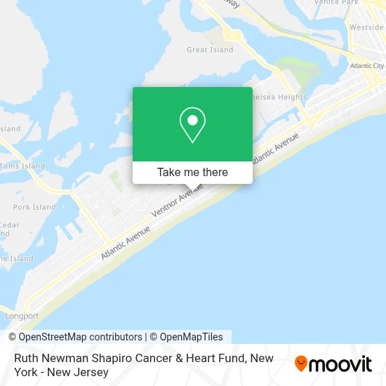
See Ruth Newman Shapiro Cancer & Heart Fund, Ventnor City, on the map
Public Transit to Ruth Newman Shapiro Cancer & Heart Fund in Ventnor City
Wondering how to get to Ruth Newman Shapiro Cancer & Heart Fund in Ventnor City? Moovit helps you find the best way to get to Ruth Newman Shapiro Cancer & Heart Fund with step-by-step directions from the nearest public transit station.
Moovit provides free maps and live directions to help you navigate through your city. View schedules, routes, timetables, and find out how long does it take to get to Ruth Newman Shapiro Cancer & Heart Fund in real time.
Looking for the nearest stop or station to Ruth Newman Shapiro Cancer & Heart Fund? Check out this list of stops closest to your destination: Ventnor Ave at Portland Ave.
Bus: 504, 505.
Want to see if there’s another route that gets you there at an earlier time? Moovit helps you find alternative routes or times. Get directions from and directions to Ruth Newman Shapiro Cancer & Heart Fund easily from the Moovit App or Website.
We make riding to Ruth Newman Shapiro Cancer & Heart Fund easy, which is why over 1.5 million users, including users in Ventnor City, trust Moovit as the best app for public transit. You don’t need to download an individual bus app or train app, Moovit is your all-in-one transit app that helps you find the best bus time or train time available.
For information on prices of bus and train, costs and ride fares to Ruth Newman Shapiro Cancer & Heart Fund, please check the Moovit app.
Use the app to navigate to popular places including to the airport, hospital, stadium, grocery store, mall, coffee shop, school, college, and university.
Ruth Newman Shapiro Cancer & Heart Fund Address: 3 S Newport Ave street in Ventnor City
- Café J'Adore,
- Janki's Beauty Salon,
- Tom Harris Jeweler,
- Oceancrat Ventnor,
- Drift Seafood,
- Sapore Restaurant,
- Medpro Medical Testing Center,
- Linda Faragasso, Apn,
- Ventnor Social,
- Virtua Heart Failure - Ventnor,
- The Arc Thrift Shop,
- Ocean Breeze Property Management,
- The Arc Makes Cents,
- Ventnor Social,
- Island Meat Market,
- Groovy Beach,
- Larry Campbell,
- Michael Angelo's Classic Painting,
- Estherviz Beauty Salon,
- Jackee's Nails & Spa
Places Near Ruth Newman Shapiro Cancer & Heart Fund (Ventnor City)
- Times Square, Manhattan,
- Katz's Deli, Manhattan,
- qqqq, Manhattan,
- 3 Stone St, Manhattan,
- Mountainside Hospital, Glen Ridge,
- Wall Street, Manhattan,
- 111 Centre New York City Supreme Court, Manhattan,
- Chinatown, Manhattan,
- 26 Federal Plaza, Manhattan,
- SoHo, Manhattan,
- Rockefeller Center, Manhattan,
- San Gennaro Feast, Manhattan,
- Pier 83, Manhattan,
- 911 Memorial, Manhattan,
- 66 John Street, Manhattan,
- 376 Hudson Street, Manhattan,
- Hudson Yards, Manhattan,
- 1 Police Plaza, Manhattan,
- Bellevue Hospital, Manhattan,
- Queens Center Mall, Queens
How to get to popular places in New York - New Jersey with public transit
Get around Ventnor City by public transit!
Traveling around Ventnor City has never been so easy. See step by step directions as you travel to any attraction, street or major public transit station. View bus and train schedules, arrival times, service alerts and detailed routes on a map, so you know exactly how to get to anywhere in Ventnor City.
When traveling to any destination around Ventnor City use Moovit's Live Directions with Get Off Notifications to know exactly where and how far to walk, how long to wait for your line, and how many stops are left. Moovit will alert you when it's time to get off — no need to constantly re-check whether yours is the next stop.
Wondering how to use public transit in Ventnor City or how to pay for public transit in Ventnor City? Moovit public transit app can help you navigate your way with public transit easily, and at minimum cost. It includes public transit fees, ticket prices, and costs. Looking for a map of Ventnor City public transit lines? Moovit public transit app shows all public transit maps in Ventnor City with all Bus, Train, Subway, Light Rail, Ferry and Cable Car routes and stops on an interactive map.
New York - New Jersey has 6 transit type(s), including: Bus, Train, Subway, Light Rail, Ferry and Cable Car, operated by several transit agencies, including MTA Subway, Metro-North Railroad, LIRR, PATH, MTA New York City Transit - Express routes, MTA Bus, NJ Transit, NYC Ferry, NICE bus, Bee-Line Bus, NJ Transit Rail, Norwalk Transit District, Hartford Line, River Valley Transit and HART