How to get to Rutherford Borough by bus?
Click on the bus route to see step by step directions with maps, line arrival times and updated time schedules.
From West New York, NJ, West New York
48 minFrom Mountainside Hospital, Glen Ridge
52 minFrom Walmart, Kearny
54 minFrom Paterson, NJ, Paterson
63 minFrom Walmart, Secaucus
63 minFrom Clara Maass Medical Center, Belleville
42 minFrom Hackensack, NJ, Hackensack
61 minFrom University Hospital, Newark
83 minFrom North Bergen, NJ, North Bergen
60 minFrom Prudential Center, Newark
53 min
How to get to Rutherford Borough by train?
Click on the train route to see step by step directions with maps, line arrival times and updated time schedules.
Bus stops near Rutherford Borough in Lyndhurst
Train station near Rutherford Borough in Lyndhurst
- Lyndhurst, 5 min walk,VIEW
Bus lines to Rutherford Borough in Lyndhurst
What are the closest stations to Rutherford Borough?
The closest stations to Rutherford Borough are:
- Park Ave at Court Ave is 87 yards away, 2 min walk.
- Lyndhurst is 308 yards away, 5 min walk.
- Rutherford Ave at Stuyvesant Ave is 643 yards away, 8 min walk.
- Kingsland Rd at River Rd is 3339 yards away, 40 min walk.
Which bus lines stop near Rutherford Borough?
These bus lines stop near Rutherford Borough: 192, 199.
Which train line stops near Rutherford Borough?
MCL (Suffern)
What’s the nearest train station to Rutherford Borough in Lyndhurst?
The nearest train station to Rutherford Borough in Lyndhurst is Lyndhurst. It’s a 5 min walk away.
What’s the nearest bus station to Rutherford Borough in Lyndhurst?
The nearest bus station to Rutherford Borough in Lyndhurst is Park Ave at Court Ave. It’s a 2 min walk away.
What time is the first train to Rutherford Borough in Lyndhurst?
The MCL is the first train that goes to Rutherford Borough in Lyndhurst. It stops nearby at 5:34 AM.
What time is the last train to Rutherford Borough in Lyndhurst?
The MCL is the last train that goes to Rutherford Borough in Lyndhurst. It stops nearby at 1:56 AM.
What time is the first bus to Rutherford Borough in Lyndhurst?
The 199 is the first bus that goes to Rutherford Borough in Lyndhurst. It stops nearby at 4:53 AM.
What time is the last bus to Rutherford Borough in Lyndhurst?
The 199 is the last bus that goes to Rutherford Borough in Lyndhurst. It stops nearby at 1:10 AM.
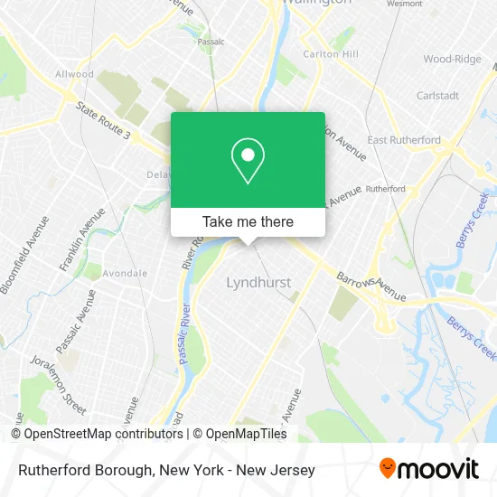
See Rutherford Borough, Lyndhurst, on the map
Public Transit to Rutherford Borough in Lyndhurst
Wondering how to get to Rutherford Borough in Lyndhurst? Moovit helps you find the best way to get to Rutherford Borough with step-by-step directions from the nearest public transit station.
Moovit provides free maps and live directions to help you navigate through your city. View schedules, routes, timetables, and find out how long does it take to get to Rutherford Borough in real time.
Looking for the nearest stop or station to Rutherford Borough? Check out this list of stops closest to your destination: Park Ave at Court Ave; Lyndhurst; Rutherford Ave at Stuyvesant Ave; Kingsland Rd at River Rd.
Bus: 192, 199, 76, 191, 195, 74.Train: MCL, PJL.
Want to see if there’s another route that gets you there at an earlier time? Moovit helps you find alternative routes or times. Get directions from and directions to Rutherford Borough easily from the Moovit App or Website.
We make riding to Rutherford Borough easy, which is why over 1.5 million users, including users in Lyndhurst, trust Moovit as the best app for public transit. You don’t need to download an individual bus app or train app, Moovit is your all-in-one transit app that helps you find the best bus time or train time available.
For information on prices of bus and train, costs and ride fares to Rutherford Borough, please check the Moovit app.
Use the app to navigate to popular places including to the airport, hospital, stadium, grocery store, mall, coffee shop, school, college, and university.
Rutherford Borough Address: 150 Park Ave street in Lyndhurst
- F.A.S.S.T.,
- All Day Athletics,
- Animal Strength & Conditioning,
- Stephen Dweck,
- Dr. Roland J. Losos,
- Ace Rosa Pen Corporation,
- Merwin Paolazzi Insurance Agency, Inc.,
- Pmy Construction Corp.,
- Warehouse Clearance Resale,
- Storkdelivery.Com,
- Floor Vision Llc,
- Exclusive Stoneworks,
- Yass Rug and Home Inc.,
- Eighth Street Bridge (Passaic River),
- Saban Engineering Group,
- Twin Monkey Playhouse,
- La Scala Pizzeria,
- E.B.S. Facility Services,
- Omega-Biochem Labs,
- Dr. Andrew F Burrows
Places Near Rutherford Borough (Lyndhurst)
- 66 John Street, Manhattan,
- 111 Centre New York City Supreme Court, Manhattan,
- Katz's Deli, Manhattan,
- SoHo, Manhattan,
- Pier 83, Manhattan,
- Rockefeller Center, Manhattan,
- Hudson Yards, Manhattan,
- 26 Federal Plaza, Manhattan,
- Queens Center Mall, Queens,
- Times Square, Manhattan,
- 376 Hudson Street, Manhattan,
- Bellevue Hospital, Manhattan,
- Chinatown, Manhattan,
- 3 Stone St, Manhattan,
- 911 Memorial, Manhattan,
- Mountainside Hospital, Glen Ridge,
- 1 Police Plaza, Manhattan,
- Wall Street, Manhattan,
- qqqq, Manhattan,
- San Gennaro Feast, Manhattan
How to get to popular places in New York - New Jersey with public transit
Get around Lyndhurst by public transit!
Traveling around Lyndhurst has never been so easy. See step by step directions as you travel to any attraction, street or major public transit station. View bus and train schedules, arrival times, service alerts and detailed routes on a map, so you know exactly how to get to anywhere in Lyndhurst.
When traveling to any destination around Lyndhurst use Moovit's Live Directions with Get Off Notifications to know exactly where and how far to walk, how long to wait for your line, and how many stops are left. Moovit will alert you when it's time to get off — no need to constantly re-check whether yours is the next stop.
Wondering how to use public transit in Lyndhurst or how to pay for public transit in Lyndhurst? Moovit public transit app can help you navigate your way with public transit easily, and at minimum cost. It includes public transit fees, ticket prices, and costs. Looking for a map of Lyndhurst public transit lines? Moovit public transit app shows all public transit maps in Lyndhurst with all Bus, Train, Subway, Light Rail, Ferry and Cable Car routes and stops on an interactive map.
New York - New Jersey has 6 transit type(s), including: Bus, Train, Subway, Light Rail, Ferry and Cable Car, operated by several transit agencies, including MTA Subway, Metro-North Railroad, LIRR, PATH, MTA New York City Transit - Express routes, MTA Bus, NJ Transit, NYC Ferry, NICE bus, Bee-Line Bus, NJ Transit Rail, Norwalk Transit District, Hartford Line, River Valley Transit and HART