How to get to Rutherford Physical Therapy by bus?
Click on the bus route to see step by step directions with maps, line arrival times and updated time schedules.
How to get to Rutherford Physical Therapy by train?
Click on the train route to see step by step directions with maps, line arrival times and updated time schedules.
Bus stops near Rutherford Physical Therapy
Train stations near Rutherford Physical Therapy
Bus lines to Rutherford Physical Therapy
What are the closest stations to Rutherford Physical Therapy?
The closest stations to Rutherford Physical Therapy are:
- Union Ave at Chestnut St is 332 yards away, 5 min walk.
- Rutherford Rail Station is 433 yards away, 6 min walk.
- Delawanna is 2558 yards away, 31 min walk.
- Wood- Ridge is 3646 yards away, 43 min walk.
Which bus lines stop near Rutherford Physical Therapy?
These bus lines stop near Rutherford Physical Therapy: 190, 76.
Which train line stops near Rutherford Physical Therapy?
MCL (Hoboken)
What’s the nearest bus station to Rutherford Physical Therapy?
The nearest bus station to Rutherford Physical Therapy is Union Ave at Chestnut St. It’s a 5 min walk away.
What time is the first train to Rutherford Physical Therapy?
The MCL is the first train that goes to Rutherford Physical Therapy. It stops nearby at 5:37 AM.
What time is the last train to Rutherford Physical Therapy?
The MCL is the last train that goes to Rutherford Physical Therapy. It stops nearby at 1:52 AM.
What time is the first bus to Rutherford Physical Therapy?
The 190 is the first bus that goes to Rutherford Physical Therapy. It stops nearby at 3:04 AM.
What time is the last bus to Rutherford Physical Therapy?
The 190 is the last bus that goes to Rutherford Physical Therapy. It stops nearby at 3:00 AM.
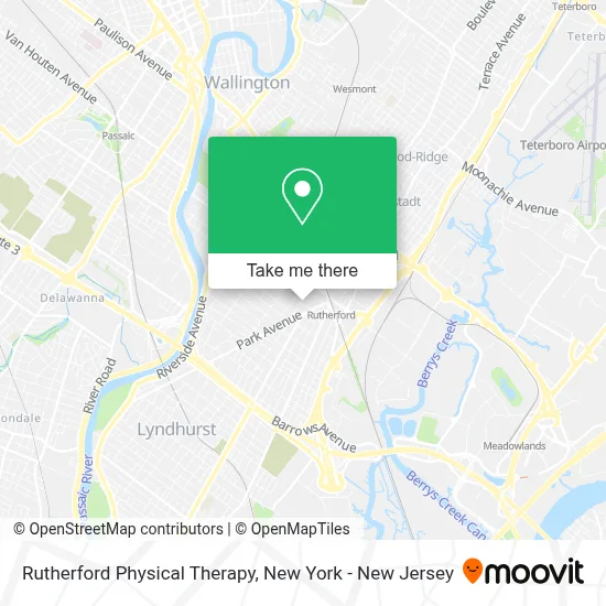
See Rutherford Physical Therapy on the map
Public Transportation to Rutherford Physical Therapy
Wondering how to get to Rutherford Physical Therapy? Moovit helps you find the best way to get to Rutherford Physical Therapy with step-by-step directions from the nearest public transit station.
Moovit provides free maps and live directions to help you navigate through your city. View schedules, routes, timetables, and find out how long does it take to get to Rutherford Physical Therapy in real time.
Looking for the nearest stop or station to Rutherford Physical Therapy? Check out this list of stops closest to your destination: Union Ave at Chestnut St; Rutherford Rail Station; Delawanna; Wood- Ridge.
Bus: 190, 76.Train: MCL, PJL, PVL.
Want to see if there’s another route that gets you there at an earlier time? Moovit helps you find alternative routes or times. Get directions from and directions to Rutherford Physical Therapy easily from the Moovit App or Website.
We make riding to Rutherford Physical Therapy easy, which is why over 1.5 million users, including users in Rutherford, trust Moovit as the best app for public transit. You don’t need to download an individual bus app or train app, Moovit is your all-in-one transit app that helps you find the best bus time or train time available.
For information on prices of bus and train, costs and ride fares to Rutherford Physical Therapy, please check the Moovit app.
Use the app to navigate to popular places including to the airport, hospital, stadium, grocery store, mall, coffee shop, school, college, and university.
Rutherford Physical Therapy Address: 71 Union Ave Ste 110A street in Rutherford
- Xfinity Store by Comcast,
- Tiny Sprouts Early Childhood Center,
- Braveseed Solutions,
- Butterfish Sushi,
- Butterfish,
- Panebianco Cucina Italiana,
- Living Bread - Artisan Sourdough Bakery & Mill,
- Heating Company Hvac,
- Steve's Coin & Stamp Shop,
- St Mary's Elementary School,
- Board & Brush Creative Studio - Rutherford,
- Transponder Car Key Locksmith,
- Stonefield Engineering,
- Jeff Jordan Architects Llc,
- Fiorentini Restaurant,
- The Loft,
- St Mary High School,
- Rutherford Senior Citizen,
- The Agency Rutherford-Park Avenue,
- Michelle Korosy
Places Near Rutherford Physical Therapy
- 1 Police Plaza, Manhattan,
- Katz's Deli, Manhattan,
- qqqq, Manhattan,
- 3 Stone St, Manhattan,
- SoHo, Manhattan,
- Chinatown, Manhattan,
- Times Square, Manhattan,
- Hudson Yards, Manhattan,
- Queens Center Mall, Queens,
- 111 Centre New York City Supreme Court, Manhattan,
- 26 Federal Plaza, Manhattan,
- Mountainside Hospital, Glen Ridge,
- San Gennaro Feast, Manhattan,
- Pier 83, Manhattan,
- 376 Hudson Street, Manhattan,
- Wall Street, Manhattan,
- 66 John Street, Manhattan,
- Bellevue Hospital, Manhattan,
- Rockefeller Center, Manhattan,
- 911 Memorial, Manhattan
How to get to popular places in New York - New Jersey with public transit
Get around Rutherford by public transit!
Traveling around Rutherford has never been so easy. See step by step directions as you travel to any attraction, street or major public transit station. View bus and train schedules, arrival times, service alerts and detailed routes on a map, so you know exactly how to get to anywhere in Rutherford.
When traveling to any destination around Rutherford use Moovit's Live Directions with Get Off Notifications to know exactly where and how far to walk, how long to wait for your line, and how many stops are left. Moovit will alert you when it's time to get off — no need to constantly re-check whether yours is the next stop.
Wondering how to use public transit in Rutherford or how to pay for public transit in Rutherford? Moovit public transit app can help you navigate your way with public transit easily, and at minimum cost. It includes public transit fees, ticket prices, and costs. Looking for a map of Rutherford public transit lines? Moovit public transit app shows all public transit maps in Rutherford with all Bus, Train, Subway, Light Rail, Ferry and Cable Car routes and stops on an interactive map.
New York - New Jersey has 6 transit type(s), including: Bus, Train, Subway, Light Rail, Ferry and Cable Car, operated by several transit agencies, including MTA Subway, Metro-North Railroad, LIRR, PATH, MTA New York City Transit - Express routes, MTA Bus, NJ Transit, NYC Ferry, NICE bus, Bee-Line Bus, NJ Transit Rail, Norwalk Transit District, Hartford Line, River Valley Transit and HART