How to get to Ruths Chris In Atlantic City by bus?
Click on the bus route to see step by step directions with maps, line arrival times and updated time schedules.
Bus stops near Ruths Chris In Atlantic City
- Atlantic Ave at Arkansas Ave, 1 min walk,VIEW
- On Atlantic Ave at Ohio Ave, 3 min walk,VIEW
- Pacific Ave at S Arkansas Ave, 3 min walk,VIEW
- Atlantic City (Caesars), 5 min walk,VIEW
- Gate #2 Inside Ac Bus Terminal, 5 min walk,VIEW
- Gate #3 Inside Ac Bus Terminal, 5 min walk,VIEW
- Gate #5 Inside Ac Bus Terminal, 6 min walk,VIEW
- Gate #7 Inside Ac Bus Terminal, 6 min walk,VIEW
- Gate #8 Inside Ac Bus Terminal, 6 min walk,VIEW
Train station near Ruths Chris In Atlantic City
- Atlantic City, 15 min walk,VIEW
Bus lines to Ruths Chris In Atlantic City
- 504, Ventnor Plz Margate,VIEW
- 505, Longport,VIEW
- 507, Ocean City,VIEW
- 508, Hamilton Mall Stockton Univ,VIEW
- 509, Somers Point Expressway,VIEW
- 502, Hamilton Mall,VIEW
- 501, Atlantic City Bus Terminal,VIEW
- 554, Atlantic City Absecon Blvd,VIEW
- AC1, Bally S Claridge Tropicana -Free Fare,VIEW
- GREYHOUND US0300, New York Port Authority,VIEW
- GREYHOUND US0320, Baltimore Downtown Bus Station,VIEW
- 552, Cape May,VIEW
- 319, New York Via Ocean Drive,VIEW
- 553, Upper Deerfld Blk Horse Pke Upper Deerfld Inspira Hosp Upper Deerfld Rowan Col Cumb,VIEW
- 559, Lakewood,VIEW
- 551, Philadelphia Gp Outlets,VIEW
What are the closest stations to Ruths Chris In Atlantic City?
The closest stations to Ruths Chris In Atlantic City are:
- Atlantic Ave at Arkansas Ave is 15 yards away, 1 min walk.
- On Atlantic Ave at Ohio Ave is 177 yards away, 3 min walk.
- Pacific Ave at S Arkansas Ave is 208 yards away, 3 min walk.
- Atlantic City (Caesars) is 322 yards away, 5 min walk.
- Gate #2 Inside Ac Bus Terminal is 385 yards away, 5 min walk.
- Gate #3 Inside Ac Bus Terminal is 398 yards away, 5 min walk.
- Gate #5 Inside Ac Bus Terminal is 408 yards away, 6 min walk.
- Gate #7 Inside Ac Bus Terminal is 418 yards away, 6 min walk.
- Gate #8 Inside Ac Bus Terminal is 424 yards away, 6 min walk.
- Atlantic City is 1238 yards away, 15 min walk.
Which bus lines stop near Ruths Chris In Atlantic City?
These bus lines stop near Ruths Chris In Atlantic City: 319, 552, 559.
What’s the nearest train station to Ruths Chris In Atlantic City?
The nearest train station to Ruths Chris In Atlantic City is Atlantic City. It’s a 15 min walk away.
What’s the nearest bus station to Ruths Chris In Atlantic City?
The nearest bus station to Ruths Chris In Atlantic City is Atlantic Ave at Arkansas Ave. It’s a 1 min walk away.
What time is the first train to Ruths Chris In Atlantic City?
The ACRL is the first train that goes to Ruths Chris In Atlantic City. It stops nearby at 4:11 AM.
What time is the last train to Ruths Chris In Atlantic City?
The ACRL is the last train that goes to Ruths Chris In Atlantic City. It stops nearby at 2:24 AM.
What time is the first bus to Ruths Chris In Atlantic City?
The 505 is the first bus that goes to Ruths Chris In Atlantic City. It stops nearby at 3:12 AM.
What time is the last bus to Ruths Chris In Atlantic City?
The 507 is the last bus that goes to Ruths Chris In Atlantic City. It stops nearby at 3:35 AM.
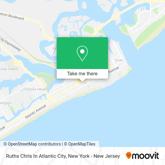
See Ruths Chris In Atlantic City on the map
Public Transportation to Ruths Chris In Atlantic City
Wondering how to get to Ruths Chris In Atlantic City? Moovit helps you find the best way to get to Ruths Chris In Atlantic City with step-by-step directions from the nearest public transit station.
Moovit provides free maps and live directions to help you navigate through your city. View schedules, routes, timetables, and find out how long does it take to get to Ruths Chris In Atlantic City in real time.
Looking for the nearest stop or station to Ruths Chris In Atlantic City? Check out this list of stops closest to your destination: Atlantic Ave at Arkansas Ave; On Atlantic Ave at Ohio Ave; Pacific Ave at S Arkansas Ave; Atlantic City (Caesars); Gate #2 Inside Ac Bus Terminal; Gate #3 Inside Ac Bus Terminal; Gate #5 Inside Ac Bus Terminal; Gate #7 Inside Ac Bus Terminal; Gate #8 Inside Ac Bus Terminal; Atlantic City.
Bus: 319, 552, 559, 504, 505, 507, 508, 509, 502, 501, 554, AC1, GREYHOUND US0300, GREYHOUND US0320.Train: ACRL.
Want to see if there’s another route that gets you there at an earlier time? Moovit helps you find alternative routes or times. Get directions from and directions to Ruths Chris In Atlantic City easily from the Moovit App or Website.
We make riding to Ruths Chris In Atlantic City easy, which is why over 1.5 million users, including users in Atlantic City, trust Moovit as the best app for public transit. You don’t need to download an individual bus app or train app, Moovit is your all-in-one transit app that helps you find the best bus time or train time available.
For information on prices of bus and train, costs and ride fares to Ruths Chris In Atlantic City, please check the Moovit app.
Use the app to navigate to popular places including to the airport, hospital, stadium, grocery store, mall, coffee shop, school, college, and university.
Ruths Chris In Atlantic City Address: 2020 Atlantic Ave street in Atlantic City
- Babalu Grill,
- 502 Shore Mall,
- Victoria's Secret & Pink,
- Banana Republic Factory Store,
- 2503 Gulf,
- Reebok,
- Hot Topic Atlantic City,
- Bcbgmaxazria,
- Crops Nonprofit,
- Atlantic City Ctr Outl,
- Kate Spade Outlet,
- Hanesbrands,
- Vans,
- Caesars Colosseum Parking Garage,
- Ceasers Hotel and Casino,
- Atlantic City Events,
- Converse,
- Guess Factory,
- Atlanticare City Hospital 6 Harmony,
- Paniq Escape Room Atlantic City
Places Near Ruths Chris In Atlantic City
- 3 Stone St, Manhattan,
- Rockefeller Center, Manhattan,
- 26 Federal Plaza, Manhattan,
- Mountainside Hospital, Glen Ridge,
- San Gennaro Feast, Manhattan,
- Chinatown, Manhattan,
- Times Square, Manhattan,
- 1 Police Plaza, Manhattan,
- Hudson Yards, Manhattan,
- Katz's Deli, Manhattan,
- Wall Street, Manhattan,
- 911 Memorial, Manhattan,
- 111 Centre New York City Supreme Court, Manhattan,
- qqqq, Manhattan,
- SoHo, Manhattan,
- Bellevue Hospital, Manhattan,
- 66 John Street, Manhattan,
- 376 Hudson Street, Manhattan,
- Pier 83, Manhattan,
- Queens Center Mall, Queens
How to get to popular places in New York - New Jersey with public transit
Get around Atlantic City by public transit!
Traveling around Atlantic City has never been so easy. See step by step directions as you travel to any attraction, street or major public transit station. View bus and train schedules, arrival times, service alerts and detailed routes on a map, so you know exactly how to get to anywhere in Atlantic City.
When traveling to any destination around Atlantic City use Moovit's Live Directions with Get Off Notifications to know exactly where and how far to walk, how long to wait for your line, and how many stops are left. Moovit will alert you when it's time to get off — no need to constantly re-check whether yours is the next stop.
Wondering how to use public transit in Atlantic City or how to pay for public transit in Atlantic City? Moovit public transit app can help you navigate your way with public transit easily, and at minimum cost. It includes public transit fees, ticket prices, and costs. Looking for a map of Atlantic City public transit lines? Moovit public transit app shows all public transit maps in Atlantic City with all Bus, Train, Subway, Light Rail, Ferry and Cable Car routes and stops on an interactive map.
New York - New Jersey has 6 transit type(s), including: Bus, Train, Subway, Light Rail, Ferry and Cable Car, operated by several transit agencies, including MTA Subway, Metro-North Railroad, LIRR, PATH, MTA New York City Transit - Express routes, MTA Bus, NJ Transit, NYC Ferry, NICE bus, Bee-Line Bus, NJ Transit Rail, Norwalk Transit District, Hartford Line, River Valley Transit and HART