How to get to Ruttkowski by bus?
Click on the bus route to see step by step directions with maps, line arrival times and updated time schedules.
From Harlem, Manhattan
65 minFrom Middle Village, NY, Queens
69 minFrom The Lucerne Hotel, Manhattan
57 minFrom Upper East Side, Manhattan
36 minFrom Long Island City Courthouse, Queens
53 minFrom Staten Island Ferry, Staten Island
79 minFrom Terminal 5, Manhattan
48 minFrom Elmhurst Hospital, Queens
72 minFrom Walmart, Secaucus
79 min
How to get to Ruttkowski by train?
Click on the train route to see step by step directions with maps, line arrival times and updated time schedules.
How to get to Ruttkowski by subway?
Click on the subway route to see step by step directions with maps, line arrival times and updated time schedules.
Subway stations near Ruttkowski in Manhattan
- Canal St, 1 min walk,VIEW
Bus stops near Ruttkowski in Manhattan
Bus lines to Ruttkowski in Manhattan
- BXM18, Downtown Wall St Via 5 Av Via Broadway,VIEW
- M55, South Ferry,VIEW
- SIM1, Eltingville - Lower Manhattan Express,VIEW
- SIM1C, Eltingville - Manhattan Express,VIEW
- SIM3C, Pt. Richmond - Manhattan Express,VIEW
- SIM4C, Huguenot - Manhattan Express,VIEW
- SIM33C, Mariners Harbor - Greenwich Village Express,VIEW
- SIM34, Mariners Harbor - Lower Manhattan Express,VIEW
- X27, Bay Ridge Shore Rd Via Broadway,VIEW
- X28, Coney Island Sea Gate Via Broadway,VIEW
- SHORTLINE HUDSON, 500 - Monroe - Chester - Goshen,VIEW
- SHORTLINE HUDSON, 200 - Northern District – Nanuet,VIEW
- SHORTLINE HUDSON, 800 - Pennsylvania,VIEW
- SHORTLINE HUDSON, 700 - Newburgh - Poughkeepsie,VIEW
- SHORTLINE HUDSON, 300 - NYC - Middletown,VIEW
- M1, Soho Centre St Via 5 Av/ Via Broadway,VIEW
What are the closest stations to Ruttkowski?
The closest stations to Ruttkowski are:
- Canal St is 80 yards away, 1 min walk.
- Broadway/Worth St is 109 yards away, 2 min walk.
- 6 Av/West Broadway is 128 yards away, 2 min walk.
- Avenue Of the Americas/West Broadway is 142 yards away, 2 min walk.
- Broadway/Walker St is 154 yards away, 2 min walk.
- Broadway & Leonard St is 397 yards away, 5 min walk.
- Centre St/Grand St is 516 yards away, 7 min walk.
Which bus lines stop near Ruttkowski?
These bus lines stop near Ruttkowski: BM2, BXM18, SIM34.
Which train lines stop near Ruttkowski?
These train lines stop near Ruttkowski: BLU, YEL.
Which subway lines stop near Ruttkowski?
These subway lines stop near Ruttkowski: C, E, J, N, Q, R.
What’s the nearest subway station to Ruttkowski in Manhattan?
The nearest subway station to Ruttkowski in Manhattan is Canal St. It’s a 1 min walk away.
What’s the nearest bus station to Ruttkowski in Manhattan?
The nearest bus stations to Ruttkowski in Manhattan are Broadway/Worth St, 6 Av/West Broadway, Avenue Of the Americas/West Broadway and Broadway/Walker St. The closest one is a 2 min walk away.
What time is the first subway to Ruttkowski in Manhattan?
The J is the first subway that goes to Ruttkowski in Manhattan. It stops nearby at 3:00 AM.
What time is the last subway to Ruttkowski in Manhattan?
The 2 is the last subway that goes to Ruttkowski in Manhattan. It stops nearby at 4:06 AM.
What time is the first bus to Ruttkowski in Manhattan?
The SIM1C is the first bus that goes to Ruttkowski in Manhattan. It stops nearby at 3:49 AM.
What time is the last bus to Ruttkowski in Manhattan?
The SIM1C is the last bus that goes to Ruttkowski in Manhattan. It stops nearby at 2:51 AM.
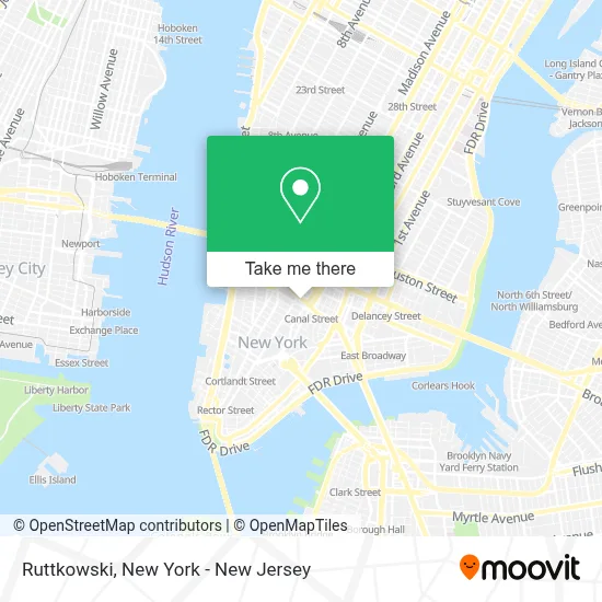
See Ruttkowski, Manhattan, on the map
Public Transit to Ruttkowski in Manhattan
Wondering how to get to Ruttkowski in Manhattan? Moovit helps you find the best way to get to Ruttkowski with step-by-step directions from the nearest public transit station.
Moovit provides free maps and live directions to help you navigate through your city. View schedules, routes, timetables, and find out how long does it take to get to Ruttkowski in real time.
Looking for the nearest stop or station to Ruttkowski? Check out this list of stops closest to your destination: Canal St; Broadway/Worth St; 6 Av/West Broadway; Avenue Of the Americas/West Broadway; Broadway/Walker St; Broadway & Leonard St; Centre St/Grand St.
Bus: BM2, BXM18, SIM34, M55, SIM1, SIM1C, SIM3C, SIM4C, SIM33C.Train: BLU, YEL.Subway: C, E, J, N, Q, R, A, 1, 2, W.
Want to see if there’s another route that gets you there at an earlier time? Moovit helps you find alternative routes or times. Get directions from and directions to Ruttkowski easily from the Moovit App or Website.
We make riding to Ruttkowski easy, which is why over 1.5 million users, including users in Manhattan, trust Moovit as the best app for public transit. You don’t need to download an individual bus app or train app, Moovit is your all-in-one transit app that helps you find the best bus time or train time available.
For information on prices of subway, bus, train and ferry, costs and ride fares to Ruttkowski, please check the Moovit app.
Use the app to navigate to popular places including to the airport, hospital, stadium, grocery store, mall, coffee shop, school, college, and university.
Ruttkowski Address: 46 Cortlandt Aly street in Manhattan
- Americana Perfume & Belt Buckle,
- Chinatown Health Clinic Foundation,
- Makeros,
- Long Island Business Institute,
- Masterskya,
- Therapy Lab - A Cbt Psychology Practice,
- Nachama Realty,
- Zab Bites Cafe&Restaurant,
- Triple Canopy,
- Paige Lowe,
- Canal Street Market,
- Mcdonald's In Chinatown,
- Soho Garden Hotel,
- BZBZ Services,
- Mogutable,
- Loknath Gift Shop Inc,
- Unique Media Store,
- Annies Kindergarten and Primary School,
- Smart Spaces Group,
- Northeast Birth Doula
Places Near Ruttkowski (Manhattan)
- Queens Center Mall, Queens,
- Wall Street, Manhattan,
- Chinatown, Manhattan,
- 26 Federal Plaza, Manhattan,
- 1 Police Plaza, Manhattan,
- 376 Hudson Street, Manhattan,
- 66 John Street, Manhattan,
- SoHo, Manhattan,
- qqqq, Manhattan,
- Bellevue Hospital, Manhattan,
- 3 Stone St, Manhattan,
- Mountainside Hospital, Glen Ridge,
- Katz's Deli, Manhattan,
- San Gennaro Feast, Manhattan,
- Hudson Yards, Manhattan,
- Times Square, Manhattan,
- 911 Memorial, Manhattan,
- 111 Centre New York City Supreme Court, Manhattan,
- Pier 83, Manhattan,
- Rockefeller Center, Manhattan
How to get to popular places in New York - New Jersey with public transit
Get around Manhattan by public transit!
Traveling around Manhattan has never been so easy. See step by step directions as you travel to any attraction, street or major public transit station. View bus and train schedules, arrival times, service alerts and detailed routes on a map, so you know exactly how to get to anywhere in Manhattan.
When traveling to any destination around Manhattan use Moovit's Live Directions with Get Off Notifications to know exactly where and how far to walk, how long to wait for your line, and how many stops are left. Moovit will alert you when it's time to get off — no need to constantly re-check whether yours is the next stop.
Wondering how to use public transit in Manhattan or how to pay for public transit in Manhattan? Moovit public transit app can help you navigate your way with public transit easily, and at minimum cost. It includes public transit fees, ticket prices, and costs. Looking for a map of Manhattan public transit lines? Moovit public transit app shows all public transit maps in Manhattan with all Bus, Train, Subway, Light Rail, Ferry and Cable Car routes and stops on an interactive map.
New York - New Jersey has 6 transit type(s), including: Bus, Train, Subway, Light Rail, Ferry and Cable Car, operated by several transit agencies, including MTA Subway, Metro-North Railroad, LIRR, PATH, MTA New York City Transit - Express routes, MTA Bus, NJ Transit, NYC Ferry, NICE bus, Bee-Line Bus, NJ Transit Rail, Norwalk Transit District, Hartford Line, River Valley Transit and HART