How to get to Rvinyl by bus?
Click on the bus route to see step by step directions with maps, line arrival times and updated time schedules.
How to get to Rvinyl by subway?
Click on the subway route to see step by step directions with maps, line arrival times and updated time schedules.
Bus stops near Rvinyl in New York - New Jersey
Ferry station near Rvinyl in New York - New Jersey
- Sunset Park/Bat, 4 min walk,VIEW
Subway station near Rvinyl in New York - New Jersey
- 59 St, 10 min walk,VIEW
Bus lines to Rvinyl in New York - New Jersey
What are the closest stations to Rvinyl?
The closest stations to Rvinyl are:
- 58 St/1 Av is 68 yards away, 1 min walk.
- Sunset Park/Bat is 319 yards away, 4 min walk.
- 3 Av/58 St is 576 yards away, 7 min walk.
- 59 St is 778 yards away, 10 min walk.
Which bus lines stop near Rvinyl?
These bus lines stop near Rvinyl: B11, B37, X27.
Which subway lines stop near Rvinyl?
These subway lines stop near Rvinyl: N, R.
What’s the nearest subway station to Rvinyl in New York - New Jersey?
The nearest subway station to Rvinyl in New York - New Jersey is 59 St. It’s a 10 min walk away.
What’s the nearest bus station to Rvinyl in New York - New Jersey?
The nearest bus station to Rvinyl in New York - New Jersey is 58 St/1 Av. It’s a 1 min walk away.
What’s the nearest ferry station to Rvinyl in New York - New Jersey?
The nearest ferry station to Rvinyl in New York - New Jersey is Sunset Park/Bat. It’s a 4 min walk away.
What time is the first subway to Rvinyl in New York - New Jersey?
The R is the first subway that goes to Rvinyl in New York - New Jersey. It stops nearby at 3:00 AM.
What time is the last subway to Rvinyl in New York - New Jersey?
The N is the last subway that goes to Rvinyl in New York - New Jersey. It stops nearby at 3:35 AM.
What time is the first bus to Rvinyl in New York - New Jersey?
The B11 is the first bus that goes to Rvinyl in New York - New Jersey. It stops nearby at 4:08 AM.
What time is the last bus to Rvinyl in New York - New Jersey?
The B11 is the last bus that goes to Rvinyl in New York - New Jersey. It stops nearby at 1:45 AM.
What time is the first ferry to Rvinyl in New York - New Jersey?
The RS is the first ferry that goes to Rvinyl in New York - New Jersey. It stops nearby at 5:47 AM.
What time is the last ferry to Rvinyl in New York - New Jersey?
The RS is the last ferry that goes to Rvinyl in New York - New Jersey. It stops nearby at 9:19 PM.
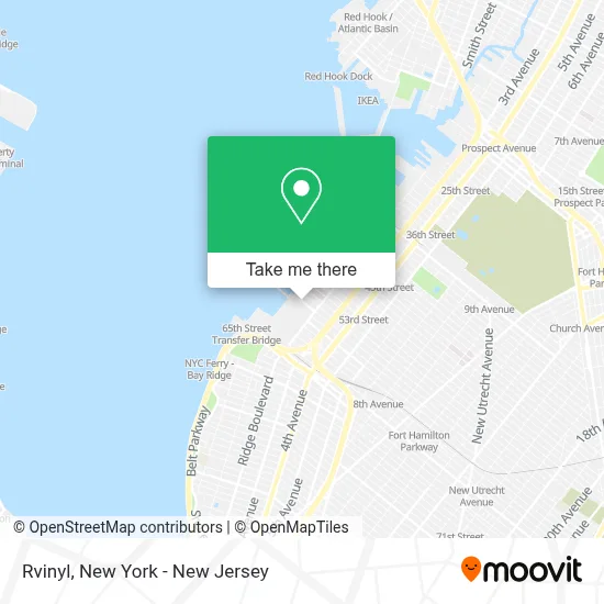
See Rvinyl, New York - New Jersey, on the map
Public Transit to Rvinyl in New York - New Jersey
Wondering how to get to Rvinyl in New York - New Jersey? Moovit helps you find the best way to get to Rvinyl with step-by-step directions from the nearest public transit station.
Moovit provides free maps and live directions to help you navigate through your city. View schedules, routes, timetables, and find out how long does it take to get to Rvinyl in real time.
Looking for the nearest stop or station to Rvinyl? Check out this list of stops closest to your destination: 58 St/1 Av; Sunset Park/Bat; 3 Av/58 St; 59 St.
Bus: B11, B37, X27.Subway: N, R, W.Ferry: RS, SB.
Want to see if there’s another route that gets you there at an earlier time? Moovit helps you find alternative routes or times. Get directions from and directions to Rvinyl easily from the Moovit App or Website.
We make riding to Rvinyl easy, which is why over 1.5 million users, including users in New York - New Jersey, trust Moovit as the best app for public transit. You don’t need to download an individual bus app or train app, Moovit is your all-in-one transit app that helps you find the best bus time or train time available.
For information on prices of subway, bus and train, costs and ride fares to Rvinyl, please check the Moovit app.
Use the app to navigate to popular places including to the airport, hospital, stadium, grocery store, mall, coffee shop, school, college, and university.
Rvinyl Address: 140 58th St Bldg B street in New York - New Jersey
- G-Star Enterprises,
- National Bias Binding Corporation.,
- MTA Bus - B11 @ 58th St & 1st Ave,
- Eventos Latinos NY,
- Nowaday! Vintage Car Tours NYC,
- 58th St (58th street and 1st Ave),
- United CHRYSLER DODGE Jeep Ram - Service Center,
- Sam and Zoey,
- Kings County Technologies,
- Screen Printing King,
- Douek Funding Group Douek Family Foundation,
- Rentaform S,
- Naturally Home,
- Apsco Enterprises,
- Regenskin,
- Fzn Creations,
- Cjpw Direct,
- Labq Diagnostics,
- Art Studio B47 | Noah X Arts | Symbolic Realism,
- Sleeping Partners International
Places Near Rvinyl (New York - New Jersey)
- Mountainside Hospital, Glen Ridge,
- Hudson Yards, Manhattan,
- 376 Hudson Street, Manhattan,
- qqqq, Manhattan,
- 1 Police Plaza, Manhattan,
- Times Square, Manhattan,
- 66 John Street, Manhattan,
- 3 Stone St, Manhattan,
- Rockefeller Center, Manhattan,
- Queens Center Mall, Queens,
- Chinatown, Manhattan,
- 26 Federal Plaza, Manhattan,
- Wall Street, Manhattan,
- SoHo, Manhattan,
- Pier 83, Manhattan,
- Bellevue Hospital, Manhattan,
- Katz's Deli, Manhattan,
- San Gennaro Feast, Manhattan,
- 911 Memorial, Manhattan,
- 111 Centre New York City Supreme Court, Manhattan
How to get to popular places in New York - New Jersey with public transit
Get around New York - New Jersey by public transit!
Traveling around New York - New Jersey has never been so easy. See step by step directions as you travel to any attraction, street or major public transit station. View bus and train schedules, arrival times, service alerts and detailed routes on a map, so you know exactly how to get to anywhere in New York - New Jersey.
When traveling to any destination around New York - New Jersey use Moovit's Live Directions with Get Off Notifications to know exactly where and how far to walk, how long to wait for your line, and how many stops are left. Moovit will alert you when it's time to get off — no need to constantly re-check whether yours is the next stop.
Wondering how to use public transit in New York - New Jersey or how to pay for public transit in New York - New Jersey? Moovit public transit app can help you navigate your way with public transit easily, and at minimum cost. It includes public transit fees, ticket prices, and costs. Looking for a map of New York - New Jersey public transit lines? Moovit public transit app shows all public transit maps in New York - New Jersey with all Bus, Train, Subway, Light Rail, Ferry and Cable Car routes and stops on an interactive map.
New York - New Jersey has 6 transit type(s), including: Bus, Train, Subway, Light Rail, Ferry and Cable Car, operated by several transit agencies, including MTA Subway, Metro-North Railroad, LIRR, PATH, MTA New York City Transit - Express routes, MTA Bus, NJ Transit, NYC Ferry, NICE bus, Bee-Line Bus, NJ Transit Rail, Norwalk Transit District, Hartford Line, River Valley Transit and HART