How to get to Rwe Clean Energy by bus?
Click on the bus route to see step by step directions with maps, line arrival times and updated time schedules.
From Port Chester, NY, Port Chester
60 minFrom St. John's Riverside Hospital, Yonkers
85 minFrom Palisades mall, West Nyack
72 minFrom Regeneron Pharmaceuticals Inc, Tarrytown
96 minFrom the bee-line system Bus Stop - Rye Playland (13, 75, 91), Rye
79 minFrom Rye Playland, Rye
80 minFrom Ridge Hill Mall, Yonkers
98 minFrom Mamaroneck NY, Mamaroneck
71 minFrom Westchester Mall, White Plains
38 minFrom White Plains, NY, White Plains
31 min
How to get to Rwe Clean Energy by train?
Click on the train route to see step by step directions with maps, line arrival times and updated time schedules.
Bus stop near Rwe Clean Energy in Mount Pleasant
- Columbus Ave @ the Summit, 3 min walk,VIEW
Train station near Rwe Clean Energy in Mount Pleasant
- Mount Pleasant, 23 min walk,VIEW
Bus lines to Rwe Clean Energy in Mount Pleasant
- 6, White Plains,VIEW
What are the closest stations to Rwe Clean Energy?
The closest stations to Rwe Clean Energy are:
- Columbus Ave @ the Summit is 197 yards away, 3 min walk.
- Mount Pleasant is 1936 yards away, 23 min walk.
Which bus line stops near Rwe Clean Energy?
6 (Bedford Rd @ Wheeler Ave)
Which train line stops near Rwe Clean Energy?
2 (613#| Southeast)
What’s the nearest train station to Rwe Clean Energy in Mount Pleasant?
The nearest train station to Rwe Clean Energy in Mount Pleasant is Mount Pleasant. It’s a 23 min walk away.
What’s the nearest bus station to Rwe Clean Energy in Mount Pleasant?
The nearest bus station to Rwe Clean Energy in Mount Pleasant is Columbus Ave @ the Summit. It’s a 3 min walk away.
What time is the first train to Rwe Clean Energy in Mount Pleasant?
The 2 is the first train that goes to Rwe Clean Energy in Mount Pleasant. It stops nearby at 3:00 AM.
What time is the last train to Rwe Clean Energy in Mount Pleasant?
The 2 is the last train that goes to Rwe Clean Energy in Mount Pleasant. It stops nearby at 3:00 AM.
What time is the first bus to Rwe Clean Energy in Mount Pleasant?
The 6 is the first bus that goes to Rwe Clean Energy in Mount Pleasant. It stops nearby at 6:38 AM.
What time is the last bus to Rwe Clean Energy in Mount Pleasant?
The 6 is the last bus that goes to Rwe Clean Energy in Mount Pleasant. It stops nearby at 10:32 PM.
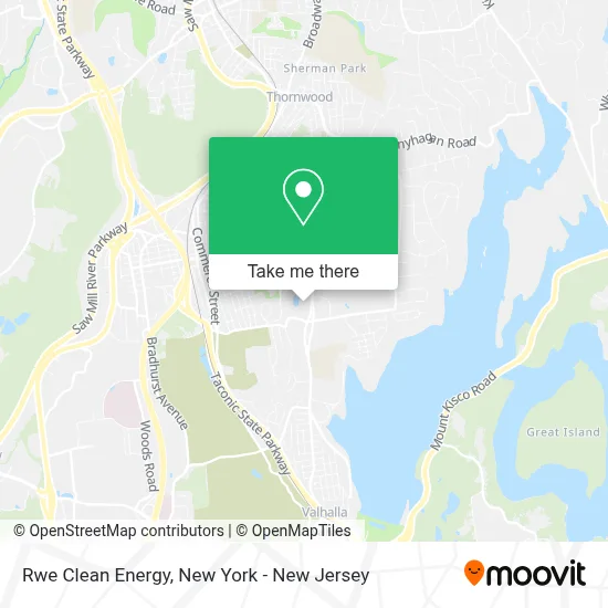
See Rwe Clean Energy, Mount Pleasant, on the map
Public Transit to Rwe Clean Energy in Mount Pleasant
Wondering how to get to Rwe Clean Energy in Mount Pleasant? Moovit helps you find the best way to get to Rwe Clean Energy with step-by-step directions from the nearest public transit station.
Moovit provides free maps and live directions to help you navigate through your city. View schedules, routes, timetables, and find out how long does it take to get to Rwe Clean Energy in real time.
Looking for the nearest stop or station to Rwe Clean Energy? Check out this list of stops closest to your destination: Columbus Ave @ the Summit; Mount Pleasant.
Bus: 6.Train: 2.
Want to see if there’s another route that gets you there at an earlier time? Moovit helps you find alternative routes or times. Get directions from and directions to Rwe Clean Energy easily from the Moovit App or Website.
We make riding to Rwe Clean Energy easy, which is why over 1.5 million users, including users in Mount Pleasant, trust Moovit as the best app for public transit. You don’t need to download an individual bus app or train app, Moovit is your all-in-one transit app that helps you find the best bus time or train time available.
For information on prices of bus and train, costs and ride fares to Rwe Clean Energy, please check the Moovit app.
Use the app to navigate to popular places including to the airport, hospital, stadium, grocery store, mall, coffee shop, school, college, and university.
Rwe Clean Energy Address: 100 Summit Lake Dr Ste 210 street in Mount Pleasant
- Ola Consulting Engineers,
- Larry R Boxer - Ameriprise Financial Services, Inc.,
- Summit Lake Financial Management Group - Ameriprise Financial Services, Llc,
- Goldstein Lieberman and Company Llc,
- Corrado A Dell'Aglio - Financial Advisor, Ameriprise Financial Services, Llc,
- Gdc Rentals,
- 100 Summit Gym,
- All Day Emergency 24 Hr A Day Valhalla Locksmith S,
- Pace University,
- Boxer, Silva & Associates - Ameriprise Financial Services, Llc,
- Robert E Feighan - Private Wealth Advisor, Ameriprise Financial Services, Llc,
- Santo Briganti - Private Wealth Advisor, Ameriprise Financial Services, Llc,
- Gregory Feighan - Private Wealth Advisor, Ameriprise Financial Services, Llc,
- Pepsi-Cola Bottling Company,
- Academy Of Management,
- Richard Leimgruber - Ameriprise Financial Services, Llc,
- David Lasco - Financial Advisor, Ameriprise Financial Services, Llc,
- Jeffrey Guzman Cpa Pc,
- Eric W Leimgruber - Financial Advisor, Ameriprise Financial Services,
- Donald Amoruso - Financial Advisor, Ameriprise Financial Services, Llc
Places Near Rwe Clean Energy (Mount Pleasant)
- Times Square, Manhattan,
- 3 Stone St, Manhattan,
- 26 Federal Plaza, Manhattan,
- Queens Center Mall, Queens,
- Hudson Yards, Manhattan,
- Katz's Deli, Manhattan,
- Wall Street, Manhattan,
- Bellevue Hospital, Manhattan,
- qqqq, Manhattan,
- 66 John Street, Manhattan,
- Mountainside Hospital, Glen Ridge,
- 911 Memorial, Manhattan,
- Pier 83, Manhattan,
- 1 Police Plaza, Manhattan,
- SoHo, Manhattan,
- 376 Hudson Street, Manhattan,
- Rockefeller Center, Manhattan,
- Chinatown, Manhattan,
- San Gennaro Feast, Manhattan,
- 111 Centre New York City Supreme Court, Manhattan
How to get to popular places in New York - New Jersey with public transit
Get around Mount Pleasant by public transit!
Traveling around Mount Pleasant has never been so easy. See step by step directions as you travel to any attraction, street or major public transit station. View bus and train schedules, arrival times, service alerts and detailed routes on a map, so you know exactly how to get to anywhere in Mount Pleasant.
When traveling to any destination around Mount Pleasant use Moovit's Live Directions with Get Off Notifications to know exactly where and how far to walk, how long to wait for your line, and how many stops are left. Moovit will alert you when it's time to get off — no need to constantly re-check whether yours is the next stop.
Wondering how to use public transit in Mount Pleasant or how to pay for public transit in Mount Pleasant? Moovit public transit app can help you navigate your way with public transit easily, and at minimum cost. It includes public transit fees, ticket prices, and costs. Looking for a map of Mount Pleasant public transit lines? Moovit public transit app shows all public transit maps in Mount Pleasant with all Bus, Train, Subway, Light Rail, Ferry and Cable Car routes and stops on an interactive map.
New York - New Jersey has 6 transit type(s), including: Bus, Train, Subway, Light Rail, Ferry and Cable Car, operated by several transit agencies, including MTA Subway, Metro-North Railroad, LIRR, PATH, MTA New York City Transit - Express routes, MTA Bus, NJ Transit, NYC Ferry, NICE bus, Bee-Line Bus, NJ Transit Rail, Norwalk Transit District, Hartford Line, River Valley Transit and HART