How to get to Rx-Safety by bus?
Click on the bus route to see step by step directions with maps, line arrival times and updated time schedules.
From Plainfield, NJ, Plainfield
44 minFrom Perth Amboy, NJ, Perth Amboy
199 minFrom Edison NJ, Edison
141 minFrom HUUHHHH??, Woodbridge
186 minFrom Highland Park, NJ, Highland Park
192 minFrom Robert Wood Johnson University Hospital, New Brunswick
190 minFrom Baps Shri Swaminarayan Mandir, Edison, NJ, USA, Edison
161 minFrom Union County College - Cranford Campus, Cranford
129 minFrom Rutgers, New Brunswick
191 minFrom Walmart, Linden
162 min
How to get to Rx-Safety by train?
Click on the train route to see step by step directions with maps, line arrival times and updated time schedules.
Bus stop near Rx-Safety in Middlesex
- Union Ave at Raritan Ave, 5 min walk,VIEW
Train station near Rx-Safety in Middlesex
- Bridgewater, 27 min walk,VIEW
What are the closest stations to Rx-Safety?
The closest stations to Rx-Safety are:
- Union Ave at Raritan Ave is 399 yards away, 5 min walk.
- Bridgewater is 2283 yards away, 27 min walk.
Which bus lines stop near Rx-Safety?
These bus lines stop near Rx-Safety: 114, 65.
Which train line stops near Rx-Safety?
RVL (Raritan / High Bridge)
What’s the nearest train station to Rx-Safety in Middlesex?
The nearest train station to Rx-Safety in Middlesex is Bridgewater. It’s a 27 min walk away.
What’s the nearest bus station to Rx-Safety in Middlesex?
The nearest bus station to Rx-Safety in Middlesex is Union Ave at Raritan Ave. It’s a 5 min walk away.
What time is the first train to Rx-Safety in Middlesex?
The RVL is the first train that goes to Rx-Safety in Middlesex. It stops nearby at 4:37 AM.
What time is the last train to Rx-Safety in Middlesex?
The RVL is the last train that goes to Rx-Safety in Middlesex. It stops nearby at 2:13 AM.
What time is the first bus to Rx-Safety in Middlesex?
The 114 is the first bus that goes to Rx-Safety in Middlesex. It stops nearby at 5:17 AM.
What time is the last bus to Rx-Safety in Middlesex?
The 114 is the last bus that goes to Rx-Safety in Middlesex. It stops nearby at 2:04 AM.
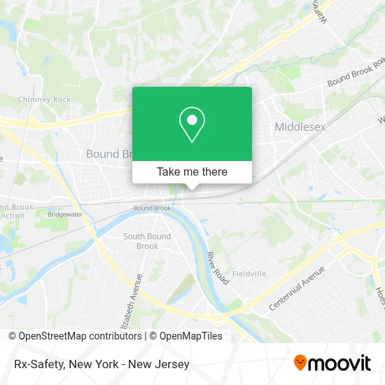
See Rx-Safety, Middlesex, on the map
Public Transit to Rx-Safety in Middlesex
Wondering how to get to Rx-Safety in Middlesex? Moovit helps you find the best way to get to Rx-Safety with step-by-step directions from the nearest public transit station.
Moovit provides free maps and live directions to help you navigate through your city. View schedules, routes, timetables, and find out how long does it take to get to Rx-Safety in real time.
Looking for the nearest stop or station to Rx-Safety? Check out this list of stops closest to your destination: Union Ave at Raritan Ave; Bridgewater.
Bus: 114, 65.Train: RVL.
Want to see if there’s another route that gets you there at an earlier time? Moovit helps you find alternative routes or times. Get directions from and directions to Rx-Safety easily from the Moovit App or Website.
We make riding to Rx-Safety easy, which is why over 1.5 million users, including users in Middlesex, trust Moovit as the best app for public transit. You don’t need to download an individual bus app or train app, Moovit is your all-in-one transit app that helps you find the best bus time or train time available.
For information on prices of bus and train, costs and ride fares to Rx-Safety, please check the Moovit app.
Use the app to navigate to popular places including to the airport, hospital, stadium, grocery store, mall, coffee shop, school, college, and university.
Rx-Safety Address: 123 Lincoln Blvd street in Middlesex
- Rx Safety,
- Pest-Gon, Inc. Termite and Pest Control,
- Pest-Gon, Inc. Termite and Pest Control,
- Coinhub Bitcoin Atm,
- Adm Corporation,
- Focus Fusion,
- Kerf Metals,
- Western Union,
- Lincoln Blvd,
- Sunoco,
- Psi Process Pumping Services,
- The Lofts at Middlesex Apartments,
- M and J Services Center,
- B Palazzi Lawn Care,
- Aim Performance,
- Peterson Bros. Mfg.,
- Classic Masonry and Home Improvements,
- Us Mechanical,
- Greatstart International Preschool Middlesex,
- Maaco Of Middlesex
Places Near Rx-Safety (Middlesex)
- 66 John Street, Manhattan,
- Wall Street, Manhattan,
- Hudson Yards, Manhattan,
- 911 Memorial, Manhattan,
- Mountainside Hospital, Glen Ridge,
- Bellevue Hospital, Manhattan,
- Pier 83, Manhattan,
- Queens Center Mall, Queens,
- qqqq, Manhattan,
- Chinatown, Manhattan,
- 26 Federal Plaza, Manhattan,
- Katz's Deli, Manhattan,
- SoHo, Manhattan,
- 1 Police Plaza, Manhattan,
- Rockefeller Center, Manhattan,
- 3 Stone St, Manhattan,
- 376 Hudson Street, Manhattan,
- 111 Centre New York City Supreme Court, Manhattan,
- San Gennaro Feast, Manhattan,
- Times Square, Manhattan
How to get to popular places in New York - New Jersey with public transit
Get around Middlesex by public transit!
Traveling around Middlesex has never been so easy. See step by step directions as you travel to any attraction, street or major public transit station. View bus and train schedules, arrival times, service alerts and detailed routes on a map, so you know exactly how to get to anywhere in Middlesex.
When traveling to any destination around Middlesex use Moovit's Live Directions with Get Off Notifications to know exactly where and how far to walk, how long to wait for your line, and how many stops are left. Moovit will alert you when it's time to get off — no need to constantly re-check whether yours is the next stop.
Wondering how to use public transit in Middlesex or how to pay for public transit in Middlesex? Moovit public transit app can help you navigate your way with public transit easily, and at minimum cost. It includes public transit fees, ticket prices, and costs. Looking for a map of Middlesex public transit lines? Moovit public transit app shows all public transit maps in Middlesex with all Bus, Train, Subway, Light Rail, Ferry and Cable Car routes and stops on an interactive map.
New York - New Jersey has 6 transit type(s), including: Bus, Train, Subway, Light Rail, Ferry and Cable Car, operated by several transit agencies, including MTA Subway, Metro-North Railroad, LIRR, PATH, MTA New York City Transit - Express routes, MTA Bus, NJ Transit, NYC Ferry, NICE bus, Bee-Line Bus, NJ Transit Rail, Norwalk Transit District, Hartford Line, River Valley Transit and HART