Directions to Rxfit (Rocky Point) with public transportation
The following transit lines have routes that pass near Rxfit
 Bus: 62.
How to get to Rxfit by bus?
Click on the bus route to see step by step directions with maps, line arrival times and updated time schedules.
From Tanger Outlets, Deer Park
124 minFrom Tanger Outlets, Riverhead, Calverton
43 minFrom Tanger Outlets, Deer Park, Deer Park
126 minFrom Jake's 58 Casino, Islandia
90 minFrom Good Samaritan Hospital Medical Center, West Islip
187 minFrom Splish Splash Waterpark, Calverton
37 minFrom Brentwood, NY, Brentwood
104 minFrom Hauppauge ny, Hauppauge
73 min
Bus stop near Rxfit in Rocky Point
- Nys 25a/Broadway, 5 min walk,VIEW
Bus lines to Rxfit in Rocky Point
- 62, Hauppauge,VIEW
What are the closest stations to Rxfit?
The closest stations to Rxfit are:
- Nys 25a/Broadway is 422 yards away, 5 min walk.
Which bus line stops near Rxfit?
62 (Riverhead Rr)
What’s the nearest bus station to Rxfit in Rocky Point?
The nearest bus station to Rxfit in Rocky Point is Nys 25a/Broadway. It’s a 5 min walk away.
What time is the first bus to Rxfit in Rocky Point?
The 62 is the first bus that goes to Rxfit in Rocky Point. It stops nearby at 5:45 AM.
What time is the last bus to Rxfit in Rocky Point?
The 62 is the last bus that goes to Rxfit in Rocky Point. It stops nearby at 10:52 PM.
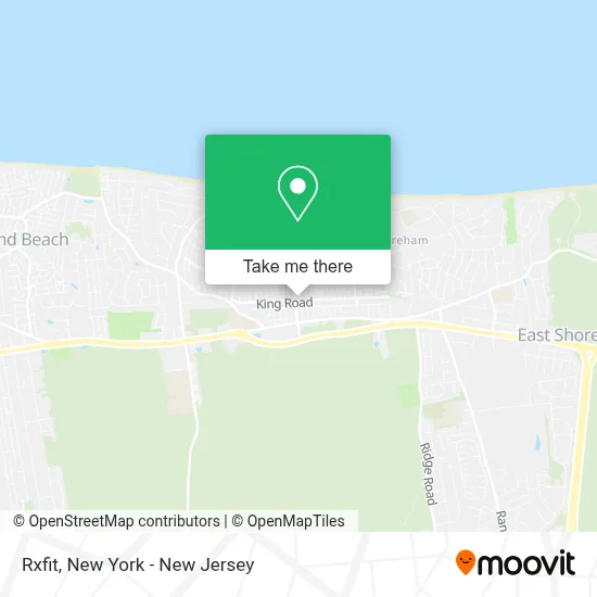
See Rxfit, Rocky Point, on the map
Public Transit to Rxfit in Rocky Point
Wondering how to get to Rxfit in Rocky Point? Moovit helps you find the best way to get to Rxfit with step-by-step directions from the nearest public transit station.
Moovit provides free maps and live directions to help you navigate through your city. View schedules, routes, timetables, and find out how long does it take to get to Rxfit in real time.
Looking for the nearest stop or station to Rxfit? Check out this list of stops closest to your destination: Nys 25a/Broadway.
Bus: 62.
Want to see if there’s another route that gets you there at an earlier time? Moovit helps you find alternative routes or times. Get directions from and directions to Rxfit easily from the Moovit App or Website.
We make riding to Rxfit easy, which is why over 1.5 million users, including users in Rocky Point, trust Moovit as the best app for public transit. You don’t need to download an individual bus app or train app, Moovit is your all-in-one transit app that helps you find the best bus time or train time available.
For information on prices of bus and train, costs and ride fares to Rxfit, please check the Moovit app.
Get to Rxfit with public transit and pay for the ride in the Moovit app. In addition to all info you may need for your trip to Rxfit, including live directions, real-time arrivals and fare prices, you can also buy public transit passes for your rides. No need for cash or paper tickets to get to Rxfit - everything you need is accessible in the app with a click of the button.
Use the app to navigate to popular places including to the airport, hospital, stadium, grocery store, mall, coffee shop, school, college, and university.
Rxfit Address: 73 Broadway street in Rocky Point
- Renegade Fitness,
- Crossfit Pine Barrens,
- Vfw Rocky Point,
- Rocky Point Fit Body Boot Camp,
- Rocky Point, New York,
- Lift Jesus Higher Fellowship,
- Zest Gourmet Catering,
- Vfw Post 6249,
- Cowpalacerockypoint,
- Petesparklywindows,
- Budgetstylemama,
- 711,
- Catch'Em All Central,
- Creative Zone Inc,
- Carquest Auto Parts,
- Ritual Wellness & Laser Spa,
- Mr Broadway Deli Corp.,
- Western Union,
- R.P.F.D North Shore Beach Company 2,
- Studio 45
Places Near Rxfit (Rocky Point)
- Queens Center Mall, Queens,
- qqqq, Manhattan,
- San Gennaro Feast, Manhattan,
- Katz's Deli, Manhattan,
- Hudson Yards, Manhattan,
- 66 John Street, Manhattan,
- 3 Stone St, Manhattan,
- 26 Federal Plaza, Manhattan,
- 1 Police Plaza, Manhattan,
- Wall Street, Manhattan,
- Mountainside Hospital, Glen Ridge,
- 376 Hudson Street, Manhattan,
- 911 Memorial, Manhattan,
- Chinatown, Manhattan,
- Times Square, Manhattan,
- Bellevue Hospital, Manhattan,
- Rockefeller Center, Manhattan,
- Pier 83, Manhattan,
- SoHo, Manhattan,
- 111 Centre New York City Supreme Court, Manhattan
How to get to popular places in New York - New Jersey with public transit
Get around Rocky Point by public transit!
Traveling around Rocky Point has never been so easy. See step by step directions as you travel to any attraction, street or major public transit station. View bus and train schedules, arrival times, service alerts and detailed routes on a map, so you know exactly how to get to anywhere in Rocky Point.
When traveling to any destination around Rocky Point use Moovit's Live Directions with Get Off Notifications to know exactly where and how far to walk, how long to wait for your line, and how many stops are left. Moovit will alert you when it's time to get off — no need to constantly re-check whether yours is the next stop.
Wondering how to use public transit in Rocky Point or how to pay for public transit in Rocky Point? Moovit public transit app can help you navigate your way with public transit easily, and at minimum cost. It includes public transit fees, ticket prices, and costs. Looking for a map of Rocky Point public transit lines? Moovit public transit app shows all public transit maps in Rocky Point with all Bus, Train, Subway, Light Rail, Ferry and Cable Car routes and stops on an interactive map.
New York - New Jersey has 6 transit type(s), including: Bus, Train, Subway, Light Rail, Ferry and Cable Car, operated by several transit agencies, including MTA Subway, Metro-North Railroad, LIRR, PATH, MTA New York City Transit - Express routes, MTA Bus, NJ Transit, NYC Ferry, NICE bus, Bee-Line Bus, NJ Transit Rail, Norwalk Transit District, Hartford Line, River Valley Transit and HART