Directions to Rxlbinjections (West Hempstead) with public transportation
The following transit lines have routes that pass near Rxlbinjections
 Bus: N6, N6X, N31, N32.
- Train: WEST HEMPSTEAD BRANCH, HEMPSTEAD BRANCH.
How to get to Rxlbinjections by bus?
Click on the bus route to see step by step directions with maps, line arrival times and updated time schedules.
From Elmont, NY, Elmont
38 minFrom DMV, Queens
69 minFrom Queens County Farm Museum, Queens
68 minFrom Springfield Gardens, NY, Queens
59 minFrom Long Island Jewish Hospital, North New Hyde Park
50 minFrom Roy Wilkins Park, Queens
63 minFrom Walmart, Queens
61 minFrom Uniondale, NY, Uniondale
34 minFrom Manhasset, NY, Manhasset
67 minFrom DMV Jamaica Nys, Queens
53 min
How to get to Rxlbinjections by train?
Click on the train route to see step by step directions with maps, line arrival times and updated time schedules.
Bus stops near Rxlbinjections in West Hempstead
Train stations near Rxlbinjections in West Hempstead
Bus lines to Rxlbinjections in West Hempstead
What are the closest stations to Rxlbinjections?
The closest stations to Rxlbinjections are:
- Cherry Val Av / Hempstead is 46 yards away, 1 min walk.
- Lakeview is 891 yards away, 11 min walk.
- Hempstead Ave + Poplar St. is 919 yards away, 12 min walk.
- Garden City is 3646 yards away, 43 min walk.
Which bus lines stop near Rxlbinjections?
These bus lines stop near Rxlbinjections: N6, N6X.
Which train line stops near Rxlbinjections?
WEST HEMPSTEAD BRANCH (West Hempstead)
What’s the nearest train station to Rxlbinjections in West Hempstead?
The nearest train station to Rxlbinjections in West Hempstead is Lakeview. It’s a 11 min walk away.
What’s the nearest bus station to Rxlbinjections in West Hempstead?
The nearest bus station to Rxlbinjections in West Hempstead is Cherry Val Av / Hempstead. It’s a 1 min walk away.
What time is the first train to Rxlbinjections in West Hempstead?
The HEMPSTEAD BRANCH is the first train that goes to Rxlbinjections in West Hempstead. It stops nearby at 3:19 AM.
What time is the last train to Rxlbinjections in West Hempstead?
The HEMPSTEAD BRANCH is the last train that goes to Rxlbinjections in West Hempstead. It stops nearby at 3:22 AM.
What time is the first bus to Rxlbinjections in West Hempstead?
The N6 is the first bus that goes to Rxlbinjections in West Hempstead. It stops nearby at 3:14 AM.
What time is the last bus to Rxlbinjections in West Hempstead?
The N6 is the last bus that goes to Rxlbinjections in West Hempstead. It stops nearby at 2:47 AM.
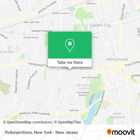
See Rxlbinjections, West Hempstead, on the map
Public Transit to Rxlbinjections in West Hempstead
Wondering how to get to Rxlbinjections in West Hempstead? Moovit helps you find the best way to get to Rxlbinjections with step-by-step directions from the nearest public transit station.
Moovit provides free maps and live directions to help you navigate through your city. View schedules, routes, timetables, and find out how long does it take to get to Rxlbinjections in real time.
Looking for the nearest stop or station to Rxlbinjections? Check out this list of stops closest to your destination: Cherry Val Av / Hempstead; Lakeview; Hempstead Ave + Poplar St.; Garden City.
Bus: N6, N6X, N31, N32.Train: WEST HEMPSTEAD BRANCH, HEMPSTEAD BRANCH.
Want to see if there’s another route that gets you there at an earlier time? Moovit helps you find alternative routes or times. Get directions from and directions to Rxlbinjections easily from the Moovit App or Website.
We make riding to Rxlbinjections easy, which is why over 1.5 million users, including users in West Hempstead, trust Moovit as the best app for public transit. You don’t need to download an individual bus app or train app, Moovit is your all-in-one transit app that helps you find the best bus time or train time available.
For information on prices of bus and train, costs and ride fares to Rxlbinjections, please check the Moovit app.
Use the app to navigate to popular places including to the airport, hospital, stadium, grocery store, mall, coffee shop, school, college, and university.
Rxlbinjections Address: 411 Hempstead Tpke street in West Hempstead
- Ms. Mara Mccrossin, Msn, Agnp-C, Rn-Bc,
- Chabad Of West Hempstead,
- Rxiv Infusions - In Home IV Treatment,
- 7-Eleven/Speedway #45038,
- Paymore - Buy, Sell & Trade Electronics,
- Fastsigns,
- Popeyes Louisiana Kitchen,
- Popeyes,
- M&T Bank Atm,
- Vinted Go Parcel Shop,
- Stop & Shop,
- Hempstead Discount Wine & Liquor,
- Oakl RT-24,
- Century 21,
- Atlas Masonry,
- Liberty Tax,
- Cherry Valley Ave - Gamestop,
- Pet Supplies Plus West Hempstead,
- Vip Petcare Vaccination Clinic,
- Superior Motor Cars Inc.
Places Near Rxlbinjections (West Hempstead)
- SoHo, Manhattan,
- Mountainside Hospital, Glen Ridge,
- Wall Street, Manhattan,
- 376 Hudson Street, Manhattan,
- 3 Stone St, Manhattan,
- 26 Federal Plaza, Manhattan,
- Bellevue Hospital, Manhattan,
- San Gennaro Feast, Manhattan,
- Chinatown, Manhattan,
- 66 John Street, Manhattan,
- Pier 83, Manhattan,
- Queens Center Mall, Queens,
- 911 Memorial, Manhattan,
- 1 Police Plaza, Manhattan,
- Katz's Deli, Manhattan,
- Times Square, Manhattan,
- Rockefeller Center, Manhattan,
- 111 Centre New York City Supreme Court, Manhattan,
- qqqq, Manhattan,
- Hudson Yards, Manhattan
How to get to popular places in New York - New Jersey with public transit
Get around West Hempstead by public transit!
Traveling around West Hempstead has never been so easy. See step by step directions as you travel to any attraction, street or major public transit station. View bus and train schedules, arrival times, service alerts and detailed routes on a map, so you know exactly how to get to anywhere in West Hempstead.
When traveling to any destination around West Hempstead use Moovit's Live Directions with Get Off Notifications to know exactly where and how far to walk, how long to wait for your line, and how many stops are left. Moovit will alert you when it's time to get off — no need to constantly re-check whether yours is the next stop.
Wondering how to use public transit in West Hempstead or how to pay for public transit in West Hempstead? Moovit public transit app can help you navigate your way with public transit easily, and at minimum cost. It includes public transit fees, ticket prices, and costs. Looking for a map of West Hempstead public transit lines? Moovit public transit app shows all public transit maps in West Hempstead with all Bus, Train, Subway, Light Rail, Ferry and Cable Car routes and stops on an interactive map.
New York - New Jersey has 6 transit type(s), including: Bus, Train, Subway, Light Rail, Ferry and Cable Car, operated by several transit agencies, including MTA Subway, Metro-North Railroad, LIRR, PATH, MTA New York City Transit - Express routes, MTA Bus, NJ Transit, NYC Ferry, NICE bus, Bee-Line Bus, NJ Transit Rail, Norwalk Transit District, Hartford Line, River Valley Transit and HART