How to get to Rxo by bus?
Click on the bus route to see step by step directions with maps, line arrival times and updated time schedules.
From Las Vegas, Nevada, Las Vegas
56 minFrom WinCo Foods, Las Vegas
67 minFrom Nuleaf Dispensary Las Vegas Strip, Las Vegas
67 minFrom Las Vegas Springs Preserve, Las Vegas
85 minFrom Bishop Gorman School, Las Vegas
71 minFrom Rick's Rollin' Smoke BBQ, Las Vegas
56 minFrom Jerry's Nugget, North Las Vegas
37 minFrom Chicken Ranch, Las Vegas
67 minFrom Nellis Air Force Base (The Department of the Air Force), Nellis Afb
51 minFrom Lamarre Theater, Las Vegas
65 min
Bus stops near Rxo in North Las Vegas
Bus lines to Rxo in North Las Vegas
What are the closest stations to Rxo?
The closest stations to Rxo are:
- Wb Craig After Berg is 832 yards away, 11 min walk.
- Wb Alexander After Halfmoon Bay is 868 yards away, 11 min walk.
Which bus lines stop near Rxo?
These bus lines stop near Rxo: 111, 219.
What’s the nearest bus station to Rxo in North Las Vegas?
The nearest bus stations to Rxo in North Las Vegas are Wb Craig After Berg and Wb Alexander After Halfmoon Bay. The closest one is a 11 min walk away.
What time is the first bus to Rxo in North Las Vegas?
The 111 is the first bus that goes to Rxo in North Las Vegas. It stops nearby at 4:03 AM.
What time is the last bus to Rxo in North Las Vegas?
The 219 is the last bus that goes to Rxo in North Las Vegas. It stops nearby at 1:31 AM.
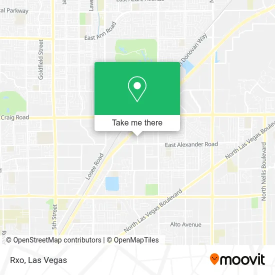
See Rxo, North Las Vegas, on the map
Public Transit to Rxo in North Las Vegas
Wondering how to get to Rxo in North Las Vegas? Moovit helps you find the best way to get to Rxo with step-by-step directions from the nearest public transit station.
Moovit provides free maps and live directions to help you navigate through your city. View schedules, routes, timetables, and find out how long does it take to get to Rxo in real time.
Looking for the nearest stop or station to Rxo? Check out this list of stops closest to your destination: Wb Craig After Berg; Wb Alexander After Halfmoon Bay.
Bus: 111, 219, DVX.
Want to see if there’s another route that gets you there at an earlier time? Moovit helps you find alternative routes or times. Get directions from and directions to Rxo easily from the Moovit App or Website.
We make riding to Rxo easy, which is why over 1.7 million users, including users in North Las Vegas, trust Moovit as the best app for public transit. You don’t need to download an individual bus app or train app, Moovit is your all-in-one transit app that helps you find the best bus time or train time available.
For information on prices of bus, costs and ride fares to Rxo, please check the Moovit app.
Use the app to navigate to popular places including to the airport, hospital, stadium, grocery store, mall, coffee shop, school, college, and university.
Rxo Address: 4050 Corporate Center Dr Ste 200 street in North Las Vegas
- DMV,
- Amazon Fulfillment Center-LAS2,
- In-N-Out Burger,
- Raahj Laboratories,
- Pecos @ Craig (S),
- Overhead Door,
- Sahara Resorts,
- East Craig,
- Losee Rd / E Craig Rd,
- Cannery Hotel & Casino,
- Cannery Casino & Hotel,
- Somerset Academy Losee,
- E Lone Mountain Rd,
- June Whitley Student Lounge,
- Raising Cane's (Raising Canes Craig Road),
- College of Southern NV-Cheyenne (CSN-North Las Vegas Campus),
- Planetarium and Observatory @ CSN,
- Amazon Fulfillment Center-DLV2,
- Texas Roadhouse,
- Olive Garden
Places Near Rxo (North Las Vegas)
- Omega Mart, Las Vegas,
- Allegiant Stadium, Paradise,
- Koolsville Tattoos, Las Vegas,
- Walmart, Las Vegas,
- Area15, Las Vegas,
- The Neon Museum, Las Vegas,
- Welcome To Fabulous Las Vegas Sign, Paradise,
- Town Square, Enterprise,
- Las Vegas Premium Outlets-North, Enterprise,
- Las Vegas South Premium Outlets, Enterprise,
- Gold & Silver Pawn Shop, Las Vegas,
- Meow Wolf - Las Vegas (Meow Wolf's Omega Mart), Las Vegas,
- Trump International Hotel Las Vegas, Paradise,
- The Palms Casino Resort, Paradise,
- Lee Canyon, Las Vegas,
- The Deuce Bus Stop at Fremont St, Las Vegas,
- Las Vegas North Premium Outlets, Las Vegas,
- Zak Bagans Haunted Museum, Las Vegas,
- Walmart Supercenter, Las Vegas,
- Arte Museum Las Vegas, Paradise
How to get to popular places in Las Vegas with public transit
Get around North Las Vegas by public transit!
Traveling around North Las Vegas has never been so easy. See step by step directions as you travel to any attraction, street or major public transit station. View bus and train schedules, arrival times, service alerts and detailed routes on a map, so you know exactly how to get to anywhere in North Las Vegas.
When traveling to any destination around North Las Vegas use Moovit's Live Directions with Get Off Notifications to know exactly where and how far to walk, how long to wait for your line, and how many stops are left. Moovit will alert you when it's time to get off — no need to constantly re-check whether yours is the next stop.
Wondering how to use public transit in North Las Vegas or how to pay for public transit in North Las Vegas? Moovit public transit app can help you navigate your way with public transit easily, and at minimum cost. It includes public transit fees, ticket prices, and costs. Looking for a map of North Las Vegas public transit lines? Moovit public transit app shows all public transit maps in North Las Vegas with all Bus and Monorail routes and stops on an interactive map.
Las Vegas has 2 transit type(s), including: Bus and Monorail, operated by several transit agencies, including RTCSNV, City of Las Vegas, Alvand Transportation, Vegas Airporter, Las Vegas Monorail, FlixBus-us and Greyhound-us