How to get to Ryan Fire Protection by bus?
Click on the bus route to see step by step directions with maps, line arrival times and updated time schedules.
From Indiana State Police West Information Booth, Indianapolis City (Balance)
47 minFrom N German Church Rd / Pendleton Pike, Lawrence
22 minFrom Rural Street And Brookside Parkway, Indianapolis City (Balance)
43 minFrom 10th And Shadeland, Indianapolis City (Balance)
49 minFrom Knights of Columbus, Indianapolis City (Balance)
81 minFrom IndyGo Bus #17, Indianapolis City (Balance)
57 minFrom Full Gospel Deliverance Church, Indianapolis City (Balance)
44 minFrom Lawrence North High School, Indianapolis City (Balance)
56 minFrom Topwot, Indianapolis City (Balance)
43 minFrom Indiana State Fairgrounds, Indianapolis City (Balance)
43 min
Bus stop near Ryan Fire Protection in Lawrence
- 42nd St & Franklin Rd, 8 min walk,VIEW
Bus lines to Ryan Fire Protection in Lawrence
- 30, Sunnyside Rd,VIEW
What are the closest stations to Ryan Fire Protection?
The closest stations to Ryan Fire Protection are:
- 42nd St & Franklin Rd is 593 yards away, 8 min walk.
Which bus lines stop near Ryan Fire Protection?
These bus lines stop near Ryan Fire Protection: 30, 4.
What’s the nearest bus station to Ryan Fire Protection in Lawrence?
The nearest bus station to Ryan Fire Protection in Lawrence is 42nd St & Franklin Rd. It’s a 8 min walk away.
What time is the first bus to Ryan Fire Protection in Lawrence?
The 30 is the first bus that goes to Ryan Fire Protection in Lawrence. It stops nearby at 4:19 AM.
What time is the last bus to Ryan Fire Protection in Lawrence?
The 30 is the last bus that goes to Ryan Fire Protection in Lawrence. It stops nearby at 12:02 AM.
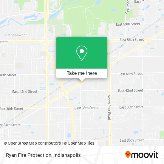
See Ryan Fire Protection, Lawrence, on the map
Public Transit to Ryan Fire Protection in Lawrence
Wondering how to get to Ryan Fire Protection in Lawrence? Moovit helps you find the best way to get to Ryan Fire Protection with step-by-step directions from the nearest public transit station.
Moovit provides free maps and live directions to help you navigate through your city. View schedules, routes, timetables, and find out how long does it take to get to Ryan Fire Protection in real time.
Looking for the nearest stop or station to Ryan Fire Protection? Check out this list of stops closest to your destination: 42nd St & Franklin Rd.
Bus: 30, 4.
Want to see if there’s another route that gets you there at an earlier time? Moovit helps you find alternative routes or times. Get directions from and directions to Ryan Fire Protection easily from the Moovit App or Website.
We make riding to Ryan Fire Protection easy, which is why over 1.5 million users, including users in Lawrence, trust Moovit as the best app for public transit. You don’t need to download an individual bus app or train app, Moovit is your all-in-one transit app that helps you find the best bus time or train time available.
For information on prices of bus, costs and ride fares to Ryan Fire Protection, please check the Moovit app.
Use the app to navigate to popular places including to the airport, hospital, stadium, grocery store, mall, coffee shop, school, college, and university.
Ryan Fire Protection Address: 8024 Pendleton Pike Indianapolis, IN 46226 street in Lawrence
- EZPAWN,
- Ezpawn (8028 Pendleton Pike, Lawrence),
- T-Mobile,
- Crew Carwash,
- Indy Soccer,
- Maru,
- La Canasta Restaurante,
- Domino's,
- Power P Bounce & Co.,
- Domino's Pizza,
- Big Red Liquors,
- 54 Beauty Lounge,
- La Vida Ink,
- Servicios Latinos,
- Indy's Connect,
- Bryanna Fentress,
- Pop Locksmith Near Me,
- Jpiercings,
- We Create Content,
- Bmv
Places Near Ryan Fire Protection (Lawrence)
- St. Vincent entrance #1, Indianapolis City (Balance),
- Castleton Square Mall, Indianapolis,
- Plainfield, IN, Plainfield,
- I-465 / I-65 Interchange, Indianapolis City (Balance),
- Lilly Corporate Center (Eli Lilly & Co), Indianapolis City (Balance),
- Lucas Oil Stadium, Indianapolis City (Balance),
- I U Health Methodist Hospital, Indianapolis City (Balance),
- Methodist Hospital of Indianapolis, Indianapolis City (Balance),
- Cotter's Massage Parlor With Happy Endings, Indianapolis City (Balance),
- Indianapolis Motor Speedway, Speedway,
- Indianapolis Airport Zone 2, Indianapolis City (Balance),
- 119 W 19th St Parking, Indianapolis City (Balance),
- Indiana Convention Center, Indianapolis City (Balance),
- Train Ride At Castleton Mall, Indianapolis City (Balance),
- Indiana, Indianapolis City (Balance),
- Jersey Barn, Indianapolis City (Balance),
- St. Vincent Hospital - Indianapolis, Indianapolis City (Balance),
- Gainbridge Fieldhouse, Indianapolis City (Balance),
- THE BALT, Indianapolis City (Balance),
- Eskenazi Hospital, Indianapolis City (Balance)
How to get to popular places in Indianapolis with public transit
Get around Lawrence by public transit!
Traveling around Lawrence has never been so easy. See step by step directions as you travel to any attraction, street or major public transit station. View bus and train schedules, arrival times, service alerts and detailed routes on a map, so you know exactly how to get to anywhere in Lawrence.
When traveling to any destination around Lawrence use Moovit's Live Directions with Get Off Notifications to know exactly where and how far to walk, how long to wait for your line, and how many stops are left. Moovit will alert you when it's time to get off — no need to constantly re-check whether yours is the next stop.
Wondering how to use public transit in Lawrence or how to pay for public transit in Lawrence? Moovit public transit app can help you navigate your way with public transit easily, and at minimum cost. It includes public transit fees, ticket prices, and costs. Looking for a map of Lawrence public transit lines? Moovit public transit app shows all public transit maps in Lawrence with all bus routes and stops on an interactive map.
Indianapolis has 1 transit type(s), including: bus, operated by several transit agencies, including IndyGo, FlixBus-us and Greyhound-us