How to get to Ryders Crossing by bus?
Click on the bus route to see step by step directions with maps, line arrival times and updated time schedules.
From Plainfield, NJ, Plainfield
146 minFrom Rutgers, New Brunswick
29 minFrom Edison NJ, Edison
56 minFrom Robert Wood Johnson University Hospital, New Brunswick
36 minFrom PNC Bank Arts Center, Holmdel
224 minFrom Perth Amboy, NJ, Perth Amboy
95 minFrom Highland Park, NJ, Highland Park
49 minFrom HUUHHHH??, Woodbridge
135 minFrom Baps Shri Swaminarayan Mandir, Edison, NJ, USA, Edison
61 min
Bus stop near Ryders Crossing in Milltown
- S Main St at Millers Ln#, 9 min walk,VIEW
Bus lines to Ryders Crossing in Milltown
- 811, New Brnswick Gerber Apts,VIEW
What are the closest stations to Ryders Crossing?
The closest stations to Ryders Crossing are:
- S Main St at Millers Ln# is 679 yards away, 9 min walk.
Which bus lines stop near Ryders Crossing?
These bus lines stop near Ryders Crossing: 811, 815.
What’s the nearest bus station to Ryders Crossing in Milltown?
The nearest bus station to Ryders Crossing in Milltown is S Main St at Millers Ln#. It’s a 9 min walk away.
What time is the first bus to Ryders Crossing in Milltown?
The 811 is the first bus that goes to Ryders Crossing in Milltown. It stops nearby at 6:51 AM.
What time is the last bus to Ryders Crossing in Milltown?
The 811 is the last bus that goes to Ryders Crossing in Milltown. It stops nearby at 5:59 PM.
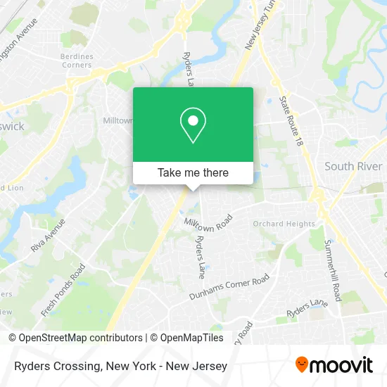
See Ryders Crossing, Milltown, on the map
Public Transit to Ryders Crossing in Milltown
Wondering how to get to Ryders Crossing in Milltown? Moovit helps you find the best way to get to Ryders Crossing with step-by-step directions from the nearest public transit station.
Moovit provides free maps and live directions to help you navigate through your city. View schedules, routes, timetables, and find out how long does it take to get to Ryders Crossing in real time.
Looking for the nearest stop or station to Ryders Crossing? Check out this list of stops closest to your destination: S Main St at Millers Ln#.
Bus: 811, 815.
Want to see if there’s another route that gets you there at an earlier time? Moovit helps you find alternative routes or times. Get directions from and directions to Ryders Crossing easily from the Moovit App or Website.
We make riding to Ryders Crossing easy, which is why over 1.5 million users, including users in Milltown, trust Moovit as the best app for public transit. You don’t need to download an individual bus app or train app, Moovit is your all-in-one transit app that helps you find the best bus time or train time available.
For information on prices of bus and train, costs and ride fares to Ryders Crossing, please check the Moovit app.
Use the app to navigate to popular places including to the airport, hospital, stadium, grocery store, mall, coffee shop, school, college, and university.
Ryders Crossing Address: 324 Ryders Ln street in Milltown
- Doors and Beyond,
- Gnc,
- Doors Outlet,
- Sally Beauty,
- Staples,
- American Family Care Milltown,
- Urban Air Trampoline Park,
- Afc Urgent Care,
- Afc Urgent Care Milltown, East Brunswick,
- STARBUCKS,
- United Healthcare,
- Milltown Long Distance Movers,
- Sunoco,
- Cvs Pharmacy,
- Bitcoin Atm Teller Milltown - Coinhub,
- Target/The Home Depot,
- Nosh Pharm Pharmacy and Holistic Care,
- COLD STONE CREAMERY,
- Hollywood Night Cruisers,
- Honest 1 Auto
Places Near Ryders Crossing (Milltown)
- Chinatown, Manhattan,
- qqqq, Manhattan,
- 3 Stone St, Manhattan,
- Times Square, Manhattan,
- 66 John Street, Manhattan,
- 911 Memorial, Manhattan,
- San Gennaro Feast, Manhattan,
- Hudson Yards, Manhattan,
- Bellevue Hospital, Manhattan,
- Rockefeller Center, Manhattan,
- Mountainside Hospital, Glen Ridge,
- 376 Hudson Street, Manhattan,
- SoHo, Manhattan,
- 111 Centre New York City Supreme Court, Manhattan,
- 1 Police Plaza, Manhattan,
- Katz's Deli, Manhattan,
- Wall Street, Manhattan,
- 26 Federal Plaza, Manhattan,
- Queens Center Mall, Queens,
- Pier 83, Manhattan
How to get to popular places in New York - New Jersey with public transit
Get around Milltown by public transit!
Traveling around Milltown has never been so easy. See step by step directions as you travel to any attraction, street or major public transit station. View bus and train schedules, arrival times, service alerts and detailed routes on a map, so you know exactly how to get to anywhere in Milltown.
When traveling to any destination around Milltown use Moovit's Live Directions with Get Off Notifications to know exactly where and how far to walk, how long to wait for your line, and how many stops are left. Moovit will alert you when it's time to get off — no need to constantly re-check whether yours is the next stop.
Wondering how to use public transit in Milltown or how to pay for public transit in Milltown? Moovit public transit app can help you navigate your way with public transit easily, and at minimum cost. It includes public transit fees, ticket prices, and costs. Looking for a map of Milltown public transit lines? Moovit public transit app shows all public transit maps in Milltown with all Bus, Train, Subway, Light Rail, Ferry and Cable Car routes and stops on an interactive map.
New York - New Jersey has 6 transit type(s), including: Bus, Train, Subway, Light Rail, Ferry and Cable Car, operated by several transit agencies, including MTA Subway, Metro-North Railroad, LIRR, PATH, MTA New York City Transit - Express routes, MTA Bus, NJ Transit, NYC Ferry, NICE bus, Bee-Line Bus, NJ Transit Rail, Norwalk Transit District, Hartford Line, River Valley Transit and HART