Directions to Rydik House (Pervomaisky District) with public transportation
The following transit lines have routes that pass near Rydik House
 Bus: 15, 15D, 15D, 63D, 169.
- Train: MINSK - RED FLAG, MINSK - RED FLAG.
- Metro: 1.
- Trolleybus: 37, 42.
How to get to Rydik House by bus?
Click on the bus route to see step by step directions with maps, line arrival times and updated time schedules.
From Minsk Regional Children's Clinical Hospital, Forest
65 minFrom Surganova, 47a, Pervomaisky District
54 minFrom Independence Avenue 95, Pervomaisky District
50 minFrom Bogdan Khmelnitsky Street, Sovetsky District
63 minFrom Frolikov Street, Partizansky District
55 minFrom Nekrasov Street, Sovetsky District
50 minFrom Republican Scientific and Practical Center of Pediatric Surgery, Pervomaisky District
52 minFrom Yakub Kolas Street 37, Sovetsky District
62 minFrom Melezha 5/1, Sovetsky District
52 minFrom Kedyshko Street, Pervomaisky District
28 min
How to get to Rydik House by train?
Click on the train route to see step by step directions with maps, line arrival times and updated time schedules.
How to get to Rydik House by metro?
Click on the metro route to see step by step directions with maps, line arrival times and updated time schedules.
From Surganova, 47a, Pervomaisky District
65 minFrom Independence Avenue 95, Pervomaisky District
64 minFrom Bogdan Khmelnitsky Street, Sovetsky District
68 minFrom Republican Scientific and Practical Center of Pediatric Surgery, Pervomaisky District
63 minFrom Yakub Kolas Street 37, Sovetsky District
69 minFrom Kedyshko Street, Pervomaisky District
66 min
Bus stops near Rydik House in Pervomaisky District
Train station near Rydik House in Pervomaisky District
- Kolodishchi, 30 min walk,VIEW
Metro station near Rydik House in Pervomaisky District
- Uruchye, 48 min walk,VIEW
Trolleybus station near Rydik House in Pervomaisky District
- Uruchye-4 Station, 52 min walk,VIEW
Bus lines to Rydik House in Pervomaisky District
What are the closest stations to Rydik House?
The closest stations to Rydik House are:
- Gurtyev is 110 meters away, 2 min walk.
- Military Academy is 424 meters away, 6 min walk.
- Tankavaya is 1353 meters away, 18 min walk.
- Kolodishchi is 2330 meters away, 30 min walk.
- Uruchye is 3706 meters away, 48 min walk.
- Uruchye-4 Station is 4067 meters away, 52 min walk.
Which bus lines stop near Rydik House?
These bus lines stop near Rydik House: 15, 15D.
Which train line stops near Rydik House?
MINSK - RED FLAG (Chyrvony Stsyag)
Which metro line stops near Rydik House?
1 (Uruchye)
What’s the nearest train station to Rydik House in Pervomaisky District?
The nearest train station to Rydik House in Pervomaisky District is Kolodishchi. It’s a 30 min walk away.
What’s the nearest bus station to Rydik House in Pervomaisky District?
The nearest bus station to Rydik House in Pervomaisky District is Gurtyev. It’s a 2 min walk away.
What time is the first metro to Rydik House in Pervomaisky District?
The 1 is the first metro that goes to Rydik House in Pervomaisky District. It stops nearby at 5:30 AM.
What time is the last metro to Rydik House in Pervomaisky District?
The 1 is the last metro that goes to Rydik House in Pervomaisky District. It stops nearby at 1:06 AM.
What time is the first train to Rydik House in Pervomaisky District?
The MINSK - RED FLAG is the first train that goes to Rydik House in Pervomaisky District. It stops nearby at 5:47 AM.
What time is the last train to Rydik House in Pervomaisky District?
The MINSK - RED FLAG is the last train that goes to Rydik House in Pervomaisky District. It stops nearby at 12:43 AM.
What time is the first bus to Rydik House in Pervomaisky District?
The 195 is the first bus that goes to Rydik House in Pervomaisky District. It stops nearby at 5:19 AM.
What time is the last bus to Rydik House in Pervomaisky District?
The 195 is the last bus that goes to Rydik House in Pervomaisky District. It stops nearby at 1:05 AM.
What time is the first Trolleybus to Rydik House in Pervomaisky District?
The 42 is the first Trolleybus that goes to Rydik House in Pervomaisky District. It stops nearby at 5:29 AM.
What time is the last Trolleybus to Rydik House in Pervomaisky District?
The 37 is the last Trolleybus that goes to Rydik House in Pervomaisky District. It stops nearby at 12:48 AM.
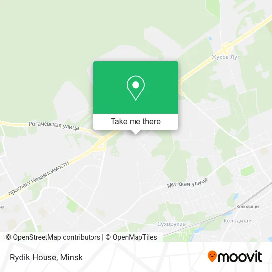
See Rydik House, Pervomaisky District, on the map
Public Transit to Rydik House in Pervomaisky District
Wondering how to get to Rydik House in Pervomaisky District? Moovit helps you find the best way to get to Rydik House with step-by-step directions from the nearest public transit station.
Moovit provides free maps and live directions to help you navigate through your city. View schedules, routes, timetables, and find out how long does it take to get to Rydik House in real time.
Looking for the nearest stop or station to Rydik House? Check out this list of stops closest to your destination: Gurtyev; Military Academy; Tankavaya; Kolodishchi; Uruchye; Uruchye-4 Station.
Bus: 15, 15D, 15D, 63D, 169, 195, 99, 153D.Train: MINSK - RED FLAG, MINSK - RED FLAG.Metro: 1.Trolleybus: 37, 42.
Want to see if there’s another route that gets you there at an earlier time? Moovit helps you find alternative routes or times. Get directions from and directions to Rydik House easily from the Moovit App or Website.
We make riding to Rydik House easy, which is why over 1.5 million users, including users in Pervomaisky District, trust Moovit as the best app for public transit. You don’t need to download an individual bus app or train app, Moovit is your all-in-one transit app that helps you find the best bus time or train time available.
For information on prices of bus, metro, Trolleybus and train, costs and ride fares to Rydik House, please check the Moovit app.
Use the app to navigate to popular places including to the airport, hospital, stadium, grocery store, mall, coffee shop, school, college, and university.
Rydik House Address: вуліца Фогеля 3 220057 Минск street in Pervomaisky District
- Fogel Street 1,
- Fogel Street,
- Construction of Building N11,
- Viva-Gold,
- Rocketeer Club,
- 9 Km,
- Gurtyeva, 9,
- Minsk-57,
- Mast-Kaya Bsb,
- 9th Kilometer,
- Independence Avenue 220,
- Military Academy of the Republic of Belarus,
- Military Academy of Belarus,
- Lesha' Shome,
- Checkpoint No. 1 Varb,
- VA RB Polyclinic,
- Military Academy Polyclinic,
- Gurteva Street 14,
- Kindergarten 9km,
- Devyatka
Places Near Rydik House (Pervomaisky District)
- Diamond City, Minsk,
- Shopping Center «Zhdanovichi», Central District,
- Makaenka Street 17, Pervomaisky District,
- 11th City Clinical Hospital, Oktyabrsky District,
- Minsk Consultation and Diagnostic Center Semashko Street, 10, Moskovskiy District,
- Republican Scientific and Practical Center 'Mother and Child', Central District,
- Shopping Center Zamok, Central District,
- 4th City Clinical Hospital Named After N.E. Savchenko, Moskovskiy District,
- 10th City Clinical Hospital, Factory District,
- Lebyazhy, Minsk,
- 6th City Clinical Hospital, Partizansky District,
- N.N. Alexandrov Oncology and Radiology Research Center, Forest,
- Belexpo Exhibition Complex, Central District,
- Dana Mall, Pervomaisky District,
- Shopping Center Zamok, Central District,
- Expobel, Minsk,
- Expobel Shopping Mall, Minsk,
- Military Unit 07147. Central Command Point of Air Force-Air Defense, Minsk,
- 24th Special Medical Examination Polyclinic, Pervomaisky District,
- Republican Clinical Medical Center, Minsk
How to get to popular places in Minsk with public transit
Get around Pervomaisky District by public transit!
Traveling around Pervomaisky District has never been so easy. See step by step directions as you travel to any attraction, street or major public transit station. View bus and train schedules, arrival times, service alerts and detailed routes on a map, so you know exactly how to get to anywhere in Pervomaisky District.
When traveling to any destination around Pervomaisky District use Moovit's Live Directions with Get Off Notifications to know exactly where and how far to walk, how long to wait for your line, and how many stops are left. Moovit will alert you when it's time to get off — no need to constantly re-check whether yours is the next stop.
Wondering how to use public transit in Pervomaisky District or how to pay for public transit in Pervomaisky District? Moovit public transit app can help you navigate your way with public transit easily, and at minimum cost. It includes public transit fees, ticket prices, and costs. Looking for a map of Pervomaisky District public transit lines? Moovit public transit app shows all public transit maps in Pervomaisky District with all Bus, Train, Metro, Light Rail and Trolleybus routes and stops on an interactive map.
Minsk has 5 transit type(s), including: Bus, Train, Metro, Light Rail and Trolleybus, operated by several transit agencies, including Capital Transport and Communications and Belarusian Railways
