How to get to Rye Marshlands by bus?
Click on the bus route to see step by step directions with maps, line arrival times and updated time schedules.
From Cross County Mall, Yonkers
53 minFrom Port Chester, NY, Port Chester
40 minFrom Ridge Hill Mall, Yonkers
77 minFrom Mamaroneck NY, Mamaroneck
50 minFrom the bee-line system Bus Stop - Rye Playland (13, 75, 91), Rye
67 minFrom St. John's Riverside Hospital, Yonkers
64 minFrom Cross County Shopping Center, Yonkers
54 minFrom New Rochelle, NY, New Rochelle
45 minFrom Rye Playland, Rye
69 minFrom Regeneron Pharmaceuticals Inc, Tarrytown
75 min
How to get to Rye Marshlands by train?
Click on the train route to see step by step directions with maps, line arrival times and updated time schedules.
Bus stops near Rye Marshlands in White Plains
Train station near Rye Marshlands in White Plains
- North White Plains, 12 min walk,VIEW
What are the closest stations to Rye Marshlands?
The closest stations to Rye Marshlands are:
- N Broadway @ White Plains Manor is 226 yards away, 3 min walk.
- North White Plains is 982 yards away, 12 min walk.
- Lake St @ Stewart Pl is 1052 yards away, 13 min walk.
Which bus lines stop near Rye Marshlands?
These bus lines stop near Rye Marshlands: 13, 6, 62.
Which train line stops near Rye Marshlands?
2 (613#| Southeast)
What’s the nearest train station to Rye Marshlands in White Plains?
The nearest train station to Rye Marshlands in White Plains is North White Plains. It’s a 12 min walk away.
What’s the nearest bus station to Rye Marshlands in White Plains?
The nearest bus station to Rye Marshlands in White Plains is N Broadway @ White Plains Manor. It’s a 3 min walk away.
What time is the first train to Rye Marshlands in White Plains?
The 2 is the first train that goes to Rye Marshlands in White Plains. It stops nearby at 4:44 AM.
What time is the last train to Rye Marshlands in White Plains?
The 2 is the last train that goes to Rye Marshlands in White Plains. It stops nearby at 2:56 AM.
What time is the first bus to Rye Marshlands in White Plains?
The 5 is the first bus that goes to Rye Marshlands in White Plains. It stops nearby at 6:08 AM.
What time is the last bus to Rye Marshlands in White Plains?
The 6 is the last bus that goes to Rye Marshlands in White Plains. It stops nearby at 10:16 PM.
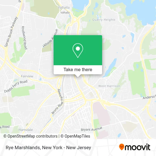
See Rye Marshlands, White Plains, on the map
Public Transit to Rye Marshlands in White Plains
Wondering how to get to Rye Marshlands in White Plains? Moovit helps you find the best way to get to Rye Marshlands with step-by-step directions from the nearest public transit station.
Moovit provides free maps and live directions to help you navigate through your city. View schedules, routes, timetables, and find out how long does it take to get to Rye Marshlands in real time.
Looking for the nearest stop or station to Rye Marshlands? Check out this list of stops closest to your destination: N Broadway @ White Plains Manor; North White Plains; Lake St @ Stewart Pl.
Bus: 13, 6, 62, 5.Train: 2.
Want to see if there’s another route that gets you there at an earlier time? Moovit helps you find alternative routes or times. Get directions from and directions to Rye Marshlands easily from the Moovit App or Website.
We make riding to Rye Marshlands easy, which is why over 1.5 million users, including users in White Plains, trust Moovit as the best app for public transit. You don’t need to download an individual bus app or train app, Moovit is your all-in-one transit app that helps you find the best bus time or train time available.
For information on prices of bus and train, costs and ride fares to Rye Marshlands, please check the Moovit app.
Use the app to navigate to popular places including to the airport, hospital, stadium, grocery store, mall, coffee shop, school, college, and university.
Location: White Plains, New York - New Jersey
- Abf Painting,
- Raj Kitchen and Bath,
- Judicial Institute,
- Pace University School Of Law - White Plains Bookstore,
- Barnes & Noble Booksellers,
- Pace Immigration Law Practitioners,
- Spice NYC,
- Pace Law Dannat Hall,
- Pace University Law School,
- Pace I Haub Environmental Law,
- Elisabeth Haub School Of Law,
- Commons II,
- 445 Hamilton Ave,
- Pace Law School - Center For Environmental Legal Studies,
- Land Use Law Center,
- Pace - Preston Hall,
- Atm Pace - Preston Hall,
- Pace University Westchester,
- Academy Of Our Lady Of Good Counsel High School,
- Exit 6 North White Plains
Places Near Rye Marshlands (White Plains)
- Mountainside Hospital, Glen Ridge,
- 1 Police Plaza, Manhattan,
- Rockefeller Center, Manhattan,
- SoHo, Manhattan,
- qqqq, Manhattan,
- Wall Street, Manhattan,
- Pier 83, Manhattan,
- 911 Memorial, Manhattan,
- Chinatown, Manhattan,
- 111 Centre New York City Supreme Court, Manhattan,
- Bellevue Hospital, Manhattan,
- 3 Stone St, Manhattan,
- 376 Hudson Street, Manhattan,
- 26 Federal Plaza, Manhattan,
- Katz's Deli, Manhattan,
- Times Square, Manhattan,
- Hudson Yards, Manhattan,
- San Gennaro Feast, Manhattan,
- Queens Center Mall, Queens,
- 66 John Street, Manhattan
How to get to popular places in New York - New Jersey with public transit
Get around White Plains by public transit!
Traveling around White Plains has never been so easy. See step by step directions as you travel to any attraction, street or major public transit station. View bus and train schedules, arrival times, service alerts and detailed routes on a map, so you know exactly how to get to anywhere in White Plains.
When traveling to any destination around White Plains use Moovit's Live Directions with Get Off Notifications to know exactly where and how far to walk, how long to wait for your line, and how many stops are left. Moovit will alert you when it's time to get off — no need to constantly re-check whether yours is the next stop.
Wondering how to use public transit in White Plains or how to pay for public transit in White Plains? Moovit public transit app can help you navigate your way with public transit easily, and at minimum cost. It includes public transit fees, ticket prices, and costs. Looking for a map of White Plains public transit lines? Moovit public transit app shows all public transit maps in White Plains with all Bus, Train, Subway, Light Rail, Ferry and Cable Car routes and stops on an interactive map.
New York - New Jersey has 6 transit type(s), including: Bus, Train, Subway, Light Rail, Ferry and Cable Car, operated by several transit agencies, including MTA Subway, Metro-North Railroad, LIRR, PATH, MTA New York City Transit - Express routes, MTA Bus, NJ Transit, NYC Ferry, NICE bus, Bee-Line Bus, NJ Transit Rail, Norwalk Transit District, Hartford Line, River Valley Transit and HART