How to get to Rye Neck Schools by bus?
Click on the bus route to see step by step directions with maps, line arrival times and updated time schedules.
From Westchester Mall, White Plains
62 minFrom Co-Op City, Bronx
74 minFrom City Island, Bronx
99 minFrom White Plains, NY, White Plains
60 minFrom Empire City Casino, Yonkers
81 minFrom Cross County Mall, Yonkers
93 minFrom Ridge Hill Mall, Yonkers
126 minFrom Port Chester, NY, Port Chester
42 minFrom Cross County Shopping Center, Yonkers
93 minFrom New Rochelle, NY, New Rochelle
50 min
How to get to Rye Neck Schools by train?
Click on the train route to see step by step directions with maps, line arrival times and updated time schedules.
Train station near Rye Neck Schools in Mamaroneck
- Mamaroneck, 7 min walk,VIEW
What are the closest stations to Rye Neck Schools?
The closest stations to Rye Neck Schools are:
- Mamaroneck is 580 yards away, 7 min walk.
Which bus line stops near Rye Neck Schools?
61 (Willet Ave @ Putnam Ave)
Which train line stops near Rye Neck Schools?
3 (1316#| Stamford)
What’s the nearest train station to Rye Neck Schools in Mamaroneck?
The nearest train station to Rye Neck Schools in Mamaroneck is Mamaroneck. It’s a 7 min walk away.
What time is the first train to Rye Neck Schools in Mamaroneck?
The 3 is the first train that goes to Rye Neck Schools in Mamaroneck. It stops nearby at 4:57 AM.
What time is the last train to Rye Neck Schools in Mamaroneck?
The 3 is the last train that goes to Rye Neck Schools in Mamaroneck. It stops nearby at 2:39 AM.
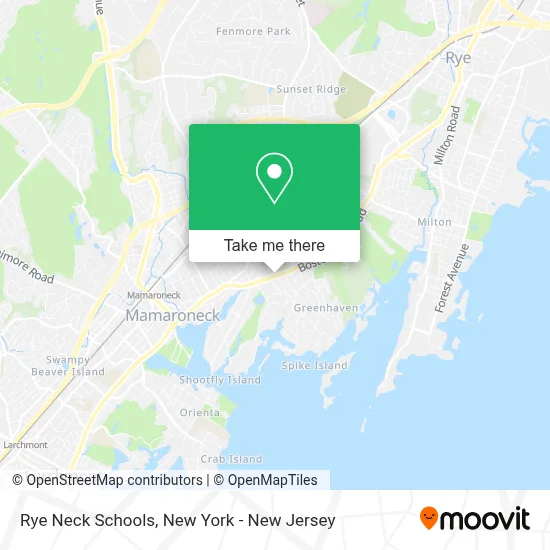
See Rye Neck Schools, Mamaroneck, on the map
Public Transit to Rye Neck Schools in Mamaroneck
Wondering how to get to Rye Neck Schools in Mamaroneck? Moovit helps you find the best way to get to Rye Neck Schools with step-by-step directions from the nearest public transit station.
Moovit provides free maps and live directions to help you navigate through your city. View schedules, routes, timetables, and find out how long does it take to get to Rye Neck Schools in real time.
Looking for the nearest stop or station to Rye Neck Schools? Check out this list of stops closest to your destination: Mamaroneck.
Bus: 61.Train: 3, 4.
Want to see if there’s another route that gets you there at an earlier time? Moovit helps you find alternative routes or times. Get directions from and directions to Rye Neck Schools easily from the Moovit App or Website.
We make riding to Rye Neck Schools easy, which is why over 1.5 million users, including users in Mamaroneck, trust Moovit as the best app for public transit. You don’t need to download an individual bus app or train app, Moovit is your all-in-one transit app that helps you find the best bus time or train time available.
For information on prices of bus and train, costs and ride fares to Rye Neck Schools, please check the Moovit app.
Use the app to navigate to popular places including to the airport, hospital, stadium, grocery store, mall, coffee shop, school, college, and university.
Rye Neck Schools Address: 310 Hornidge Rd street in Mamaroneck
- Bp,
- Kartech NY Inc,
- A Plus Limousine & Car Service,
- York Antiques,
- Super Stop & Shop,
- Toyota City,
- Rye Neck Middle School,
- Al's Rye Neck Service,
- Tardio Paving & Masonry Corp.,
- Orange Bank & Trust Company,
- Diana Benincasa,
- Kumon Math and Reading Center,
- John Fall Cpa, Llc,
- Luke D Yang Dds and Michael J Barbieri Dds,
- Palumbo & Kasofsky Inc,
- Darrell E. Valenti, Dds,
- Westchester Bodyworks Massage Therapy,
- Mamaroneck Foot and Ankle Care,
- Weiss Acupuncture,
- Harrison Pediatrics
Places Near Rye Neck Schools (Mamaroneck)
- Pier 83, Manhattan,
- 1 Police Plaza, Manhattan,
- Queens Center Mall, Queens,
- 376 Hudson Street, Manhattan,
- qqqq, Manhattan,
- Rockefeller Center, Manhattan,
- San Gennaro Feast, Manhattan,
- Mountainside Hospital, Glen Ridge,
- Times Square, Manhattan,
- 111 Centre New York City Supreme Court, Manhattan,
- 66 John Street, Manhattan,
- Chinatown, Manhattan,
- 3 Stone St, Manhattan,
- Wall Street, Manhattan,
- 911 Memorial, Manhattan,
- Hudson Yards, Manhattan,
- Bellevue Hospital, Manhattan,
- Katz's Deli, Manhattan,
- SoHo, Manhattan,
- 26 Federal Plaza, Manhattan
How to get to popular places in New York - New Jersey with public transit
Get around Mamaroneck by public transit!
Traveling around Mamaroneck has never been so easy. See step by step directions as you travel to any attraction, street or major public transit station. View bus and train schedules, arrival times, service alerts and detailed routes on a map, so you know exactly how to get to anywhere in Mamaroneck.
When traveling to any destination around Mamaroneck use Moovit's Live Directions with Get Off Notifications to know exactly where and how far to walk, how long to wait for your line, and how many stops are left. Moovit will alert you when it's time to get off — no need to constantly re-check whether yours is the next stop.
Wondering how to use public transit in Mamaroneck or how to pay for public transit in Mamaroneck? Moovit public transit app can help you navigate your way with public transit easily, and at minimum cost. It includes public transit fees, ticket prices, and costs. Looking for a map of Mamaroneck public transit lines? Moovit public transit app shows all public transit maps in Mamaroneck with all Bus, Train, Subway, Light Rail, Ferry and Cable Car routes and stops on an interactive map.
New York - New Jersey has 6 transit type(s), including: Bus, Train, Subway, Light Rail, Ferry and Cable Car, operated by several transit agencies, including MTA Subway, Metro-North Railroad, LIRR, PATH, MTA New York City Transit - Express routes, MTA Bus, NJ Transit, NYC Ferry, NICE bus, Bee-Line Bus, NJ Transit Rail, Norwalk Transit District, Hartford Line, River Valley Transit and HART