How to get to Rye Presbyterian Thrift Shop by bus?
Click on the bus route to see step by step directions with maps, line arrival times and updated time schedules.
How to get to Rye Presbyterian Thrift Shop by train?
Click on the train route to see step by step directions with maps, line arrival times and updated time schedules.
Bus stops near Rye Presbyterian Thrift Shop
Train station near Rye Presbyterian Thrift Shop
- Rye, 20 min walk,VIEW
What are the closest stations to Rye Presbyterian Thrift Shop?
The closest stations to Rye Presbyterian Thrift Shop are:
- Milton Rd @ Resurrection Es is 159 yards away, 3 min walk.
- Theodore Fremd Ave @ North St is 1165 yards away, 15 min walk.
- Rye is 1620 yards away, 20 min walk.
Which bus lines stop near Rye Presbyterian Thrift Shop?
These bus lines stop near Rye Presbyterian Thrift Shop: 13, 61.
Which train line stops near Rye Presbyterian Thrift Shop?
3 (1314#| Stamford)
What’s the nearest train station to Rye Presbyterian Thrift Shop?
The nearest train station to Rye Presbyterian Thrift Shop is Rye. It’s a 20 min walk away.
What’s the nearest bus station to Rye Presbyterian Thrift Shop?
The nearest bus station to Rye Presbyterian Thrift Shop is Milton Rd @ Resurrection Es. It’s a 3 min walk away.
What time is the first train to Rye Presbyterian Thrift Shop?
The 3 is the first train that goes to Rye Presbyterian Thrift Shop. It stops nearby at 4:54 AM.
What time is the last train to Rye Presbyterian Thrift Shop?
The 3 is the last train that goes to Rye Presbyterian Thrift Shop. It stops nearby at 2:42 AM.
What time is the first bus to Rye Presbyterian Thrift Shop?
The 61 is the first bus that goes to Rye Presbyterian Thrift Shop. It stops nearby at 6:22 AM.
What time is the last bus to Rye Presbyterian Thrift Shop?
The 61 is the last bus that goes to Rye Presbyterian Thrift Shop. It stops nearby at 7:37 PM.
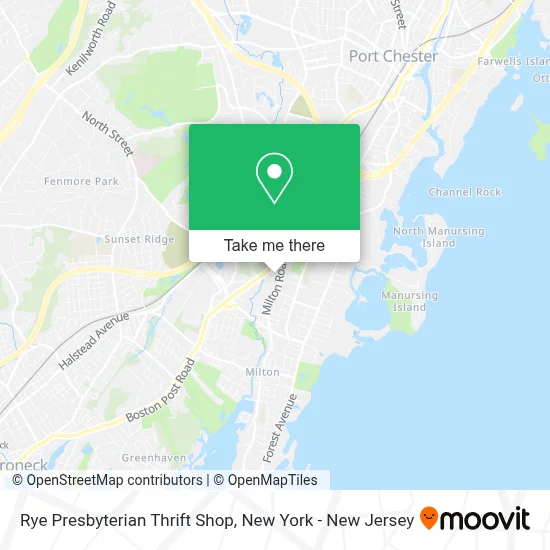
See Rye Presbyterian Thrift Shop on the map
Public Transportation to Rye Presbyterian Thrift Shop
Wondering how to get to Rye Presbyterian Thrift Shop? Moovit helps you find the best way to get to Rye Presbyterian Thrift Shop with step-by-step directions from the nearest public transit station.
Moovit provides free maps and live directions to help you navigate through your city. View schedules, routes, timetables, and find out how long does it take to get to Rye Presbyterian Thrift Shop in real time.
Looking for the nearest stop or station to Rye Presbyterian Thrift Shop? Check out this list of stops closest to your destination: Milton Rd @ Resurrection Es; Theodore Fremd Ave @ North St; Rye.
Bus: 13, 61.Train: 3, 4.
Want to see if there’s another route that gets you there at an earlier time? Moovit helps you find alternative routes or times. Get directions from and directions to Rye Presbyterian Thrift Shop easily from the Moovit App or Website.
We make riding to Rye Presbyterian Thrift Shop easy, which is why over 1.5 million users, including users in Rye, trust Moovit as the best app for public transit. You don’t need to download an individual bus app or train app, Moovit is your all-in-one transit app that helps you find the best bus time or train time available.
For information on prices of bus and train, costs and ride fares to Rye Presbyterian Thrift Shop, please check the Moovit app.
Use the app to navigate to popular places including to the airport, hospital, stadium, grocery store, mall, coffee shop, school, college, and university.
Rye Presbyterian Thrift Shop Address: 882 Boston Post Rd street in Rye
- Resurrection School Alumni, Rye NY,
- Resurrection - Chapel,
- The Rye Arts Center,
- Angela Manning Dds Pc,
- Veraworn,
- The Rye Arts Center,
- Post Road Market Wine & Spirits,
- Valtori Pizza Kitchen,
- Annex Sports Performance - NY,
- Lime Painting Of Westchester, NY,
- Mimi Bloom,
- Dr. Grewe & Partners, Cpas, Llp,
- Rye Brook Services Station,
- The Beauty Box Hair Salon Rye,
- Anahomeservices,
- Rye Brook Post Rd. Svc.,
- Hair + Co.,
- Midland Elementary, Rye, NY,
- Addiction Treatment Rye,
- Giving Tree Global - Bread Of Life
Places Near Rye Presbyterian Thrift Shop
- Mountainside Hospital, Glen Ridge,
- Hudson Yards, Manhattan,
- SoHo, Manhattan,
- Pier 83, Manhattan,
- Queens Center Mall, Queens,
- 26 Federal Plaza, Manhattan,
- Times Square, Manhattan,
- Katz's Deli, Manhattan,
- San Gennaro Feast, Manhattan,
- Wall Street, Manhattan,
- 376 Hudson Street, Manhattan,
- Rockefeller Center, Manhattan,
- Bellevue Hospital, Manhattan,
- 911 Memorial, Manhattan,
- 3 Stone St, Manhattan,
- 1 Police Plaza, Manhattan,
- 111 Centre New York City Supreme Court, Manhattan,
- 66 John Street, Manhattan,
- qqqq, Manhattan,
- Chinatown, Manhattan
How to get to popular places in New York - New Jersey with public transit
Get around Rye by public transit!
Traveling around Rye has never been so easy. See step by step directions as you travel to any attraction, street or major public transit station. View bus and train schedules, arrival times, service alerts and detailed routes on a map, so you know exactly how to get to anywhere in Rye.
When traveling to any destination around Rye use Moovit's Live Directions with Get Off Notifications to know exactly where and how far to walk, how long to wait for your line, and how many stops are left. Moovit will alert you when it's time to get off — no need to constantly re-check whether yours is the next stop.
Wondering how to use public transit in Rye or how to pay for public transit in Rye? Moovit public transit app can help you navigate your way with public transit easily, and at minimum cost. It includes public transit fees, ticket prices, and costs. Looking for a map of Rye public transit lines? Moovit public transit app shows all public transit maps in Rye with all Bus, Train, Subway, Light Rail, Ferry and Cable Car routes and stops on an interactive map.
New York - New Jersey has 6 transit type(s), including: Bus, Train, Subway, Light Rail, Ferry and Cable Car, operated by several transit agencies, including MTA Subway, Metro-North Railroad, LIRR, PATH, MTA New York City Transit - Express routes, MTA Bus, NJ Transit, NYC Ferry, NICE bus, Bee-Line Bus, NJ Transit Rail, Norwalk Transit District, Hartford Line, River Valley Transit and HART