How to get to Rylee + Cru by bus?
Click on the bus route to see step by step directions with maps, line arrival times and updated time schedules.
From Louis Armstrong Stadium, Queens
90 minFrom 1 New York Plaza, Manhattan
66 minFrom 1 Police Plaza (Nypd Headquarters), Manhattan
60 minFrom John's of Bleeker Street, Manhattan
61 minFrom Brooklyn Bridge Park - Pier 1, Manhattan
133 minFrom New York Law School, Manhattan
72 minFrom Castle Clinton National Monument, Manhattan
70 minFrom Chelsea, Manhattan
47 minFrom Hudson County Courthouse, Jersey City
84 minFrom Grove Street (Path), Jersey City
89 min
How to get to Rylee + Cru by train?
Click on the train route to see step by step directions with maps, line arrival times and updated time schedules.
From Louis Armstrong Stadium, Queens
103 minFrom Grove Street (Path), Jersey City
112 minFrom 1 New York Plaza, Manhattan
200 minFrom 1 Police Plaza (Nypd Headquarters), Manhattan
194 minFrom Hudson County Courthouse, Jersey City
125 minFrom John's of Bleeker Street, Manhattan
106 minFrom Castle Clinton National Monument, Manhattan
197 minFrom Chelsea, Manhattan
91 min
How to get to Rylee + Cru by subway?
Click on the subway route to see step by step directions with maps, line arrival times and updated time schedules.
From Louis Armstrong Stadium, Queens
56 minFrom 1 New York Plaza, Manhattan
37 minFrom 1 Police Plaza (Nypd Headquarters), Manhattan
29 minFrom John's of Bleeker Street, Manhattan
39 minFrom Brooklyn Bridge Park - Pier 1, Manhattan
40 minFrom New York Law School, Manhattan
34 minFrom Castle Clinton National Monument, Manhattan
34 minFrom Chelsea, Manhattan
33 min
Bus stops near Rylee + Cru in Manhattan
Bus lines to Rylee + Cru in Manhattan
- M1, Soho Centre St Via 5 Av/ Via Broadway,VIEW
- M2, East Village 8 St Via 5 Av,VIEW
- M3, 125 St St. Nicholas Av,VIEW
- M4, Midtown 32 St & 5 Av Via Bway 5 Av,VIEW
- M86-SBS, Select Bus Yorkville 1av-92 St Crosstown,VIEW
- BXM3, Yonkers Getty Sq Via Sedgwick Av Via Broadway,VIEW
- BXM4, Midtown 26 St Via 5 Av,VIEW
- M101, East Village 3 Av-6 St Via Lex Av,VIEW
- M102, East Village 6 St Via Lex Av,VIEW
- M103, City Hall Via Lex Av,VIEW
- BXM2, Riverdale 263 St Via H. Hudson Pky,VIEW
- BXM11, East Midtown 23 St Via Bronx Riv Pky Via 5 Av,VIEW
- BXM6, Parkchester - Midtown,VIEW
- BXM7, Co-Op City - Midtown,VIEW
- BXM8, Pelham Bay/City Island - Midtown,VIEW
- BXM9, Throgs Neck - Midtown Express,VIEW
- BXM10, Williamsbridge/Morris Park - Midtown,VIEW
- 28, - Bxm4c,VIEW
- SHORTLINE HUDSON, Eastside Woodbury Common,VIEW
- SHORTLINE HUDSON, Eastside Manhattan Commuter Service,VIEW
What are the closest stations to Rylee + Cru?
The closest stations to Rylee + Cru are:
- Madison Av/E 89 St is 63 yards away, 1 min walk.
- 77 St is 83 yards away, 2 min walk.
- E 86 St/Madison Av is 208 yards away, 3 min walk.
- 5 Av/E 87 St is 296 yards away, 4 min walk.
- Lexington Av/E 89 St is 379 yards away, 5 min walk.
- Madison Av/E 84 St is 382 yards away, 5 min walk.
- 5 Av/W 85 St Traverse is 501 yards away, 6 min walk.
- Lexington Ave & E 86th St is 511 yards away, 7 min walk.
- 86 St is 1107 yards away, 14 min walk.
Which bus lines stop near Rylee + Cru?
These bus lines stop near Rylee + Cru: M1, M2, M3, M86-SBS.
Which train lines stop near Rylee + Cru?
These train lines stop near Rylee + Cru: 3, PORT WASHINGTON BRANCH, WEST HEMPSTEAD BRANCH.
Which subway lines stop near Rylee + Cru?
These subway lines stop near Rylee + Cru: 4, 5, 6.
What’s the nearest subway station to Rylee + Cru in Manhattan?
The nearest subway station to Rylee + Cru in Manhattan is 77 St. It’s a 2 min walk away.
What’s the nearest bus station to Rylee + Cru in Manhattan?
The nearest bus station to Rylee + Cru in Manhattan is Madison Av/E 89 St. It’s a 1 min walk away.
What time is the first subway to Rylee + Cru in Manhattan?
The 4 is the first subway that goes to Rylee + Cru in Manhattan. It stops nearby at 3:03 AM.
What time is the last subway to Rylee + Cru in Manhattan?
The 4 is the last subway that goes to Rylee + Cru in Manhattan. It stops nearby at 3:48 AM.
What time is the first bus to Rylee + Cru in Manhattan?
The M103 is the first bus that goes to Rylee + Cru in Manhattan. It stops nearby at 3:04 AM.
What time is the last bus to Rylee + Cru in Manhattan?
The M103 is the last bus that goes to Rylee + Cru in Manhattan. It stops nearby at 3:04 AM.
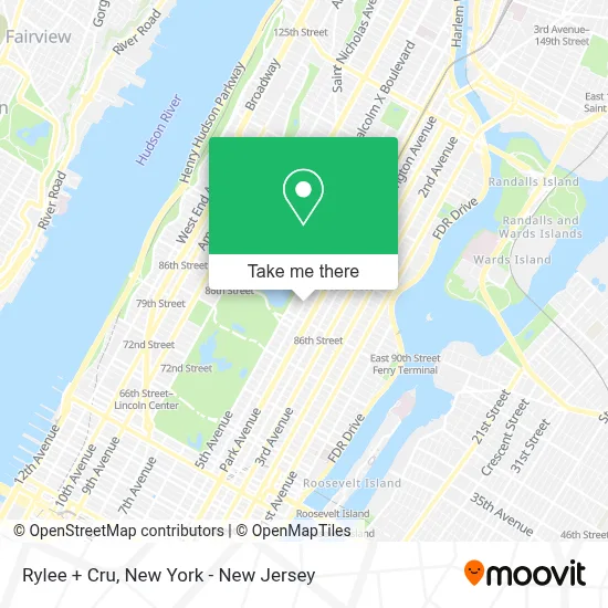
See Rylee + Cru, Manhattan, on the map
Public Transit to Rylee + Cru in Manhattan
Wondering how to get to Rylee + Cru in Manhattan? Moovit helps you find the best way to get to Rylee + Cru with step-by-step directions from the nearest public transit station.
Moovit provides free maps and live directions to help you navigate through your city. View schedules, routes, timetables, and find out how long does it take to get to Rylee + Cru in real time.
Looking for the nearest stop or station to Rylee + Cru? Check out this list of stops closest to your destination: Madison Av/E 89 St; 77 St; E 86 St/Madison Av; 5 Av/E 87 St; Lexington Av/E 89 St; Madison Av/E 84 St; 5 Av/W 85 St Traverse; Lexington Ave & E 86th St; 86 St.
Bus: M1, M2, M3, M86-SBS, M4, BXM3, BXM4, M101, M102, M103.Train: 3, PORT WASHINGTON BRANCH, WEST HEMPSTEAD BRANCH.Subway: 4, 5, 6, 6X, N, Q, R, W.
Want to see if there’s another route that gets you there at an earlier time? Moovit helps you find alternative routes or times. Get directions from and directions to Rylee + Cru easily from the Moovit App or Website.
We make riding to Rylee + Cru easy, which is why over 1.5 million users, including users in Manhattan, trust Moovit as the best app for public transit. You don’t need to download an individual bus app or train app, Moovit is your all-in-one transit app that helps you find the best bus time or train time available.
For information on prices of subway, bus and train, costs and ride fares to Rylee + Cru, please check the Moovit app.
Use the app to navigate to popular places including to the airport, hospital, stadium, grocery store, mall, coffee shop, school, college, and university.
Rylee + Cru Address: 1225 Madison Ave street in Manhattan
- Robert Marc Nyc Eyewear,
- Blank Street,
- Madison Fare,
- The Benalloul Team,
- 1228 Madison Avenue Sales Gallery,
- Emporio Armani Junior New York,
- Via Quadronno Carnegie Hill,
- The Pink Chicken,
- 88th St and Madis,
- Doreen Nails II,
- Benefit Cosmetics Brows A Go-Go,
- Nununu,
- Libertyx Bitcoin Atm,
- Western Union,
- Julia Recruiter,
- Jnj Nail,
- Toast,
- Hsbc Bank,
- Loren Skeist,
- 40 East 88 Owners
Places Near Rylee + Cru (Manhattan)
- 3 Stone St, Manhattan,
- Pier 83, Manhattan,
- Rockefeller Center, Manhattan,
- 376 Hudson Street, Manhattan,
- qqqq, Manhattan,
- San Gennaro Feast, Manhattan,
- Mountainside Hospital, Glen Ridge,
- Queens Center Mall, Queens,
- 911 Memorial, Manhattan,
- Katz's Deli, Manhattan,
- 66 John Street, Manhattan,
- Wall Street, Manhattan,
- 111 Centre New York City Supreme Court, Manhattan,
- Hudson Yards, Manhattan,
- 26 Federal Plaza, Manhattan,
- SoHo, Manhattan,
- Chinatown, Manhattan,
- 1 Police Plaza, Manhattan,
- Times Square, Manhattan,
- Bellevue Hospital, Manhattan
How to get to popular places in New York - New Jersey with public transit
Get around Manhattan by public transit!
Traveling around Manhattan has never been so easy. See step by step directions as you travel to any attraction, street or major public transit station. View bus and train schedules, arrival times, service alerts and detailed routes on a map, so you know exactly how to get to anywhere in Manhattan.
When traveling to any destination around Manhattan use Moovit's Live Directions with Get Off Notifications to know exactly where and how far to walk, how long to wait for your line, and how many stops are left. Moovit will alert you when it's time to get off — no need to constantly re-check whether yours is the next stop.
Wondering how to use public transit in Manhattan or how to pay for public transit in Manhattan? Moovit public transit app can help you navigate your way with public transit easily, and at minimum cost. It includes public transit fees, ticket prices, and costs. Looking for a map of Manhattan public transit lines? Moovit public transit app shows all public transit maps in Manhattan with all Bus, Train, Subway, Light Rail, Ferry and Cable Car routes and stops on an interactive map.
New York - New Jersey has 6 transit type(s), including: Bus, Train, Subway, Light Rail, Ferry and Cable Car, operated by several transit agencies, including MTA Subway, Metro-North Railroad, LIRR, PATH, MTA New York City Transit - Express routes, MTA Bus, NJ Transit, NYC Ferry, NICE bus, Bee-Line Bus, NJ Transit Rail, Norwalk Transit District, Hartford Line, River Valley Transit and HART