How to get to Rylo by bus?
Click on the bus route to see step by step directions with maps, line arrival times and updated time schedules.
From Salvation Army, Las Vegas
61 minFrom Arizona Charlie's Boulder, Paradise
57 minFrom E Sunset Rd / S Pecos Rd, Paradise
76 minFrom Nelson's Landing Cliff Jump, Las Vegas
84 minFrom Trader Joe's, Las Vegas
51 minFrom Clifford J Lawrence Junior High School, Spring Valley
67 minFrom Las Vegas South Premium Outlets, Enterprise
58 minFrom Libertyx Bitcoin ATM, Spring Valley
84 minFrom Island Pacific, Spring Valley
65 minFrom Aveda Institute Las Vegas, Paradise
63 min
Bus stops near Rylo in Las Vegas
Monorail station near Rylo in Las Vegas
- Sls Station, 25 min walk,VIEW
Bus lines to Rylo in Las Vegas
What are the closest stations to Rylo?
The closest stations to Rylo are:
- Eb Sahara Before Teddy is 397 yards away, 5 min walk.
- Nb Sammy Davis Jr After Goh Tong is 977 yards away, 12 min walk.
- Sls Station is 2052 yards away, 25 min walk.
Which bus lines stop near Rylo?
These bus lines stop near Rylo: 104, 119, 203, SX.
What’s the nearest bus station to Rylo in Las Vegas?
The nearest bus station to Rylo in Las Vegas is Eb Sahara Before Teddy. It’s a 5 min walk away.
What’s the nearest Monorail station to Rylo in Las Vegas?
The nearest Monorail station to Rylo in Las Vegas is Sls Station. It’s a 25 min walk away.
What time is the first bus to Rylo in Las Vegas?
The SX is the first bus that goes to Rylo in Las Vegas. It stops nearby at 3:12 AM.
What time is the last bus to Rylo in Las Vegas?
The SX is the last bus that goes to Rylo in Las Vegas. It stops nearby at 3:17 AM.
What time is the first Monorail to Rylo in Las Vegas?
The LVM is the first Monorail that goes to Rylo in Las Vegas. It stops nearby at 7:00 AM.
What time is the last Monorail to Rylo in Las Vegas?
The LVM is the last Monorail that goes to Rylo in Las Vegas. It stops nearby at 12:02 AM.
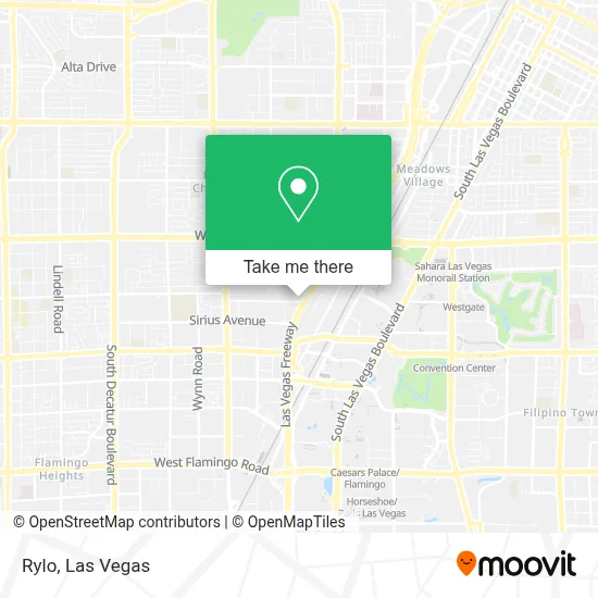
See Rylo, Las Vegas, on the map
Public Transit to Rylo in Las Vegas
Wondering how to get to Rylo in Las Vegas? Moovit helps you find the best way to get to Rylo with step-by-step directions from the nearest public transit station.
Moovit provides free maps and live directions to help you navigate through your city. View schedules, routes, timetables, and find out how long does it take to get to Rylo in real time.
Looking for the nearest stop or station to Rylo? Check out this list of stops closest to your destination: Eb Sahara Before Teddy; Nb Sammy Davis Jr After Goh Tong; Sls Station.
Bus: 104, 119, 203, SX.Monorail: LVM.
Want to see if there’s another route that gets you there at an earlier time? Moovit helps you find alternative routes or times. Get directions from and directions to Rylo easily from the Moovit App or Website.
We make riding to Rylo easy, which is why over 1.7 million users, including users in Las Vegas, trust Moovit as the best app for public transit. You don’t need to download an individual bus app or train app, Moovit is your all-in-one transit app that helps you find the best bus time or train time available.
For information on prices of bus, costs and ride fares to Rylo, please check the Moovit app.
Use the app to navigate to popular places including to the airport, hospital, stadium, grocery store, mall, coffee shop, school, college, and university.
Rylo Address: 2950 S Rancho Dr Ste 100 street in Las Vegas
- Southern Highland Cent,
- Tarkanian Basketball Academy (Dann Tarkanian Basketball),
- Area15,
- Omega Mart - Meow Wolf,
- Meow Wolf - Las Vegas (Meow Wolf's Omega Mart),
- Caesars Palace Palms Place Palms Casino Resort,
- Welder Up,
- Omega Mart,
- Palace Station Hotel & Casino,
- Las Vegas Escorts Service,
- Grand Ballroom @ Palace Station,
- Deja Vu Love Boutique,
- Meow Wolf Las Vegas,
- Erotic Heritage Museum,
- Palace Station Hotel and Casino (Palace Station Las Vegas),
- 204 Sahara Bus Eastbound,
- Reef Dispensaries,
- In-N-Out Burger,
- RTC Sahara Express - Palace Station Westbound,
- Count's Kustoms
Places Near Rylo (Las Vegas)
- Las Vegas Premium Outlets-North, Enterprise,
- Arte Museum Las Vegas, Paradise,
- Lee Canyon, Las Vegas,
- Allegiant Stadium, Paradise,
- Zak Bagans Haunted Museum, Las Vegas,
- Walmart Supercenter, Las Vegas,
- Walmart, Las Vegas,
- Town Square, Enterprise,
- Area15, Las Vegas,
- Meow Wolf - Las Vegas (Meow Wolf's Omega Mart), Las Vegas,
- Las Vegas South Premium Outlets, Enterprise,
- Welcome To Fabulous Las Vegas Sign, Paradise,
- Las Vegas North Premium Outlets, Las Vegas,
- The Neon Museum, Las Vegas,
- Koolsville Tattoos, Las Vegas,
- Trump International Hotel Las Vegas, Paradise,
- Gold & Silver Pawn Shop, Las Vegas,
- Omega Mart, Las Vegas,
- The Deuce Bus Stop at Fremont St, Las Vegas,
- The Palms Casino Resort, Paradise
How to get to popular places in Las Vegas with public transit
Get around Las Vegas by public transit!
Traveling around Las Vegas has never been so easy. See step by step directions as you travel to any attraction, street or major public transit station. View bus and train schedules, arrival times, service alerts and detailed routes on a map, so you know exactly how to get to anywhere in Las Vegas.
When traveling to any destination around Las Vegas use Moovit's Live Directions with Get Off Notifications to know exactly where and how far to walk, how long to wait for your line, and how many stops are left. Moovit will alert you when it's time to get off — no need to constantly re-check whether yours is the next stop.
Wondering how to use public transit in Las Vegas or how to pay for public transit in Las Vegas? Moovit public transit app can help you navigate your way with public transit easily, and at minimum cost. It includes public transit fees, ticket prices, and costs. Looking for a map of Las Vegas public transit lines? Moovit public transit app shows all public transit maps in Las Vegas with all Bus and Monorail routes and stops on an interactive map.
Las Vegas has 2 transit type(s), including: Bus and Monorail, operated by several transit agencies, including RTCSNV, City of Las Vegas, Alvand Transportation, Vegas Airporter, Las Vegas Monorail, FlixBus-us and Greyhound-us