How to get to Rym21 by bus?
Click on the bus route to see step by step directions with maps, line arrival times and updated time schedules.
From Broadway & 50th St, Manhattan
90 minFrom 34th-Street - Penn Station, Manhattan
88 minFrom Forest Hills, Queens
40 minFrom Broadway and 168th St, Manhattan
74 minFrom General Consulate Honduras, Manhattan
82 minFrom Bellevue Hospital, Manhattan
66 minFrom 961 E 174th St, Bronx
84 minFrom 230 Fifth Rooftop Bar, Manhattan
87 minFrom 168 St, Manhattan
69 minFrom Washington Heights, Manhattan
69 min
How to get to Rym21 by train?
Click on the train route to see step by step directions with maps, line arrival times and updated time schedules.
How to get to Rym21 by subway?
Click on the subway route to see step by step directions with maps, line arrival times and updated time schedules.
From Broadway & 50th St, Manhattan
62 minFrom 34th-Street - Penn Station, Manhattan
65 minFrom Forest Hills, Queens
48 minFrom Broadway and 168th St, Manhattan
86 minFrom General Consulate Honduras, Manhattan
66 minFrom Bellevue Hospital, Manhattan
56 minFrom 961 E 174th St, Bronx
99 minFrom 230 Fifth Rooftop Bar, Manhattan
65 minFrom 168 St, Manhattan
86 minFrom Washington Heights, Manhattan
86 min
Bus stops near Rym21 in Queens
Subway stations near Rym21 in Queens
Bus lines to Rym21 in Queens
What are the closest stations to Rym21?
The closest stations to Rym21 are:
- 94 St/24 Av is 265 yards away, 4 min walk.
- Astoria Blvd/98 St is 476 yards away, 6 min walk.
- 23 Av/94 St is 479 yards away, 6 min walk.
- 94 St/23 Av is 512 yards away, 7 min walk.
- 90 St-Elmhurst Av is 1644 yards away, 20 min walk.
- Junction Blvd is 3284 yards away, 39 min walk.
Which bus lines stop near Rym21?
These bus lines stop near Rym21: M60-SBS, Q47, Q72.
Which train line stops near Rym21?
PORT WASHINGTON BRANCH (Port Washington)
Which subway lines stop near Rym21?
These subway lines stop near Rym21: 2, 7.
What’s the nearest subway station to Rym21 in Queens?
The nearest subway station to Rym21 in Queens is 90 St-Elmhurst Av. It’s a 20 min walk away.
What’s the nearest bus station to Rym21 in Queens?
The nearest bus station to Rym21 in Queens is 94 St/24 Av. It’s a 4 min walk away.
What time is the first subway to Rym21 in Queens?
The 7 is the first subway that goes to Rym21 in Queens. It stops nearby at 3:02 AM.
What time is the last subway to Rym21 in Queens?
The 7 is the last subway that goes to Rym21 in Queens. It stops nearby at 3:26 AM.
What time is the first bus to Rym21 in Queens?
The M60-SBS is the first bus that goes to Rym21 in Queens. It stops nearby at 3:02 AM.
What time is the last bus to Rym21 in Queens?
The M60-SBS is the last bus that goes to Rym21 in Queens. It stops nearby at 3:22 AM.
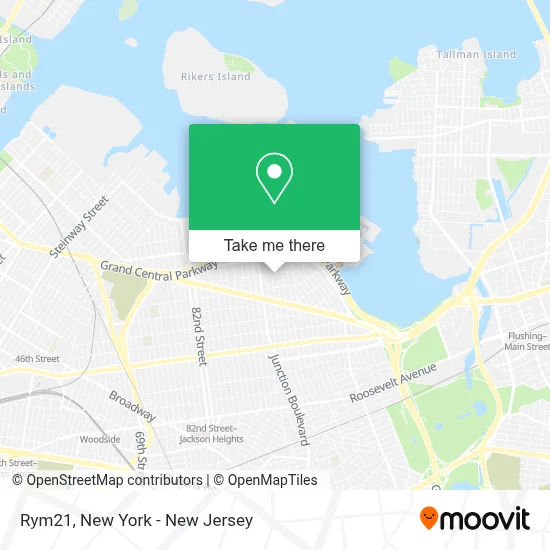
See Rym21, Queens, on the map
Public Transit to Rym21 in Queens
Wondering how to get to Rym21 in Queens? Moovit helps you find the best way to get to Rym21 with step-by-step directions from the nearest public transit station.
Moovit provides free maps and live directions to help you navigate through your city. View schedules, routes, timetables, and find out how long does it take to get to Rym21 in real time.
Looking for the nearest stop or station to Rym21? Check out this list of stops closest to your destination: 94 St/24 Av; Astoria Blvd/98 St; 23 Av/94 St; 94 St/23 Av; 90 St-Elmhurst Av; Junction Blvd.
Bus: M60-SBS, Q47, Q72, Q19, Q49.Train: PORT WASHINGTON BRANCH.Subway: 2, 7, 7X.
Want to see if there’s another route that gets you there at an earlier time? Moovit helps you find alternative routes or times. Get directions from and directions to Rym21 easily from the Moovit App or Website.
We make riding to Rym21 easy, which is why over 1.5 million users, including users in Queens, trust Moovit as the best app for public transit. You don’t need to download an individual bus app or train app, Moovit is your all-in-one transit app that helps you find the best bus time or train time available.
For information on prices of bus, subway and train, costs and ride fares to Rym21, please check the Moovit app.
Use the app to navigate to popular places including to the airport, hospital, stadium, grocery store, mall, coffee shop, school, college, and university.
Rym21 Address: 24-06 97th St street in Queens
- Mrf Gym,
- The Calex Group Llc,
- Locksmith For Nyc,
- Liz Academy,
- East Elmhurst Jame-E-Masjid,
- Colombianos En New York,
- Hiram 26,
- Jass_Lash_Studio,
- Future Builders Construction,
- Limusinas Nueva York,
- Puñay,
- Car Hire Queens | Sixt Rent A Car,
- PS 127 (The Jerospace Science Academy),
- Helen Marshall Playground,
- P.S. 127 Aerospace Science Magnet School,
- Radical Storage,
- Helen Marshall Playground Tennis Courts,
- Flame Station,
- Nyingma Palyul Dharma Center,
- District 30 Pre-K Center
Places Near Rym21 (Queens)
- San Gennaro Feast, Manhattan,
- 26 Federal Plaza, Manhattan,
- Rockefeller Center, Manhattan,
- Pier 83, Manhattan,
- Wall Street, Manhattan,
- Hudson Yards, Manhattan,
- Times Square, Manhattan,
- 3 Stone St, Manhattan,
- Bellevue Hospital, Manhattan,
- Queens Center Mall, Queens,
- 66 John Street, Manhattan,
- qqqq, Manhattan,
- Mountainside Hospital, Glen Ridge,
- 1 Police Plaza, Manhattan,
- 911 Memorial, Manhattan,
- SoHo, Manhattan,
- 111 Centre New York City Supreme Court, Manhattan,
- Katz's Deli, Manhattan,
- 376 Hudson Street, Manhattan,
- Chinatown, Manhattan
How to get to popular places in New York - New Jersey with public transit
Get around Queens by public transit!
Traveling around Queens has never been so easy. See step by step directions as you travel to any attraction, street or major public transit station. View bus and train schedules, arrival times, service alerts and detailed routes on a map, so you know exactly how to get to anywhere in Queens.
When traveling to any destination around Queens use Moovit's Live Directions with Get Off Notifications to know exactly where and how far to walk, how long to wait for your line, and how many stops are left. Moovit will alert you when it's time to get off — no need to constantly re-check whether yours is the next stop.
Wondering how to use public transit in Queens or how to pay for public transit in Queens? Moovit public transit app can help you navigate your way with public transit easily, and at minimum cost. It includes public transit fees, ticket prices, and costs. Looking for a map of Queens public transit lines? Moovit public transit app shows all public transit maps in Queens with all Bus, Train, Subway, Light Rail, Ferry and Cable Car routes and stops on an interactive map.
New York - New Jersey has 6 transit type(s), including: Bus, Train, Subway, Light Rail, Ferry and Cable Car, operated by several transit agencies, including MTA Subway, Metro-North Railroad, LIRR, PATH, MTA New York City Transit - Express routes, MTA Bus, NJ Transit, NYC Ferry, NICE bus, Bee-Line Bus, NJ Transit Rail, Norwalk Transit District, Hartford Line, River Valley Transit and HART