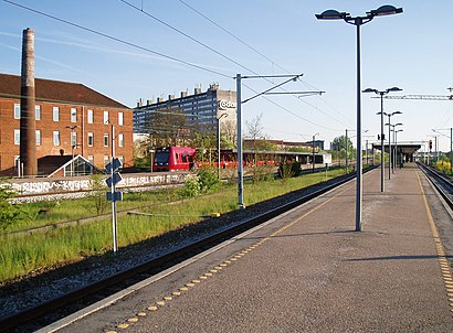
Ryparken St. station - Thursday schedule
| Line | Direction | Time |
|---|---|---|
| F | NY Ellebjerg St. | 05:04 |
| F | NY Ellebjerg St. | 05:14 |
| B | Farum St. | 05:19 |
| F | NY Ellebjerg St. | 05:24 |
| B | Høje Taastrup St. | 05:26 |
| F | NY Ellebjerg St. | 05:34 |
| B | Farum St. | 05:39 |
| 920E | Hillerød | 05:41 |
| F | NY Ellebjerg St. | 05:44 |
| B | Høje Taastrup St. | 05:46 |
| 920E | Hillerød | 05:51 |
| F | NY Ellebjerg St. | 05:54 |
| B | Farum St. | 05:59 |
| 920E | Hillerød | 06:01 |
| F | NY Ellebjerg St. | 06:04 |
| B | Høje Taastrup St. | 06:06 |
| 920E | Hillerød | 06:11 |
| F | NY Ellebjerg St. | 06:14 |
| B | Høje Taastrup St. | 06:16 |
| B | Farum St. | 06:19 |
| 920E | Hillerød | 06:21 |
| F | NY Ellebjerg St. | 06:24 |
| B | Høje Taastrup St. | 06:26 |
| B | Farum St. | 06:29 |
| F | NY Ellebjerg St. | 06:29 |
Directions to Ryparken St. (København) with public transportation
The following transit lines have routes that pass near Ryparken St.
How to get to Ryparken St. by bus?
Click on the bus route to see step by step directions with maps, line arrival times and updated time schedules.
How to get to Ryparken St. by train?
Click on the train route to see step by step directions with maps, line arrival times and updated time schedules.
How to get to Ryparken St. by metro?
Click on the metro route to see step by step directions with maps, line arrival times and updated time schedules.
Bus stations near Ryparken St. in København
- Ryparken St. (Lyngbyvej), 4 min walk,
- Lyngbyvej (Sejrøgade), 9 min walk,
Metro stations near Ryparken St. in København
- Vibenshus Runddel St. (Metro), 15 min walk,
Train stations near Ryparken St. in København
- Svanemøllen St., 20 min walk,
- Bispebjerg St., 27 min walk,
Bus lines to Ryparken St. in København
- 14, Ryparken (Rymarksvej) - Nørreport St. (Nørre Voldgade),
- 15E, Nørreport St. (Nørre Voldgade) - Søhuset Forskerparken (Bøge Allé),
- 94N, Hillerød St. - Rådhuspladsen St. (H.C. Andersens Boulevard),
- 150S, Kokkedal St. - Nørreport St. (Nørre Voldgade),
- 184, Holte St. - Nørreport St. (Nørre Voldgade),
- 185, Nørreport St. (Nørre Voldgade) - Klampenborg St. (Dyrehavevej),
- 12, Svanemøllen St.,
What are the closest stations to Ryparken St.?
The closest stations to Ryparken St. are:
- Ryparken St. (Lyngbyvej) is 235 meters away, 4 min walk.
- Lyngbyvej (Sejrøgade) is 666 meters away, 9 min walk.
- Vibenshus Runddel St. (Metro) is 1115 meters away, 15 min walk.
- Svanemøllen St. is 1486 meters away, 20 min walk.
- Bispebjerg St. is 2041 meters away, 27 min walk.
Which bus lines stop near Ryparken St.?
These bus lines stop near Ryparken St.: 14, 150S, 184.
Which train lines stop near Ryparken St.?
These train lines stop near Ryparken St.: B, F.
Which metro line stops near Ryparken St.?
M3
What’s the nearest metro station to Ryparken St. in København?
The nearest metro station to Ryparken St. in København is Vibenshus Runddel St. (Metro). It’s a 15 min walk away.
What’s the nearest train station to Ryparken St. in København?
The nearest train station to Ryparken St. in København is Svanemøllen St.. It’s a 20 min walk away.
What’s the nearest bus stop to Ryparken St. in København?
The nearest bus stop to Ryparken St. in København is Ryparken St. (Lyngbyvej). It’s a 4 min walk away.
What time is the first metro to Ryparken St. in København?
The M3 is the first metro that goes to Ryparken St. in København. It stops nearby at 3:02 AM.
What time is the last metro to Ryparken St. in København?
The M3 is the last metro that goes to Ryparken St. in København. It stops nearby at 3:12 AM.
What time is the first train to Ryparken St. in København?
The B is the first train that goes to Ryparken St. in København. It stops nearby at 3:04 AM.
What time is the last train to Ryparken St. in København?
The B is the last train that goes to Ryparken St. in København. It stops nearby at 1:01 AM.
What time is the first bus to Ryparken St. in København?
The 150S is the first bus that goes to Ryparken St. in København. It stops nearby at 3:06 AM.
What time is the last bus to Ryparken St. in København?
The 150S is the last bus that goes to Ryparken St. in København. It stops nearby at 3:20 AM.
See Ryparken St., København, on the map
Public transit to Ryparken St. station in København
Looking for directions to Ryparken St. in København, Denmark?
Download the Moovit App to find the current schedule and step-by-step directions for Train, Bus or Metro routes that pass through Ryparken St..
Looking for the nearest stops closest to Ryparken St. ? Check out this list of closest stops to your destination: Ryparken St. (Lyngbyvej); Lyngbyvej (Sejrøgade); Vibenshus Runddel St. (Metro); Svanemøllen St.; Bispebjerg St..
Bus: 14, 150S, 184, 15E, 94N, 12.Train: B, F, A, BX, C, E.Metro: M3.
We make riding on public transit to Ryparken St. easy, which is why over 1.5 million users, including users in København trust Moovit as the best app for public transit.
Use the app to navigate to popular places including to the airport, hospital, stadium, grocery store, mall, coffee shop, school, college, and university.
The station has the following entrances: Lyngbyvej, Lyngbyvej and Lyngbyvej
The first line to this station is F, at 05:04, and the last line is 920E at 01:01.
Lyngbyvej 102, Copenhagen, Denmark
This station serves DSB S-tog and Lokaltog A/S’s lines
Popular routes from Ryparken St., København
Metro station near Ryparken St.
Vibenshus Runddel St. (Metro)Popular public transit stations in København
Viaduktvej (Thistedvej / Nørresundby),Regionshospitalet Silkeborg,Himmelev Egelund (Herregårdsvej),Arnkilgade V Sygehuset,Avedøre Havnevej (Gammel Køge Landevej),Bork Havn Efterskole (Ringkøbing-Skjern Kom),Hammerholmen (Stamholmen),Nyvangsgården (Oldvejen),Hulegården (Brøndbyøstervej),Ravnsborggade (Nørrebrogade),Lokalcenter Havkær/Havkærvej (Aarhus Kom),Kasernen (Kasernevej),Næstved Gymnasium (Nygårdsvej),Kastruplundgade (Saltværksvej),Tietgens Allé / Sdr. Boulevard (Odense Kommune),Kristiansminde Plejecenter (Holbækvej),Kongens Nytorv St. (Metro),Uplandsgade (Vermlandsgade),Kalørvej / Rugårdsvej (Odense Kommune),P.P. Ørums Gade/Jyllands Allé (Aarhus Kom)Get around Denmark by public transit!
Traveling around Denmark has never been so easy. See step by step directions as you travel to any attraction, street or major public transit station. View bus and train schedules, arrival times, service alerts and detailed routes on a map, so you know exactly how to get to anywhere in Denmark.
When traveling to any destination around Denmark use Moovit's Live Directions with Get Off Notifications to know exactly where and how far to walk, how long to wait for your line, and how many stops are left. Moovit will alert you when it's time to get off — no need to constantly re-check whether yours is the next stop.
Wondering how to use public transit in Denmark or how to pay for public transit in Denmark? Moovit public transit app can help you navigate your way with public transit easily, and at minimum cost. It includes public transit fees, ticket prices, and costs. Looking for a map of Denmark public transit lines? Moovit public transit app shows all public transit maps in Denmark with all Bus, Train, Metro, Light Rail and Ferry routes and stops on an interactive map.
Denmark has 5 transit type(s), including: Bus, Train, Metro, Light Rail and Ferry, operated by several transit agencies, including Metroselskabet, DSB S-tog, Lokaltog A/S, Midttrafik, Odense Letbane, DSB, NT, GoCollective, Skånetrafiken, Movia, FYNBUS, Sydtrafik, Bornholms Trafik, Citybus, Ærø Kommune