Directions to Rz Informatica (Mercês) with public transportation
The following transit lines have routes that pass near Rz Informatica
How to get to Rz Informatica by bus?
Click on the bus route to see step by step directions with maps, line arrival times and updated time schedules.
From Rua Delegado Leopoldo Belczak, Capão Da Imbúia
38 minFrom Rua México, Bacacheri
44 minFrom Rua Affife Mansur, Novo Mundo
51 minFrom Rua Leonardo Novicki, Cajuru
55 minFrom Rua Salvador Ferrante, Boqueirão
53 minFrom Santa Candida, Santa Cândida
44 minFrom Rua Lothário Boutin 90, Pinheirinho
54 minFrom Avenida Monteiro Tourinho 1506, Atuba
36 minFrom Avenida Winston Churchill, Capão Raso
54 minFrom Muffato Max Linha Verde, Pinheirinho
65 min
Bus stops near Rz Informatica in Mercês
- R. Professora Rosa Saporski, 451, 2 min walk,VIEW
- R. Jacarezinho, 1000, 3 min walk,VIEW
- R. Jacarezinho, 1040, 3 min walk,VIEW
- R. Jacarezinho, 1300, 4 min walk,VIEW
- Av. Manoel Ribas, 1363 - Praça Divina Pastora, 4 min walk,VIEW
- Praça das Mercês, 5 min walk,VIEW
- Av. Manoel Ribas, 1400, 5 min walk,VIEW
- Av. Manoel Ribas, 1100 (Hospital Nossa Senhora das Graças), 6 min walk,VIEW
Bus lines to Rz Informatica in Mercês
- 150 CANAL DA MÚSICA / VISTA ALEGRE, Vista Alegre → Teatro Guaíra,VIEW
- 020 INTERBAIRROS II (HORÁRIO), Campina do Siqueira → Cabral,VIEW
- 160 JARDIM MERCÊS / GUANABARA, Guanabara → Jardim Mercês,VIEW
- 021 INTERBAIRROS II (ANTI-HORÁRIO), Cabral → Campina do Siqueira,VIEW
- 168 RAPOSO TAVARES, Raposo Tavares → Travessa Nestor de Castro,VIEW
- 901 SANTA FELICIDADE, SANTA FELICIDADE,VIEW
- 965 SÃO BERNARDO, SÃO BERNARDO,VIEW
- 967 JÚLIO GRAF, JÚLIO GRAF,VIEW
- 972 JARDIM ITÁLIA, JARDIM ITÁLIA,VIEW
- 989 MAD. SANTA FELICIDADE, MAD. SANTA FELICIDADE,VIEW
- 022 INTER 2 (HORÁRIO), Campina do Siqueira → Cabral,VIEW
- 023 INTER 2 (ANTI-HORÁRIO), Cabral → Campina do Siqueira,VIEW
- 307 BAIRRO ALTO / SANTA FELICIDADE, Terminal Bairro Alto → Terminal Santa Felicidade,VIEW
- 902 SANTA FELICIDADE / PRAÇA TIRADENTES, Terminal Santa Felicidade → Praça Tiradentes,VIEW
- P69 MAD. CAMPO MAGRO / CURITIBA, Curitiba (Fernando Moreira) → Campo Magro,VIEW
- 464 ALCIDES MUNHOZ / JARDIM BOTÂNICO, Alcides Munhoz → Jardim Botânico,VIEW
- 011 INTERBAIRROS I (ANTI-HORÁRIO), Prefeitura → Estação PUC (Linha Verde),VIEW
What are the closest stations to Rz Informatica?
The closest stations to Rz Informatica are:
- R. Professora Rosa Saporski, 451 is 130 meters away, 2 min walk.
- R. Jacarezinho, 1000 is 178 meters away, 3 min walk.
- R. Jacarezinho, 1040 is 218 meters away, 3 min walk.
- R. Jacarezinho, 1300 is 239 meters away, 4 min walk.
- Av. Manoel Ribas, 1363 - Praça Divina Pastora is 291 meters away, 4 min walk.
- Praça das Mercês is 358 meters away, 5 min walk.
- Av. Manoel Ribas, 1400 is 369 meters away, 5 min walk.
- Av. Manoel Ribas, 1100 (Hospital Nossa Senhora das Graças) is 457 meters away, 6 min walk.
Which bus lines stop near Rz Informatica?
These bus lines stop near Rz Informatica: 020 INTERBAIRROS II (HORÁRIO), 023 INTER 2 (ANTI-HORÁRIO), 150 CANAL DA MÚSICA / VISTA ALEGRE, 160 JARDIM MERCÊS / GUANABARA, 307 BAIRRO ALTO / SANTA FELICIDADE, 902 SANTA FELICIDADE / PRAÇA TIRADENTES.
What’s the nearest bus station to Rz Informatica in Mercês?
The nearest bus station to Rz Informatica in Mercês is R. Professora Rosa Saporski, 451. It’s a 2 min walk away.
What time is the first bus to Rz Informatica in Mercês?
The 989 MAD. SANTA FELICIDADE is the first bus that goes to Rz Informatica in Mercês. It stops nearby at 3:27 AM.
What time is the last bus to Rz Informatica in Mercês?
The 989 MAD. SANTA FELICIDADE is the last bus that goes to Rz Informatica in Mercês. It stops nearby at 3:28 AM.
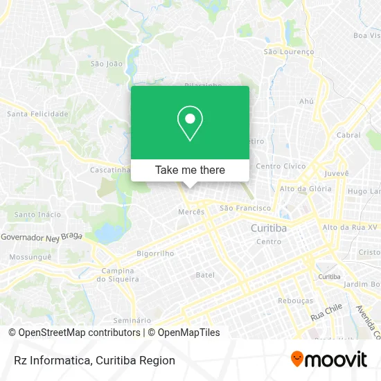
See Rz Informatica, Mercês, on the map
Public Transit to Rz Informatica in Mercês
Wondering how to get to Rz Informatica in Mercês? Moovit helps you find the best way to get to Rz Informatica with step-by-step directions from the nearest public transit station.
Moovit provides free maps and live directions to help you navigate through your city. View schedules, routes, timetables, and find out how long does it take to get to Rz Informatica in real time.
Looking for the nearest stop or station to Rz Informatica? Check out this list of stops closest to your destination: R. Professora Rosa Saporski; R. Jacarezinho; R. Jacarezinho; R. Jacarezinho; Av. Manoel Ribas; Praça das Mercês; Av. Manoel Ribas; Av. Manoel Ribas.
Bus: 020 INTERBAIRROS II (HORÁRIO), 023 INTER 2 (ANTI-HORÁRIO), 150 CANAL DA MÚSICA / VISTA ALEGRE, 160 JARDIM MERCÊS / GUANABARA, 307 BAIRRO ALTO / SANTA FELICIDADE, 902 SANTA FELICIDADE / PRAÇA TIRADENTES, 021 INTERBAIRROS II (ANTI-HORÁRIO), 168 RAPOSO TAVARES, 901 SANTA FELICIDADE, 965 SÃO BERNARDO, 967 JÚLIO GRAF, 972 JARDIM ITÁLIA, 989 MAD. SANTA FELICIDADE, 022 INTER 2 (HORÁRIO).
Want to see if there’s another route that gets you there at an earlier time? Moovit helps you find alternative routes or times. Get directions from and directions to Rz Informatica easily from the Moovit App or Website.
We make riding to Rz Informatica easy, which is why over 1.5 million users, including users in Mercês, trust Moovit as the best app for public transit. You don’t need to download an individual bus app or train app, Moovit is your all-in-one transit app that helps you find the best bus time or train time available.
For information on prices of bus, costs and ride fares to Rz Informatica, please check the Moovit app.
Use the app to navigate to popular places including to the airport, hospital, stadium, grocery store, mall, coffee shop, school, college, and university.
Rz Informatica Address: Rua Desembargador Vieira Cavalcanti, 1279 Mercês Curitiba-PR 80810-050 street in Mercês
- B D Arte & Silk Screen,
- Wd Motos,
- Atelier de Costura Rose,
- Casa De Massas Jacarezinho,
- Troyer smart Premium Assistencia Tecnica,
- Habitran,
- Cheese Market,
- Familia do Queijo,
- Instituto Da Circulação - Dr. Jorge R. Ribas Timi,
- Salgemma Eventos,
- Pet Cuidados,
- Regattieri Rocha Diagnosticos Médicos,
- César Vinícius Grande,
- Hcl Med,
- L. Massuquetto Vidro Temperado,
- Armazém Municipal,
- Borracharia Santa Helena,
- Jornal Imóveis Ctba,
- Super Sigma Lavanderias,
- Estacionamento Crystal
Places Near Rz Informatica (Mercês)
- Arena Da Baixada - Curitiba,
- Shopping Estação, Rebouças,
- Jardim Botânico de Curitiba PR, Centro,
- Park Shopping Barigüi, Mossunguê,
- Hospital Da Cruz Vermelha, Batel,
- Hospital de Clínicas (HC - UFPR), Centro,
- Shopping Palladium, Portão,
- Hhhhh, Fazendinha,
- Hospital Erasto Gaertner, Jardim Das Américas,
- Jockey Plaza Shopping Center, Tarumã,
- Rua General Mário Tourinho, Campina Do Siqueira,
- Hospital Angelina Caron, Campina Grande Do Sul,
- Pontifícia Universidade Católica do Paraná (PUCPR), Prado Velho,
- Rua Martim Afonso 558, Mercês,
- Hospital Madalena Sofia, Bairro Alto,
- Hospital Nossa Senhora Das Graças, Mercês,
- Hospital do Rocio, Campo,
- Parque Barigui, Mercês,
- Campo Largo, Campo,
- Hospital Universitário Evangélico de Curitiba, Bigorrilho
How to get to popular places in Curitiba Region with public transit
Get around Mercês by public transit!
Traveling around Mercês has never been so easy. See step by step directions as you travel to any attraction, street or major public transit station. View bus and train schedules, arrival times, service alerts and detailed routes on a map, so you know exactly how to get to anywhere in Mercês.
When traveling to any destination around Mercês use Moovit's Live Directions with Get Off Notifications to know exactly where and how far to walk, how long to wait for your line, and how many stops are left. Moovit will alert you when it's time to get off — no need to constantly re-check whether yours is the next stop.
Wondering how to use public transit in Mercês or how to pay for public transit in Mercês? Moovit public transit app can help you navigate your way with public transit easily, and at minimum cost. It includes public transit fees, ticket prices, and costs. Looking for a map of Mercês public transit lines? Moovit public transit app shows all public transit maps in Mercês with all Bus and Cable Car routes and stops on an interactive map.
Curitiba Region has 2 transit type(s), including: Bus and Cable Car, operated by several transit agencies, including Sistema Integrado de Mobilidade (URBS), Sistema Integrado de Mobilidade (AMEP), URBS (Cartões bancários e Dinheiro), URBS (Cartões bancários / Cartão URBS), AMEP (Cartões bancários / Cartão MetroCard), AMEP (Cartões bancários / Cartão MetroCard / Dinheiro), Viação Colombo (Dinheiro), TRIAR (Cartão TRIAR / Dinheiro), Empresa Curitiba Cerro Azul (Dinheiro), Expresso Nossa Senhora da Penha (Dinheiro), Empresa Campo Alto Tijucas (Dinheiro), Auto Viação São José (Cartão VEM / Dinheiro), BRT S/A (Cartão VEM / Dinheiro), TransPiedade (Cartão Cidadão / Dinheiro) and Oceânica Sul (Cartão Transporte / Dinheiro)