Directions to Sítio Dalila (Duque De Caxias) with public transportation
The following transit lines have routes that pass near Sítio Dalila
 Bus: 510, 018, 2470C (EXECUTIVO), TZ19, 470C.
- Train: EXTENSÃO VILA INHOMIRIM.
How to get to Sítio Dalila by bus?
Click on the bus route to see step by step directions with maps, line arrival times and updated time schedules.
From Outlet Premium Caxias, Duque De Caxias
46 minFrom Terminal Rodoviário de Piabetá, Magé
35 minFrom Terminal Rodoviário Governador Leonel Brizola, Petrópolis
57 minFrom Santa Cruz da Serra, Duque De Caxias
22 minFrom Casa do Alemão, Petrópolis
67 minFrom Hipershopping ABC, Petrópolis
73 minFrom Serra de Petrópolis, Duque De Caxias
65 minFrom Quitandinha, Petrópolis
66 minFrom Alto da Serra, Petrópolis
69 minFrom Petrópolis, Petrópolis
86 min
Bus stops near Sítio Dalila in Duque De Caxias
Train station near Sítio Dalila in Duque De Caxias
- Manoel Belo, 54 min walk,VIEW
Bus lines to Sítio Dalila in Duque De Caxias
What are the closest stations to Sítio Dalila?
The closest stations to Sítio Dalila are:
- Estrada Da Soledade, 86 is 152 meters away, 3 min walk.
- Estrada Cachoeira Das Dores is 181 meters away, 3 min walk.
- Avenida Cerro Corá, 197 is 493 meters away, 7 min walk.
- Manoel Belo is 4193 meters away, 54 min walk.
Which bus line stops near Sítio Dalila?
510
What’s the nearest bus station to Sítio Dalila in Duque De Caxias?
The nearest bus stations to Sítio Dalila in Duque De Caxias are Estrada Da Soledade, 86 and Estrada Cachoeira Das Dores. The closest one is a 3 min walk away.
What time is the first train to Sítio Dalila in Duque De Caxias?
The EXTENSÃO VILA INHOMIRIM is the first train that goes to Sítio Dalila in Duque De Caxias. It stops nearby at 5:11 AM.
What time is the last train to Sítio Dalila in Duque De Caxias?
The EXTENSÃO VILA INHOMIRIM is the last train that goes to Sítio Dalila in Duque De Caxias. It stops nearby at 10:32 PM.
What time is the first bus to Sítio Dalila in Duque De Caxias?
The 470C is the first bus that goes to Sítio Dalila in Duque De Caxias. It stops nearby at 4:00 AM.
What time is the last bus to Sítio Dalila in Duque De Caxias?
The 470C is the last bus that goes to Sítio Dalila in Duque De Caxias. It stops nearby at 2:40 AM.
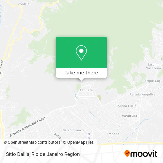
See Sítio Dalila, Duque De Caxias, on the map
Public Transit to Sítio Dalila in Duque De Caxias
Wondering how to get to Sítio Dalila in Duque De Caxias? Moovit helps you find the best way to get to Sítio Dalila with step-by-step directions from the nearest public transit station.
Moovit provides free maps and live directions to help you navigate through your city. View schedules, routes, timetables, and find out how long does it take to get to Sítio Dalila in real time.
Looking for the nearest stop or station to Sítio Dalila? Check out this list of stops closest to your destination: Estrada Da Soledade; Estrada Cachoeira Das Dores; Avenida Cerro Corá; Manoel Belo.
Bus: 510, 018, 2470C (EXECUTIVO), TZ19, 470C.Train: EXTENSÃO VILA INHOMIRIM.
Want to see if there’s another route that gets you there at an earlier time? Moovit helps you find alternative routes or times. Get directions from and directions to Sítio Dalila easily from the Moovit App or Website.
We make riding to Sítio Dalila easy, which is why over 1.5 million users, including users in Duque De Caxias, trust Moovit as the best app for public transit. You don’t need to download an individual bus app or train app, Moovit is your all-in-one transit app that helps you find the best bus time or train time available.
For information on prices of bus, costs and ride fares to Sítio Dalila, please check the Moovit app.
Use the app to navigate to popular places including to the airport, hospital, stadium, grocery store, mall, coffee shop, school, college, and university.
Sítio Dalila Address: Estrada da Soledade, 54 Taquara Duque de Caxias-RJ 25270-495 street in Duque De Caxias
- Sítio Arcanjo Miguel,
- Estrada da Soledade, 256,
- Sítio Família Unida,
- Parque Ecológico Vale dos Orixás - Pevo,
- Assembleia de Deus Ministerio Fonte das Aguas,
- Praça Monitor,
- Condominio Narcisa Amália,
- Museu Histórico da Taqura,
- Vale do Jaboque,
- Coca-Cola Andina Brasil,
- Rua Três, 16,
- Cachoeira da Taquara,
- Primeira Igreja Batista Em Parque Guararapes,
- Estrada Cachoeira das Dores,
- Sítio Nova Xavantina,
- Parque Natural Municipal da Taquara,
- E. E. Nova América,
- Receita Federal do Brasil,
- Prodescad Projetos Industriais,
- Altertec
Places Near Sítio Dalila (Duque De Caxias)
- Shopping Downtown, Barra Da Tijuca,
- Norte Shopping, Cachambi,
- Shopping Rio Sul, Botafogo,
- Feira Livre da Gloria, Glória,
- Rodoviária Novo Rio (Rodoviária do Rio de Janeiro), Santo Cristo,
- Museu Do Amanhã, Centro,
- Rua Licínio Cardoso, São Francisco Xavier,
- Hospital Federal Cardoso Fontes, Jacarepaguá,
- Avenida Rio Branco, Centro,
- Avenida Venezuela 134, Saúde,
- Shopping Nova América, Del Castilho,
- Feirão De Malhas, Duque De Caxias,
- Hospital Pedro Ernesto, Vila Isabel,
- Niterói, Niterói,
- Shopping RioSul, Botafogo,
- Rio De Janeiro,
- Praia do Arpoador, Ipanema,
- Hospital Federal Do Andaraí, Andaraí,
- Rua Ulysses Guimarães 16, Cidade Nova,
- Hospital Municipal Ronaldo Gazolla, Acari
How to get to popular places in Rio de Janeiro Region with public transit
Get around Duque De Caxias by public transit!
Traveling around Duque De Caxias has never been so easy. See step by step directions as you travel to any attraction, street or major public transit station. View bus and train schedules, arrival times, service alerts and detailed routes on a map, so you know exactly how to get to anywhere in Duque De Caxias.
When traveling to any destination around Duque De Caxias use Moovit's Live Directions with Get Off Notifications to know exactly where and how far to walk, how long to wait for your line, and how many stops are left. Moovit will alert you when it's time to get off — no need to constantly re-check whether yours is the next stop.
Wondering how to use public transit in Duque De Caxias or how to pay for public transit in Duque De Caxias? Moovit public transit app can help you navigate your way with public transit easily, and at minimum cost. It includes public transit fees, ticket prices, and costs. Looking for a map of Duque De Caxias public transit lines? Moovit public transit app shows all public transit maps in Duque De Caxias with all Bus, Train, Metro, Light Rail, Ferry, Cable Car, Gondola and Funicular routes and stops on an interactive map.
Rio de Janeiro Region has 8 transit type(s), including: Bus, Train, Metro, Light Rail, Ferry, Cable Car, Gondola and Funicular, operated by several transit agencies, including TrensRJ, Metrô Rio, VLT Carioca, Barcas Rio, BRT MOBI-Rio, Auto Viação Alpha, Auto Viação Tijuca, Gire Transportes, Transurb, Viação Nossa Senhora das Graças, Consórcio INTERSUL, Braso Lisboa (Municipal), Caprichosa Auto Ônibus, Auto Viação Três Amigos and Rodoviária Âncora Matias