Directions to Sørmarka Arena (Stavanger) with public transportation
The following transit lines have routes that pass near Sørmarka Arena
 Bus: 11, 4, 5, X39, N85.
- Train: L5, F5.
How to get to Sørmarka Arena by bus?
Click on the bus route to see step by step directions with maps, line arrival times and updated time schedules.
How to get to Sørmarka Arena by train?
Click on the train route to see step by step directions with maps, line arrival times and updated time schedules.
Bus stops near Sørmarka Arena in Stavanger
- Auglendsdalen, 4 min walk,
- Stranddalsveien, 4 min walk,
Train station near Sørmarka Arena in Stavanger
- Jåttåvågen Stasjon, 23 min walk,
Bus lines to Sørmarka Arena in Stavanger
- 11, Stavanger Via Sus Våland,
- 4, Stavanger Via Madlamark-Sus Våland,
- N85, Stavanger Via Sus Våland,
What are the closest stations to Sørmarka Arena?
The closest stations to Sørmarka Arena are:
- Auglendsdalen stop is 276 meters away, 4 min walk.
- Stranddalsveien stop is 288 meters away, 4 min walk.
- Jåttåvågen Stasjon station is 1762 meters away, 23 min walk.
Which bus lines stop near Sørmarka Arena?
These bus lines stop near Sørmarka Arena: 11, 4, 5, X39.
Which train line stops near Sørmarka Arena?
L5 (Stavanger)
What’s the nearest train station to Sørmarka Arena in Stavanger?
The nearest train station to Sørmarka Arena in Stavanger is Jåttåvågen Stasjon. It’s a 23 min walk away.
What’s the nearest bus station to Sørmarka Arena in Stavanger?
The nearest bus stations to Sørmarka Arena in Stavanger are Auglendsdalen and Stranddalsveien. The closest one is a 4 min walk away.
What time is the first train to Sørmarka Arena in Stavanger?
The F5 is the first train that goes to Sørmarka Arena in Stavanger. It stops nearby at 3:39 AM.
What time is the last train to Sørmarka Arena in Stavanger?
The F5 is the last train that goes to Sørmarka Arena in Stavanger. It stops nearby at 3:43 AM.
What time is the first bus to Sørmarka Arena in Stavanger?
The 11 is the first bus that goes to Sørmarka Arena in Stavanger. It stops nearby at 6:11 AM.
What time is the last bus to Sørmarka Arena in Stavanger?
The 4 is the last bus that goes to Sørmarka Arena in Stavanger. It stops nearby at 12:20 AM.
See Sørmarka Arena, Stavanger, on the map
Public Transit to Sørmarka Arena in Stavanger
Wondering how to get to Sørmarka Arena in Stavanger? Moovit helps you find the best way to get to Sørmarka Arena with step-by-step directions from the nearest public transit station.
Moovit provides free maps and live directions to help you navigate through your city. View schedules, routes, timetables, and find out how long does it take to get to Sørmarka Arena in real time.
Looking for the nearest stop or station to Sørmarka Arena? Check out this list of stops closest to your destination: Auglendsdalen; Stranddalsveien; Jåttåvågen Stasjon.
Bus: 11, 4, 5, X39, N85.Train: L5, F5.
Want to see if there’s another route that gets you there at an earlier time? Moovit helps you find alternative routes or times. Get directions from and directions to Sørmarka Arena easily from the Moovit App or Website.
We make riding to Sørmarka Arena easy, which is why over 1.7 billion users, including users in Stavanger, trust Moovit as the best app for public transit. You don’t need to download an individual bus app or train app, Moovit is your all-in-one transit app that helps you find the best bus time or train time available.
For information on prices of bus, train and ferry, costs and ride fares to Sørmarka Arena, please check the Moovit app.
Use the app to navigate to popular places including to the airport, hospital, stadium, grocery store, mall, coffee shop, school, college, and university.
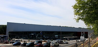
Sørmarka Arena Address: Sørmarkveien 20 street in Stavanger
- Sørmarka,
- Stavanger Fengsel, Auklend Overgangsbolig,
- Motehus.No,
- Auglendsdalen 77,
- Rsm Fasade,
- Sormarka Arena,
- Vannassen Bofellesskap,
- Joltama,
- Åsen,
- Dj Tor Kåre Enoksen,
- Gresk Grill & Catering Mariero AS,
- Film & Fotopartner,
- Mekonomen Åsensenteret Bilverksted,
- Solakrossveien 14,
- Siviling H A Langva,
- Solar,
- Akuttjournalen Arena,
- Ragn-Sells,
- Høydepunkt Arrangementsservice,
- Europris Åsen 573
Places Near Sørmarka Arena (Stavanger)
- Color Line Terminal, Oslo,
- Rikshospitalet (trikk), Oslo,
- Jekta Storsenter, Tromsø,
- Radiumhospitalet, Oslo,
- DFDS Seaways, Oslo,
- Oslo S spor 19 (Trelastgata), Oslo,
- Voldsløkka, Oslo,
- Ikea Leangen, Trondheim,
- Vestby Outlet Store, Vestby,
- Ullevål Stadion (T), Oslo,
- IKEA, Oslo,
- Drammen Sykehus, Drammen,
- Lovisenberg Diakonale Sykehus, Oslo,
- Tyholttårnet, Trondheim,
- Bjerke Travbane, Oslo,
- Haukeland Universitetssjukehus, Bergen,
- Nylandsbrua, Oslo,
- IKEA, Bergen,
- Quality Hotel Edvard Grieg, Bergen,
- Ulriken, Bergen
How to get to popular places in Norway with public transit
Get around Stavanger by public transit!
Traveling around Stavanger has never been so easy. See step by step directions as you travel to any attraction, street or major public transit station. View bus and train schedules, arrival times, service alerts and detailed routes on a map, so you know exactly how to get to anywhere in Stavanger.
When traveling to any destination around Stavanger use Moovit's Live Directions with Get Off Notifications to know exactly where and how far to walk, how long to wait for your line, and how many stops are left. Moovit will alert you when it's time to get off — no need to constantly re-check whether yours is the next stop.
Wondering how to use public transit in Stavanger or how to pay for public transit in Stavanger? Moovit public transit app can help you navigate your way with public transit easily, and at minimum cost. It includes public transit fees, ticket prices, and costs. Looking for a map of Stavanger public transit lines? Moovit public transit app shows all public transit maps in Stavanger with all Bus, Train, Subway, Light Rail, Ferry and Cable Car routes and stops on an interactive map.
Norway has 6 transit type(s), including: Bus, Train, Subway, Light Rail, Ferry and Cable Car, operated by several transit agencies, including Ruter, Skyss, AtB, Flytoget, Vy Tåg, SJ, Go-Ahead Norge AS, SJ Nord, Vestfold Kollektivtrafikk as, Snelandia, Innlandstrafikk, FRAM, FlixBus, Kolumbus and Brakar