How to get to Súper Villalta by bus?
Click on the bus route to see step by step directions with maps, line arrival times and updated time schedules.
From Corporativo Principal Afore, Aguascalientes
75 minFrom San Marcos, Aguascalientes
49 minFrom Avenida Moscatel 802, Aguascalientes
56 minFrom 45, Aguascalientes
56 minFrom Funeraria Hernández, Aguascalientes
42 minFrom Clínica 1 Estomatología, Aguascalientes
74 minFrom Fracc Villas de las Fuentes, Aguascalientes
49 minFrom clinica 3 uaa, Aguascalientes
74 minFrom Av.Valle de Los Romeros, Aguascalientes
54 minFrom Avenida Constitución, Aguascalientes
49 min
Bus stops near Súper Villalta in Aguascalientes
Bus lines to Súper Villalta in Aguascalientes
What are the closest stations to Súper Villalta?
The closest stations to Súper Villalta are:
- Calle Arroyo, 1309 is 126 meters away, 2 min walk.
- Avenida Poliducto, 230 is 579 meters away, 8 min walk.
- Prolongación Mariano Hidalgo, 3100a is 985 meters away, 13 min walk.
- Avenida Siglo Xxi, Lb is 1025 meters away, 14 min walk.
- Avenida Mariano Hidalgo, 2904 is 1189 meters away, 16 min walk.
Which bus lines stop near Súper Villalta?
These bus lines stop near Súper Villalta: RUTA 07, RUTA 12, RUTA 35, RUTA 42, RUTA 50.
What’s the nearest bus station to Súper Villalta in Aguascalientes?
The nearest bus station to Súper Villalta in Aguascalientes is Calle Arroyo, 1309. It’s a 2 min walk away.
What time is the first bus to Súper Villalta in Aguascalientes?
The RUTA 29 is the first bus that goes to Súper Villalta in Aguascalientes. It stops nearby at 6:04 AM.
What time is the last bus to Súper Villalta in Aguascalientes?
The RUTA 07 is the last bus that goes to Súper Villalta in Aguascalientes. It stops nearby at 11:07 PM.
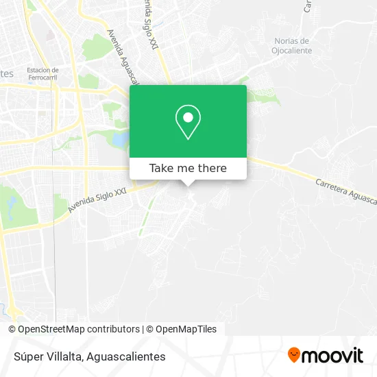
See Súper Villalta, Aguascalientes, on the map
Public Transit to Súper Villalta in Aguascalientes
Wondering how to get to Súper Villalta in Aguascalientes? Moovit helps you find the best way to get to Súper Villalta with step-by-step directions from the nearest public transit station.
Moovit provides free maps and live directions to help you navigate through your city. View schedules, routes, timetables, and find out how long does it take to get to Súper Villalta in real time.
Looking for the nearest stop or station to Súper Villalta? Check out this list of stops closest to your destination: Calle Arroyo; Avenida Poliducto; Prolongación Mariano Hidalgo; Avenida Siglo Xxi; Avenida Mariano Hidalgo.
Bus: RUTA 07, RUTA 12, RUTA 35, RUTA 42, RUTA 50, RUTA 29, RUTA 02, RUTA 14, RUTA 36.
Want to see if there’s another route that gets you there at an earlier time? Moovit helps you find alternative routes or times. Get directions from and directions to Súper Villalta easily from the Moovit App or Website.
We make riding to Súper Villalta easy, which is why over 1.5 million users, including users in Aguascalientes, trust Moovit as the best app for public transit. You don’t need to download an individual bus app or train app, Moovit is your all-in-one transit app that helps you find the best bus time or train time available.
For information on prices of bus, costs and ride fares to Súper Villalta, please check the Moovit app.
Use the app to navigate to popular places including to the airport, hospital, stadium, grocery store, mall, coffee shop, school, college, and university.
Súper Villalta Address: Súper Villalta, Avenida Villalta, Fraccionamiento Villalta, 20299 Aguascalientes, Aguascalientes street in Aguascalientes
- Dra. Jaz Pulido,
- Sonigas,
- Fraccionamiento Villalta,
- Tienda Ropa Rosy,
- Avenida Villalta,
- Primaria Teresa Arteaga de Flores,
- Tienda de Abarrotes Los Gueros,
- Club de Nutrición,
- Chocos,
- Kinder Adelina Zendejas Gómez,
- Venta de Pañales Desechables,
- Fruteria,
- Carnitas La Family,
- Notaría Pública 63 Aguascalientes,
- WESTERN UNION,
- Tacos de Guisadfo El Corazón del Mar,
- Papeleria y Cosmeticos,
- Fraccionamiento Cima del Chapulín,
- Club de Carmelita,
- Avenida Margarita Maza de Juárez 207
Places Near Súper Villalta (Aguascalientes)
- Isla San Marcos, Aguascalientes,
- Hospital Imss No. 3, Aguascalientes,
- Aeropuerto de Aguascalientes S.A. de C.V., Aguascalientes,
- Agropecuario, Aguascalientes,
- Parque Las Tres Centurias, Aguascalientes,
- Central De Autobuses, Aguascalientes,
- Imss Clinica 1, Aguascalientes,
- clinica 3 uaa, Aguascalientes,
- Villasuncion, Aguascalientes,
- Universidad Autónoma de Aguascalientes, Aguascalientes,
- ESPACIOS, Aguascalientes,
- Blvd. Luis Donaldo Colosio, Aguascalientes,
- Centro Comercial Altaria, Aguascalientes,
- Nuevo Hospital Hidalgo, Aguascalientes,
- La Isla San Marcos, Aguascalientes,
- Terminal De Combis, Aguascalientes,
- Centro, Aguascalientes,
- Villas de Nuestra Señora de la Asunción, Aguascalientes,
- Ciudad industrial, Aguascalientes,
- Jesús María, Aguascalientes
How to get to popular places in Aguascalientes with public transit
Get around Aguascalientes by public transit!
Traveling around Aguascalientes has never been so easy. See step by step directions as you travel to any attraction, street or major public transit station. View bus and train schedules, arrival times, service alerts and detailed routes on a map, so you know exactly how to get to anywhere in Aguascalientes.
When traveling to any destination around Aguascalientes use Moovit's Live Directions with Get Off Notifications to know exactly where and how far to walk, how long to wait for your line, and how many stops are left. Moovit will alert you when it's time to get off — no need to constantly re-check whether yours is the next stop.
Wondering how to use public transit in Aguascalientes or how to pay for public transit in Aguascalientes? Moovit public transit app can help you navigate your way with public transit easily, and at minimum cost. It includes public transit fees, ticket prices, and costs. Looking for a map of Aguascalientes public transit lines? Moovit public transit app shows all public transit maps in Aguascalientes with all bus routes and stops on an interactive map.
Aguascalientes has 1 transit type(s), including: bus, operated by several transit agencies, including Coordinación General de Movilidad