How to get to SACARA by bus?
Click on the bus route to see step by step directions with maps, line arrival times and updated time schedules.
From 50/50, Eilot Regional Council
61 minFrom Ramon International Airport, Eilat
58 minFrom Ovda Base, Eilot Regional Council
94 minFrom Scout Camp, Eilot Regional Council
82 minFrom Scout Camp, Eilot Regional Council
66 minFrom Camp Segev, Eilot Regional Council
50 minFrom Long-Term Parking Lot Taba Border, Eilat
26 min
Bus stops near SACARA in Eilat
Bus lines to SACARA in Eilat
- 3, Park and Ride Eilat Approaches,VIEW
- 4, Park and Ride Eilat Approaches,VIEW
- 6, Six Day War/Sara Imenu,VIEW
- 6A, Six Day War/Sara Imenu,VIEW
- 11, Beit Almog/HaMelacha,VIEW
- 22, Eilat,VIEW
- 23, Eilat,VIEW
- 5, Park and Ride Eilat Approaches,VIEW
- 5A, Eilat Cemetery,VIEW
- 10, Beit Almog/HaMelacha,VIEW
- 22, Yotvata,VIEW
- 2, ת. מרכזית אילת,VIEW
- 82, Goldwater High School/Hativat HaNegev,VIEW
- 81, HaTmarim Boulevard/Roded,VIEW
- 1, ת. מרכזית אילת,VIEW
- 1A, ת. מרכזית אילת,VIEW
- 30א - הנגשה בהזמנה מראש ♿, תחנה מרכזית/חטיבת הנגב,VIEW
- 30 - Accessibility by Advance Reservation ♿, Egypt Road/Colony Complex,VIEW
What are the closest stations to SACARA?
The closest stations to SACARA are:
- Big Center/HaSatat is 229 meters away, 4 min walk.
- Golani Brigade/HaMelicha is 650 meters away, 9 min walk.
- Golani Brigade/HaSatat is 702 meters away, 10 min walk.
- Golani Brigade/Wolves Square is 794 meters away, 11 min walk.
- Toronto Square/Arava Road is 944 meters away, 13 min walk.
- Sports Complex/Hotel Road is 1460 meters away, 19 min walk.
Which bus lines stop near SACARA?
These bus lines stop near SACARA: 23, 3, 4.
What’s the nearest bus station to SACARA in Eilat?
The nearest bus station to SACARA in Eilat is Big Center/HaSatat. It’s a 4 min walk away.
What time is the first bus to SACARA in Eilat?
The 3 is the first bus that goes to SACARA in Eilat. It stops nearby at 5:33 AM.
What time is the last bus to SACARA in Eilat?
The 1 is the last bus that goes to SACARA in Eilat. It stops nearby at 11:51 PM.
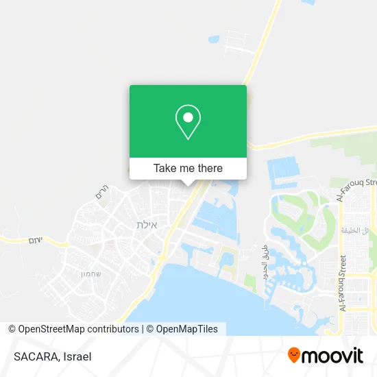
See SACARA, Eilat, on the map
Public Transit to SACARA in Eilat
Wondering how to get to SACARA in Eilat? Moovit helps you find the best way to get to SACARA with step-by-step directions from the nearest public transit station.
Moovit provides free maps and live directions to help you navigate through your city. View schedules, routes, timetables, and find out how long does it take to get to SACARA in real time.
Looking for the nearest stop or station to SACARA? Check out this list of stops closest to your destination: Big Center/HaSatat; Golani Brigade/HaMelicha; Golani Brigade/HaSatat; Golani Brigade/Wolves Square; Toronto Square/Arava Road; Sports Complex/Hotel Road.
Bus: 23, 3, 4, 6, 6A, 11, 5, 5A, 10, 22, 2, 82, 81, 1, 1A, 30א - הנגשה בהזמנה מראש ♿.
Want to see if there’s another route that gets you there at an earlier time? Moovit helps you find alternative routes or times. Get directions from and directions to SACARA easily from the Moovit App or Website.
We make riding to SACARA easy, which is why over 1.7 million users, including users in Eilat, trust Moovit as the best app for public transit. You don’t need to download an individual bus app or train app, Moovit is your all-in-one transit app that helps you find the best bus time or train time available.
For information on prices of bus, costs and ride fares to SACARA, please check the Moovit app.
Use the app to navigate to popular places including to the airport, hospital, stadium, grocery store, mall, coffee shop, school, college, and university.
Location: Eilat, Israel
- Magnolia,
- Big Eilat,
- ALDO,
- Big Center Eilat,
- Big,
- Disc Club,
- NIKE Factory Store,
- NIKE Store,
- Delta Israel Brands Ltd,
- FM Stereo,
- Barak HaMifratz Marketing and Supply Ltd,
- Gentleman Gifts for Men - Big Eilat Branch,
- A.L.M.,
- Sunny Fruits and Vegetables,
- Max Stock,
- A.B. Vehicle Parts,
- Hummus Full Beahava Vegan,
- Shriunit Hasam - Authorized Dealer,
- Rami Metalwork,
- Noga Signs
Places Near SACARA (Eilat)
- Gideon Camp - Military Base 7, Emek Lod Regional Council,
- Glilot Complex, Hof HaSharon Regional Council,
- Kashcafe, Kiryat Ata,
- Azrieli, Tel Aviv-Yafo,
- Ichilov Hospital, Tel Aviv-Yafo,
- Ramat Gan Stadium, Ramat Gan,
- Tel HaShomer North Gate, Ramat Gan,
- Moovit Office, Nes Ziona,
- HaKotel, Jerusalem,
- Expo Tel Aviv, Tel Aviv-Yafo,
- Carmel Market, Tel Aviv-Yafo,
- Bloomfield Stadium, Tel Aviv-Yafo,
- Yarkon Park, Tel Aviv-Yafo,
- Menora Mivtachim Arena, Tel Aviv-Yafo,
- Assuta Hospital - Ramat HaHayal, Tel Aviv-Yafo,
- Tel Hashomer Base, Ramat Gan,
- Bislach 17, Ramat Negev Regional Council,
- Southern Medical Center, Ramat Negev Regional Council,
- Beilinson Hospital, Petah Tikva,
- Dizengoff Center, Tel Aviv-Yafo
How to get to popular places in Israel with public transit
Get around Eilat by public transit!
Traveling around Eilat has never been so easy. See step by step directions as you travel to any attraction, street or major public transit station. View bus and train schedules, arrival times, service alerts and detailed routes on a map, so you know exactly how to get to anywhere in Eilat.
When traveling to any destination around Eilat use Moovit's Live Directions with Get Off Notifications to know exactly where and how far to walk, how long to wait for your line, and how many stops are left. Moovit will alert you when it's time to get off — no need to constantly re-check whether yours is the next stop.
Wondering how to use public transit in Eilat or how to pay for public transit in Eilat? Moovit public transit app can help you navigate your way with public transit easily, and at minimum cost. It includes public transit fees, ticket prices, and costs. Looking for a map of Eilat public transit lines? Moovit public transit app shows all public transit maps in Eilat with all Bus, Israel Railways, Light Rail, Carmelit / Rachbalit and Shuttle routes and stops on an interactive map.
Israel has 5 transit type(s), including: Bus, Israel Railways, Light Rail, Carmelit / Rachbalit and Shuttle, operated by several transit agencies, including Dan, Tel Aviv Light Rail - Tevel - Red Line, Israel Railways, Egged, Metropoline, Kavim, Electra Afikim, Nateev Express, Extra, Extra Jerusalem, Jerusalem Light Rail - Kfir, Egged Jerusalem Envelope Route, Dan Badarom, Dan Beer-Sheva and Electra Afikim Transport