How to get to SEMACONNECT by bus?
Click on the bus route to see step by step directions with maps, line arrival times and updated time schedules.
From Thrifty Rental Car, Spokane
46 minFrom Spokane Airstream Adventures, Spokane Valley
48 minFrom Brett's Tree Service, Spokane Valley
49 minFrom Pacific Metal Company, Spokane Valley
35 minFrom Spokane Falls Plumbing, Spokane Valley
48 minFrom Seasons Cafe, Liberty Lake
23 minFrom Phillips 66 Terminal Load Rack, Spokane Valley
53 minFrom Ben Volk Insurance, Liberty Lake
23 minFrom Sativa Sisters, Millwood
33 minFrom ANYTIME FITNESS, Liberty Lake
23 min
Bus stops near SEMACONNECT in Spokane Valley
Bus lines to SEMACONNECT in Spokane Valley
What are the closest stations to SEMACONNECT?
The closest stations to SEMACONNECT are:
- Indiana @ Desmet Ct is 233 yards away, 3 min walk.
- Flora @ Mission is 697 yards away, 9 min walk.
Which bus line stops near SEMACONNECT?
7 (Liberty Lake Park & Ride)
What’s the nearest bus station to SEMACONNECT in Spokane Valley?
The nearest bus station to SEMACONNECT in Spokane Valley is Indiana @ Desmet Ct. It’s a 3 min walk away.
What time is the first bus to SEMACONNECT in Spokane Valley?
The 7 is the first bus that goes to SEMACONNECT in Spokane Valley. It stops nearby at 4:51 AM.
What time is the last bus to SEMACONNECT in Spokane Valley?
The 7 is the last bus that goes to SEMACONNECT in Spokane Valley. It stops nearby at 11:44 PM.
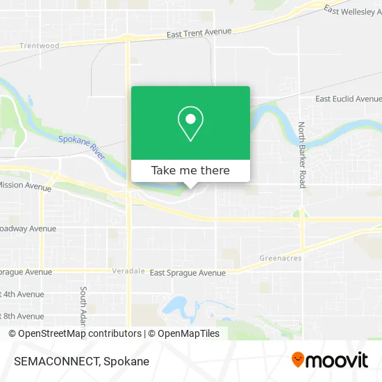
See SEMACONNECT, Spokane Valley, on the map
Public Transit to SEMACONNECT in Spokane Valley
Wondering how to get to SEMACONNECT in Spokane Valley? Moovit helps you find the best way to get to SEMACONNECT with step-by-step directions from the nearest public transit station.
Moovit provides free maps and live directions to help you navigate through your city. View schedules, routes, timetables, and find out how long does it take to get to SEMACONNECT in real time.
Looking for the nearest stop or station to SEMACONNECT? Check out this list of stops closest to your destination: Indiana @ Desmet Ct; Flora @ Mission.
Bus: 7, 95.
Want to see if there’s another route that gets you there at an earlier time? Moovit helps you find alternative routes or times. Get directions from and directions to SEMACONNECT easily from the Moovit App or Website.
We make riding to SEMACONNECT easy, which is why over 1.5 million users, including users in Spokane Valley, trust Moovit as the best app for public transit. You don’t need to download an individual bus app or train app, Moovit is your all-in-one transit app that helps you find the best bus time or train time available.
For information on prices of bus, costs and ride fares to SEMACONNECT, please check the Moovit app.
Use the app to navigate to popular places including to the airport, hospital, stadium, grocery store, mall, coffee shop, school, college, and university.
SEMACONNECT Address: 1313 N Mission Ave Greenacres, WA 99016 street in Spokane Valley
- Blink Charging,
- Rite Aid,
- Kevin R. Kellogg, MMS, Pa-C,
- Laura S. Fralich, M.D.,
- Brian L. Simmerman, M.D.,
- Pennie L. Schultz, MD,
- Janet Z. Zierer, MD,
- Pacific Cataract and Laser Institute,
- Benjamin F. Edwards,
- Pure Infusion Suites O,
- American Exploration & Mining Association,
- Collabra Technology, Inc.,
- Aston Carter,
- Thekey,
- Actalent,
- Douglas Croff, DPM,
- Clearchoice Dental Implant Center,
- Abraham & Co.,
- Spokane Optical,
- Tekoa Software
Places Near SEMACONNECT (Spokane Valley)
- Spokane Falls Community College, Spokane,
- Social Security Office, Spokane,
- Sacred Heart Doctors Building, Spokane,
- Amazon,
- Spokane Valley Mall, Spokane Valley,
- Manito Park, Spokane,
- Walmart Supercenter, Spokane Valley,
- 1+1 Oil Spa Asian Massage, Spokane,
- Space Oil Spa Massage Asian Massage, Spokane Valley,
- Spokane Community College, Spokane,
- Providence Sacred Heart Medical Center and Children s Hospital, Spokane,
- Walmart, Spokane,
- Walmart, Spokane Valley,
- Perfect Asian Massage Spa, Spokane Valley,
- Spokane, WA, Spokane,
- Riverfront Park, Spokane,
- Holy Family Hospital, Spokane,
- Sacred Heart Medical Center, Spokane,
- Northtown Mall, Spokane,
- Spokane Tribe Casino, Airway Heights
How to get to popular places in Spokane with public transit
Get around Spokane Valley by public transit!
Traveling around Spokane Valley has never been so easy. See step by step directions as you travel to any attraction, street or major public transit station. View bus and train schedules, arrival times, service alerts and detailed routes on a map, so you know exactly how to get to anywhere in Spokane Valley.
When traveling to any destination around Spokane Valley use Moovit's Live Directions with Get Off Notifications to know exactly where and how far to walk, how long to wait for your line, and how many stops are left. Moovit will alert you when it's time to get off — no need to constantly re-check whether yours is the next stop.
Wondering how to use public transit in Spokane Valley or how to pay for public transit in Spokane Valley? Moovit public transit app can help you navigate your way with public transit easily, and at minimum cost. It includes public transit fees, ticket prices, and costs. Looking for a map of Spokane Valley public transit lines? Moovit public transit app shows all public transit maps in Spokane Valley with all Bus and Train routes and stops on an interactive map.
Spokane has 2 transit type(s), including: Bus and Train, operated by several transit agencies, including STA, Amtrak and FlixBus-us