Directions to SHTF Armory (Port St. Lucie) with public transportation
The following transit lines have routes that pass near SHTF Armory
 Bus: 6.
How to get to SHTF Armory by bus?
Click on the bus route to see step by step directions with maps, line arrival times and updated time schedules.
From US-1 / SE Port St Lucie Blvd, Port St. Lucie
143 minFrom Tradition Park, Port St. Lucie
171 minFrom Stuart, Florida, Stuart
168 minFrom US-1, Fort Pierce
105 minFrom CVS Pharmacy - (Lyngate Dr), Port St. Lucie
118 minFrom Hca Florida Lawnwood Hospital, Fort Pierce
117 minFrom Indian River State College, Fort Pierce
163 min
Bus stop near SHTF Armory in Port St. Lucie
- NW University Blvd & NW Peacock Blvd, 4 min walk,VIEW
Bus lines to SHTF Armory in Port St. Lucie
- 6, SE Deacon Ave & SE Belvedere St,VIEW
What are the closest stations to SHTF Armory?
The closest stations to SHTF Armory are:
- NW University Blvd & NW Peacock Blvd is 235 yards away, 4 min walk.
Which bus line stops near SHTF Armory?
6 (NW University Blvd & NW Peacock Blvd)
What’s the nearest bus station to SHTF Armory in Port St. Lucie?
The nearest bus station to SHTF Armory in Port St. Lucie is NW University Blvd & NW Peacock Blvd. It’s a 4 min walk away.
What time is the first bus to SHTF Armory in Port St. Lucie?
The 6 is the first bus that goes to SHTF Armory in Port St. Lucie. It stops nearby at 6:00 AM.
What time is the last bus to SHTF Armory in Port St. Lucie?
The 6 is the last bus that goes to SHTF Armory in Port St. Lucie. It stops nearby at 8:00 PM.
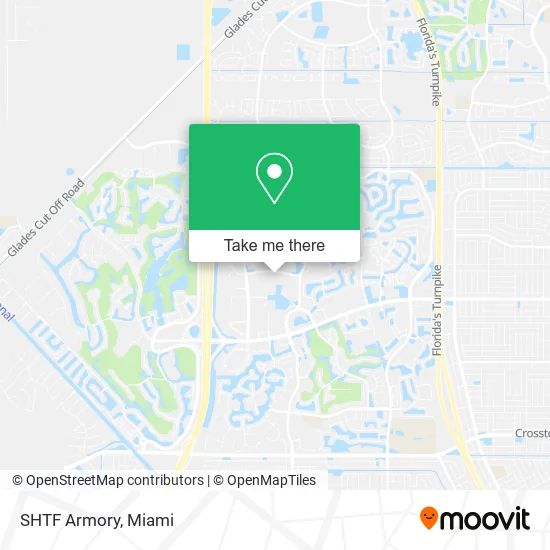
See SHTF Armory, Port St. Lucie, on the map
Public Transit to SHTF Armory in Port St. Lucie
Wondering how to get to SHTF Armory in Port St. Lucie? Moovit helps you find the best way to get to SHTF Armory with step-by-step directions from the nearest public transit station.
Moovit provides free maps and live directions to help you navigate through your city. View schedules, routes, timetables, and find out how long does it take to get to SHTF Armory in real time.
Looking for the nearest stop or station to SHTF Armory? Check out this list of stops closest to your destination: NW University Blvd & NW Peacock Blvd.
Bus: 6.
Want to see if there’s another route that gets you there at an earlier time? Moovit helps you find alternative routes or times. Get directions from and directions to SHTF Armory easily from the Moovit App or Website.
We make riding to SHTF Armory easy, which is why over 1.5 million users, including users in Port St. Lucie, trust Moovit as the best app for public transit. You don’t need to download an individual bus app or train app, Moovit is your all-in-one transit app that helps you find the best bus time or train time available.
For information on prices of bus, costs and ride fares to SHTF Armory, please check the Moovit app.
Use the app to navigate to popular places including to the airport, hospital, stadium, grocery store, mall, coffee shop, school, college, and university.
SHTF Armory Address: 540 NW University Blvd Port St Lucie, FL 34986 street in Port St. Lucie
- Anthony Schwab C PA,
- Curtis L Disque Attorney,
- Miami Web Designs,
- Proctor, Crook, Crowder & Fogal, P.A.,
- Families of the Treasure Coast,
- Success TMS - Depression Treatment Specialists,
- Affordable Events and Party Rentals,
- Naturoclean,
- Prosperity Business Suites,
- Home Nest Realty,
- American Job Centers,
- Navy Recruiter,
- Purcor Pest Solutions,
- Realtors Association of the Palm Beaches,
- Dataprise,
- The Maids,
- Six-S Flooring,
- Freedom Impact Windows & Doors,
- Star Paws Pet Services,
- HPG
Places Near SHTF Armory (Port St. Lucie)
- Bayside Marketplace, Miami,
- Dolphin Mall, Miami,
- Sawgrass Mall, Miami,
- Marlins Park, Miami,
- Miami Design District, Miami,
- Wynwood, Miami,
- Little Havana, Miami,
- Hard Rock Stadium, Miami Gardens,
- Richard E. Gerstein Justice Building, Miami,
- Brickell City Centre, Miami,
- Zoo Miami, Miami,
- Miami VA Hospital, Miami,
- Sawgrass mall ( FL ), Miami Beach,
- Port of Miami Cruise Terminal, Miami,
- Aventura Mall, Miami,
- Miami Freedom Park, Miami,
- Keiser University Flagship Campus, West Palm Beach,
- Miami-Dade County Courthouse, Miami,
- Dolphin Mall Bus, Miami,
- Aventura Mall, Miami Beach
How to get to popular places in Miami with public transit
Get around Port St. Lucie by public transit!
Traveling around Port St. Lucie has never been so easy. See step by step directions as you travel to any attraction, street or major public transit station. View bus and train schedules, arrival times, service alerts and detailed routes on a map, so you know exactly how to get to anywhere in Port St. Lucie.
When traveling to any destination around Port St. Lucie use Moovit's Live Directions with Get Off Notifications to know exactly where and how far to walk, how long to wait for your line, and how many stops are left. Moovit will alert you when it's time to get off — no need to constantly re-check whether yours is the next stop.
Wondering how to use public transit in Port St. Lucie or how to pay for public transit in Port St. Lucie? Moovit public transit app can help you navigate your way with public transit easily, and at minimum cost. It includes public transit fees, ticket prices, and costs. Looking for a map of Port St. Lucie public transit lines? Moovit public transit app shows all public transit maps in Port St. Lucie with all Bus, Train, Light Rail and Ferry routes and stops on an interactive map.
Miami has 4 transit type(s), including: Bus, Train, Light Rail and Ferry, operated by several transit agencies, including Broward County Transit, Miami-Dade Transit, Metrorail, Palm Tran, Tri-Rail, Brightline, MARTY, City of Homestead Trolley, Key West Transit, Treasure Coast Connector, GoLine IRT, Amtrak, Greyhound-us, FlixBus-us and Aventura Express Shuttle Bus