How to get to SOS 13 by bus?
Click on the bus route to see step by step directions with maps, line arrival times and updated time schedules.
From Praia de Angeiras, Perafita, Lavra e Santa Cruz do Bispo
98 minFrom Santuário de Alexandrina de Balasar, Balazar
49 minFrom Zona Industrial da Varziela, Fajozes
62 minFrom Mindelo Park, Fajozes
64 minFrom Guilhabreu, Guilhabreu
93 minFrom Vc Fashion Outlet Modivas, Modivas
73 minFrom Macieira da Maia, Macieira da Maia
61 minFrom VILA do CONDE PORTO FASHION OUTLET, Modivas
74 minFrom Labruge, Labruge
88 min
How to get to SOS 13 by metro?
Click on the metro route to see step by step directions with maps, line arrival times and updated time schedules.
Bus stops near SOS 13 in Póvoa de Varzim, Beiriz e Argivai
Metro station near SOS 13 in Póvoa de Varzim, Beiriz e Argivai
- Vila do Conde, 49 min walk,VIEW
Bus lines to SOS 13 in Póvoa de Varzim, Beiriz e Argivai
- 3001, Paranho - Portas Fronhas (Metro) (via Travassos),VIEW
- 3001, Rua de Santo António - Largo das Dores,VIEW
- 3002, Agra - Portas Fronhas (Metro) (via Giesteira),VIEW
- 3002, Sistelos - Largo das Dores,VIEW
- 9308, Guimarães (Terminal),VIEW
- 3304, Circular | Póvoa de Varzim,VIEW
- 3305, Circular | Póvoa de Varzim,VIEW
- 3514, Junqueira (via Seixo),VIEW
- 3517, Fontaínhas (via Junqueira),VIEW
What are the closest stations to SOS 13?
The closest stations to SOS 13 are:
- Giesteira is 368 meters away, 6 min walk.
- Argivai (Supermercado) II is 1233 meters away, 17 min walk.
- Gandara -2 is 1241 meters away, 17 min walk.
- Rua da Pedreira (N.º 236) is 1278 meters away, 18 min walk.
- Vila do Conde is 3762 meters away, 49 min walk.
Which bus lines stop near SOS 13?
These bus lines stop near SOS 13: 3001, 3002, 3304, 3309.
Which metro line stops near SOS 13?
B (Póvoa de Varzim)
What’s the nearest bus station to SOS 13 in Póvoa de Varzim, Beiriz e Argivai?
The nearest bus station to SOS 13 in Póvoa de Varzim, Beiriz e Argivai is Giesteira. It’s a 6 min walk away.
What time is the first metro to SOS 13 in Póvoa de Varzim, Beiriz e Argivai?
The B is the first metro that goes to SOS 13 in Póvoa de Varzim, Beiriz e Argivai. It stops nearby at 5:44 AM.
What time is the last metro to SOS 13 in Póvoa de Varzim, Beiriz e Argivai?
The B is the last metro that goes to SOS 13 in Póvoa de Varzim, Beiriz e Argivai. It stops nearby at 1:35 AM.
What time is the first bus to SOS 13 in Póvoa de Varzim, Beiriz e Argivai?
The 3304 is the first bus that goes to SOS 13 in Póvoa de Varzim, Beiriz e Argivai. It stops nearby at 6:05 AM.
What time is the last bus to SOS 13 in Póvoa de Varzim, Beiriz e Argivai?
The 3305 is the last bus that goes to SOS 13 in Póvoa de Varzim, Beiriz e Argivai. It stops nearby at 11:32 PM.
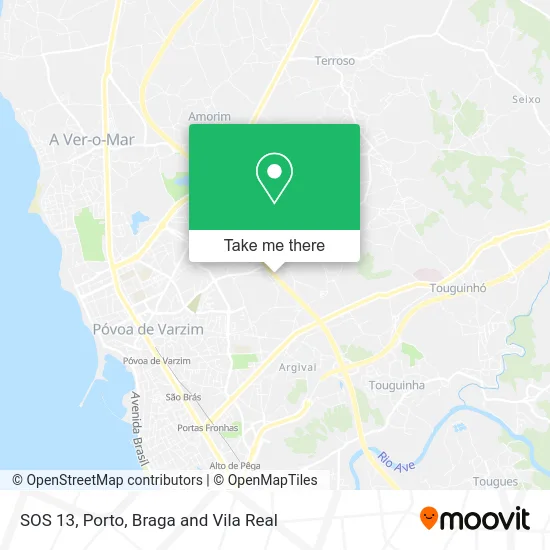
See SOS 13, Póvoa de Varzim, Beiriz e Argivai, on the map
Public Transit to SOS 13 in Póvoa de Varzim, Beiriz e Argivai
Wondering how to get to SOS 13 in Póvoa de Varzim, Beiriz e Argivai? Moovit helps you find the best way to get to SOS 13 with step-by-step directions from the nearest public transit station.
Moovit provides free maps and live directions to help you navigate through your city. View schedules, routes, timetables, and find out how long does it take to get to SOS 13 in real time.
Looking for the nearest stop or station to SOS 13? Check out this list of stops closest to your destination: Giesteira; Argivai (Supermercado) II; Gandara -2; Rua da Pedreira (N.º 236); Vila do Conde.
Bus: 3001, 3002, 3304, 3309, 9308, 3305, 3514, 3517.Metro: B, BX.
Want to see if there’s another route that gets you there at an earlier time? Moovit helps you find alternative routes or times. Get directions from and directions to SOS 13 easily from the Moovit App or Website.
We make riding to SOS 13 easy, which is why over 1.5 million users, including users in Póvoa de Varzim, Beiriz e Argivai, trust Moovit as the best app for public transit. You don’t need to download an individual bus app or train app, Moovit is your all-in-one transit app that helps you find the best bus time or train time available.
For information on prices of bus and metro, costs and ride fares to SOS 13, please check the Moovit app.
Use the app to navigate to popular places including to the airport, hospital, stadium, grocery store, mall, coffee shop, school, college, and university.
SOS 13 Address: Rua de Paredes street in Póvoa de Varzim, Beiriz e Argivai
- Escola Prática dos Serviços,
- Multibanco,
- Loja O Novelo,
- SOCIEDADE INTERBANCARIA DE SERVICOS S A SIBS,
- Restaurante Funchal,
- Cemitério Municipal II da Póvoa do Varzim,
- Talho Ruben & Manuela, Lda,
- Matias & Silva Soc. Agr. Lda,
- Perimata, Unipessoal, Lda,
- We Care,
- G a Seguros,
- SOCIEDADE INTERBANCARIA DE SERVICOS S A SIBS,
- Multibanco,
- Campo de Futebol de Argivai,
- Beiriz,
- Rua Corregedor Gaspar Cardoso 195,
- Escola Básica do 1. Ciclo N 7 de Póvoa de Varzim,
- A.maia - Oficina de Reparações de Automóveis Lda,
- Clínica Viarizi,
- Manuel Ant. Amorim Moreira
Places Near SOS 13 (Póvoa de Varzim, Beiriz e Argivai)
- Arrábida Shopping, Santa Marinha e São Pedro da Afurada,
- MAR Shopping, Matosinhos e Leça da Palmeira,
- Espinho, Espinho,
- Avintes, Vila Nova De Gaia,
- Leça da Palmeira, Matosinhos e Leça da Palmeira,
- Canidelo, Vila Nova De Gaia,
- Zoo Santo Inácio, Vila Nova De Gaia,
- Parque Aquatico Amarante - Aqua Aventura, Amarante,
- Hospital da Prelada, Ramalde,
- Senhor de Matosinhos, Matosinhos e Leça da Palmeira,
- Acesso ao Shopping Parque Nascente, Campanhã,
- Valongo, Valongo,
- VILA do CONDE PORTO FASHION OUTLET, Modivas,
- Rua Calouste Gulbenkian, Lordelo do Ouro e Massarelos,
- Exponor, Matosinhos e Leça da Palmeira,
- Hospital de Santo António, Cedofeita, Santo Ildefonso, Sé, Miragaia, São Nicolau e Vitória,
- Maia, Maia,
- El Corte Inglés de Gaia, Mafamude e Vilar do Paraíso,
- Hospital Santos Silva, Vila Nova De Gaia,
- Palácio de Cristal, Lordelo do Ouro e Massarelos
How to get to popular places in Porto, Braga and Vila Real with public transit
Get around Póvoa de Varzim, Beiriz e Argivai by public transit!
Traveling around Póvoa de Varzim, Beiriz e Argivai has never been so easy. See step by step directions as you travel to any attraction, street or major public transit station. View bus and train schedules, arrival times, service alerts and detailed routes on a map, so you know exactly how to get to anywhere in Póvoa de Varzim, Beiriz e Argivai.
When traveling to any destination around Póvoa de Varzim, Beiriz e Argivai use Moovit's Live Directions with Get Off Notifications to know exactly where and how far to walk, how long to wait for your line, and how many stops are left. Moovit will alert you when it's time to get off — no need to constantly re-check whether yours is the next stop.
Wondering how to use public transit in Póvoa de Varzim, Beiriz e Argivai or how to pay for public transit in Póvoa de Varzim, Beiriz e Argivai? Moovit public transit app can help you navigate your way with public transit easily, and at minimum cost. It includes public transit fees, ticket prices, and costs. Looking for a map of Póvoa de Varzim, Beiriz e Argivai public transit lines? Moovit public transit app shows all public transit maps in Póvoa de Varzim, Beiriz e Argivai with all Bus, Train, Metro, Ferry, Funicular and Gondola routes and stops on an interactive map.
Porto, Braga and Vila Real has 6 transit type(s), including: Bus, Train, Metro, Ferry, Funicular and Gondola, operated by several transit agencies, including Metro do Porto, Metro do Porto - Metrobus, CP - Comboios de Portugal, STCP, UNIR Mobilidade da Area Metropolitana do Porto, Getbus - Aerobus, Mobiave, Valpibus, TUB - Transportes Urbanos de Braga, TuViana, Guimabus, Ave Mobilidade, Cávado Mobilidade, Transdev and Câmara Municipal de Santo Tirso