Directions to SOS Car (Colombo) with public transportation
The following transit lines have routes that pass near SOS Car
How to get to SOS Car by bus?
Click on the bus route to see step by step directions with maps, line arrival times and updated time schedules.
From Santa Mônica Clube de Campo, Colombo
66 minFrom Parque Tanguá, O Parque Mais Lindo de Curitiba, Taboão
77 minFrom Alphaville Graciosa, Pinhais
62 minFrom Avenida Victor Ferreira do Amaral, Tarumã
54 minFrom Parque São Lourenço, São Lourenço
63 minFrom Rua Augusto Stresser, Juvevê
41 minFrom Juvevê, Juvevê
47 minFrom Pinhais, Pinhais
63 minFrom Rua Manoel Eufrásio, Juvevê
48 minFrom Terminal Colombo, Colombo
24 min
Bus stops near SOS Car in Colombo
Bus lines to SOS Car in Colombo
- U01 SEDE / MARACANÃ, Terminal Maracanã → Terminal Sede Colombo,VIEW
- S16 GUARACI, Terminal Sede Colombo → Terminal Roça Grande,VIEW
- B78 SÃO GABRIEL / GUADALUPE, São Gabriel → Terminal Guadalupe,VIEW
- U11 ITAJACURU / SANTA GEMA (IMBUIAL), Terminal Sede Colombo ↺ Itajacuru / Santa Gema (Circular),VIEW
- S89 SÃO SEBASTIÃO / GUADALUPE (VIA SÃO GABRIEL), São Sebastião → Terminal Guadalupe,VIEW
- B76 SÃO SEBASTIÃO / GUADALUPE, São Sebastião → Terminal Guadalupe,VIEW
What are the closest stations to SOS Car?
The closest stations to SOS Car are:
- Rua Alfredo Miguel Baduy, 78 is 14 meters away, 1 min walk.
- Avenida Prefeito João Batista Stocco, 2341 is 87 meters away, 2 min walk.
- Rua Alfredo Miguel Baduy, 353 is 307 meters away, 5 min walk.
- Rua Aílton Luís Nodari, 451 is 313 meters away, 5 min walk.
Which bus lines stop near SOS Car?
These bus lines stop near SOS Car: B76 SÃO SEBASTIÃO / GUADALUPE, B78 SÃO GABRIEL / GUADALUPE, S16 GUARACI, U01 SEDE / MARACANÃ.
What’s the nearest bus station to SOS Car in Colombo?
The nearest bus station to SOS Car in Colombo is Rua Alfredo Miguel Baduy, 78. It’s a 1 min walk away.
What time is the first bus to SOS Car in Colombo?
The B78 SÃO GABRIEL / GUADALUPE is the first bus that goes to SOS Car in Colombo. It stops nearby at 5:05 AM.
What time is the last bus to SOS Car in Colombo?
The B76 SÃO SEBASTIÃO / GUADALUPE is the last bus that goes to SOS Car in Colombo. It stops nearby at 12:15 AM.
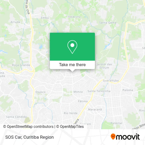
See SOS Car, Colombo, on the map
Public Transit to SOS Car in Colombo
Wondering how to get to SOS Car in Colombo? Moovit helps you find the best way to get to SOS Car with step-by-step directions from the nearest public transit station.
Moovit provides free maps and live directions to help you navigate through your city. View schedules, routes, timetables, and find out how long does it take to get to SOS Car in real time.
Looking for the nearest stop or station to SOS Car? Check out this list of stops closest to your destination: Rua Alfredo Miguel Baduy; Avenida Prefeito João Batista Stocco; Rua Alfredo Miguel Baduy; Rua Aílton Luís Nodari.
Bus: B76 SÃO SEBASTIÃO / GUADALUPE, B78 SÃO GABRIEL / GUADALUPE, S16 GUARACI, U01 SEDE / MARACANÃ, U11 ITAJACURU / SANTA GEMA (IMBUIAL), S89 SÃO SEBASTIÃO / GUADALUPE (VIA SÃO GABRIEL).
Want to see if there’s another route that gets you there at an earlier time? Moovit helps you find alternative routes or times. Get directions from and directions to SOS Car easily from the Moovit App or Website.
We make riding to SOS Car easy, which is why over 1.5 million users, including users in Colombo, trust Moovit as the best app for public transit. You don’t need to download an individual bus app or train app, Moovit is your all-in-one transit app that helps you find the best bus time or train time available.
For information on prices of bus, costs and ride fares to SOS Car, please check the Moovit app.
Use the app to navigate to popular places including to the airport, hospital, stadium, grocery store, mall, coffee shop, school, college, and university.
SOS Car Address: Rua Alfredo Miguel Baduy, 54 São Gabriel Colombo-PR 83407-150 street in Colombo
- Bar E Mercearia Cristal,
- Jumper Brinquedos,
- K Broker Negocios Imobiliarios,
- Andrea Presentes,
- Favile Pinturas e Reformas,
- RR Moto Pecas,
- Medpro Produtos Hospitalares,
- Banca São Gabriel,
- Kulik Assessorias,
- Tsr Transportes,
- Jhenniffer Taline X Chagas Psicologia,
- Condomínio Residencial Edificio Ipanema,
- Brasilplacas,
- Frutariacolombo,
- Compensados Vendramini,
- Acir Pinturas,
- Gfc Representante,
- Recanto Gaucho,
- 10 Ieq Colombo,
- Barbearia MB Barber
Places Near SOS Car (Colombo)
- Hospital Universitário Evangélico de Curitiba, Bigorrilho,
- Hhhhh, Fazendinha,
- Shopping Estação, Rebouças,
- Hospital Angelina Caron, Campina Grande Do Sul,
- Arena Da Baixada - Curitiba,
- Jockey Plaza Shopping Center, Tarumã,
- Hospital do Rocio, Campo,
- Parque Barigui, Mercês,
- Shopping Palladium, Portão,
- Park Shopping Barigüi, Mossunguê,
- Hospital Da Cruz Vermelha, Batel,
- Pontifícia Universidade Católica do Paraná (PUCPR), Prado Velho,
- Hospital de Clínicas (HC - UFPR), Centro,
- Campo Largo, Campo,
- Rua Martim Afonso 558, Mercês,
- Rua General Mário Tourinho, Campina Do Siqueira,
- Hospital Erasto Gaertner, Jardim Das Américas,
- Hospital Madalena Sofia, Bairro Alto,
- Hospital Nossa Senhora Das Graças, Mercês,
- Jardim Botânico de Curitiba PR, Centro
How to get to popular places in Curitiba Region with public transit
Get around Colombo by public transit!
Traveling around Colombo has never been so easy. See step by step directions as you travel to any attraction, street or major public transit station. View bus and train schedules, arrival times, service alerts and detailed routes on a map, so you know exactly how to get to anywhere in Colombo.
When traveling to any destination around Colombo use Moovit's Live Directions with Get Off Notifications to know exactly where and how far to walk, how long to wait for your line, and how many stops are left. Moovit will alert you when it's time to get off — no need to constantly re-check whether yours is the next stop.
Wondering how to use public transit in Colombo or how to pay for public transit in Colombo? Moovit public transit app can help you navigate your way with public transit easily, and at minimum cost. It includes public transit fees, ticket prices, and costs. Looking for a map of Colombo public transit lines? Moovit public transit app shows all public transit maps in Colombo with all Bus and Cable Car routes and stops on an interactive map.
Curitiba Region has 2 transit type(s), including: Bus and Cable Car, operated by several transit agencies, including Sistema Integrado de Mobilidade (URBS), Sistema Integrado de Mobilidade (AMEP), URBS (Cartões bancários e Dinheiro), URBS (Cartões bancários / Cartão URBS), AMEP (Cartões bancários / Cartão MetroCard), AMEP (Cartões bancários / Cartão MetroCard / Dinheiro), Viação Colombo (Dinheiro), TRIAR (Cartão TRIAR / Dinheiro), Empresa Curitiba Cerro Azul (Dinheiro), Expresso Nossa Senhora da Penha (Dinheiro), Empresa Campo Alto Tijucas (Dinheiro), Auto Viação São José (Cartão VEM / Dinheiro), BRT S/A (Cartão VEM / Dinheiro), TransPiedade (Cartão Cidadão / Dinheiro) and Oceânica Sul (Cartão Transporte / Dinheiro)