How to get to STARBUCKS by bus?
Click on the bus route to see step by step directions with maps, line arrival times and updated time schedules.
From Lorton, VA, Fairfax County
108 minFrom Rose Gaming Resort, Prince William County
68 minFrom Department of State SA 34, Fairfax County
142 minFrom Transportation Security Administration - TSA Headquarters, Fairfax County
69 minFrom National Geospatial-Intelligence Agency (NGA), Fairfax County
111 minFrom Franconia-Springfield Metro Station, Fairfax County
61 minFrom Burke, VA, Fairfax County
179 minFrom U.S. Department of State SA-28, Fairfax County
78 minFrom Lorton, VA - Amtrak Auto Train Station (LOR), Fairfax County
108 min
Bus stops near STARBUCKS in Prince William County
Bus lines to STARBUCKS in Prince William County
- 93, Woodbridge Local,VIEW
- 94, Lake Ridge Connector,VIEW
- 95, Prince William Metro Express,VIEW
- 95-SS, PWME - WEEKEND,VIEW
- 96, 96 - Hub - Pwc Courthouse,VIEW
- 971, Horner / Telegraph / Dale City Lots Via Minnieville,VIEW
- 972-C, Pentagon / Crystal City,VIEW
- 972-R, Pentagon / Horner / Telegraph / Dale City Lots Via Minnieville,VIEW
What are the closest stations to STARBUCKS?
The closest stations to STARBUCKS are:
- Worth Ave @ Prince William Pkwy is 199 yards away, 3 min walk.
- Smoketown Rd @ Nazarene Way is 1280 yards away, 16 min walk.
- Caton Hill Rd @ Killarney Dr is 1748 yards away, 21 min walk.
Which bus lines stop near STARBUCKS?
These bus lines stop near STARBUCKS: 93, 94, 95.
What’s the nearest bus station to STARBUCKS in Prince William County?
The nearest bus station to STARBUCKS in Prince William County is Worth Ave @ Prince William Pkwy. It’s a 3 min walk away.
What time is the first bus to STARBUCKS in Prince William County?
The 972-R is the first bus that goes to STARBUCKS in Prince William County. It stops nearby at 4:22 AM.
What time is the last bus to STARBUCKS in Prince William County?
The 95 is the last bus that goes to STARBUCKS in Prince William County. It stops nearby at 10:59 PM.
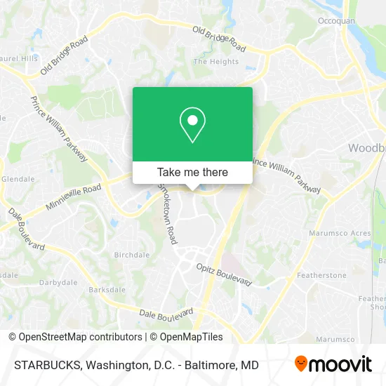
See STARBUCKS, Prince William County, on the map
Public Transit to STARBUCKS in Prince William County
Wondering how to get to STARBUCKS in Prince William County? Moovit helps you find the best way to get to STARBUCKS with step-by-step directions from the nearest public transit station.
Moovit provides free maps and live directions to help you navigate through your city. View schedules, routes, timetables, and find out how long does it take to get to STARBUCKS in real time.
Looking for the nearest stop or station to STARBUCKS? Check out this list of stops closest to your destination: Worth Ave @ Prince William Pkwy; Smoketown Rd @ Nazarene Way; Caton Hill Rd @ Killarney Dr.
Bus: 93, 94, 95, 95-SS, 96, 971, 972-C, 972-R.
Want to see if there’s another route that gets you there at an earlier time? Moovit helps you find alternative routes or times. Get directions from and directions to STARBUCKS easily from the Moovit App or Website.
We make riding to STARBUCKS easy, which is why over 1.5 million users, including users in Prince William County, trust Moovit as the best app for public transit. You don’t need to download an individual bus app or train app, Moovit is your all-in-one transit app that helps you find the best bus time or train time available.
For information on prices of bus, costs and ride fares to STARBUCKS, please check the Moovit app.
Use the app to navigate to popular places including to the airport, hospital, stadium, grocery store, mall, coffee shop, school, college, and university.
STARBUCKS Address: 13010 Worth Ave Woodbridge, VA 22192 street in Prince William County
- Smoketown Stations - Block 5,
- Kimco Realty Corporation,
- Motto Clear Aligners,
- Aspen Dental - Woodbridge, VA,
- Immortal Cutz,
- First Watch,
- Manny Carreras,
- Destination XL,
- PM Pediatric Urgent Care,
- Maika'I Massage,
- Luis Medrano Painting,
- Palacios Landscaping,
- Divine Time Logistics,
- Accurate Realty Services,
- Safe Routes Counseling,
- Ramirez Landscaping Services,
- Berrios Painting,
- Rubio's Paving,
- Raw Power Detailing,
- 4 Fast Plumber
Places Near STARBUCKS (Prince William County)
- National Theatre, Washington,
- Marriott Marquis Washington, DC, Washington,
- Capital One Arena, Washington,
- Rock Creek Tennis Center, Washington,
- Washington National Cathedral, Washington,
- Amazon Hq2, Arlington County,
- Camden Yards, Baltimore,
- National Zoo, Washington,
- M&T Bank Stadium, Baltimore,
- National Museum of African American History and Culture, Washington,
- The Anthem, Washington,
- Basilica of the National Shrine, Washington,
- Washington DC VA Medical Center, Washington,
- Museum Of The Bible, Washington,
- Warner Theatre, Washington,
- Westfield Montgomery Mall, Montgomery County,
- Pennsylvania Ave NW (3rd st and pennsylvania), Washington,
- PG Mall, Prince George's County,
- Sibley Memorial Hospital, Washington,
- Georgetown, Washington
How to get to popular places in Washington, D.C. - Baltimore, MD with public transit
Get around Prince William County by public transit!
Traveling around Prince William County has never been so easy. See step by step directions as you travel to any attraction, street or major public transit station. View bus and train schedules, arrival times, service alerts and detailed routes on a map, so you know exactly how to get to anywhere in Prince William County.
When traveling to any destination around Prince William County use Moovit's Live Directions with Get Off Notifications to know exactly where and how far to walk, how long to wait for your line, and how many stops are left. Moovit will alert you when it's time to get off — no need to constantly re-check whether yours is the next stop.
Wondering how to use public transit in Prince William County or how to pay for public transit in Prince William County? Moovit public transit app can help you navigate your way with public transit easily, and at minimum cost. It includes public transit fees, ticket prices, and costs. Looking for a map of Prince William County public transit lines? Moovit public transit app shows all public transit maps in Prince William County with all Bus, Train, Metro, Light Rail and Ferry routes and stops on an interactive map.
Washington, D.C. - Baltimore, MD has 5 transit type(s), including: Bus, Train, Metro, Light Rail and Ferry, operated by several transit agencies, including WMATA, Montgomery County Ride On, Fairfax Connector, TheBus, PRTC, DASH - Alexandria, Arlington Transit (ART), RTA of Central Maryland, MDOT MTA, MDOT MTA Light RailLink, MDOT MTA Commuter Bus, MDOT MTA Local Bus, FXBGO!, Virginia Railway Express (VRE) and MARC