How to get to STARBUCKS by bus?
Click on the bus route to see step by step directions with maps, line arrival times and updated time schedules.
From Tomb of the Unknown Soldier, Arlington County
62 minFrom National Hall / Reagan National Airport (DCA), Arlington County
63 minFrom Wegmans, Washington
65 minFrom Army and Navy Club, Washington
55 minFrom 999 9th Street Northwest, Washington
69 minFrom Tunnel between Convention Ctr & Marriott Marquis, Washington
71 minFrom Thomas Jefferson High School for Science and Technology, Fairfax County
73 minFrom The Wharf, Washington
73 minFrom Hilton Arlington National Landing, Arlington County
53 minFrom Courtyard by Marriott Washington Downtown Convention Center, Washington
71 min
How to get to STARBUCKS by metro?
Click on the metro route to see step by step directions with maps, line arrival times and updated time schedules.
From Tomb of the Unknown Soldier, Arlington County
57 minFrom National Hall / Reagan National Airport (DCA), Arlington County
57 minFrom Wegmans, Washington
84 minFrom Army and Navy Club, Washington
51 minFrom 999 9th Street Northwest, Washington
61 minFrom Tunnel between Convention Ctr & Marriott Marquis, Washington
63 minFrom The Wharf, Washington
68 minFrom Hilton Arlington National Landing, Arlington County
67 minFrom Courtyard by Marriott Washington Downtown Convention Center, Washington
63 min
Bus stops near STARBUCKS in Arlington County
Metro stations near STARBUCKS in Arlington County
Bus lines to STARBUCKS in Arlington County
What are the closest stations to STARBUCKS?
The closest stations to STARBUCKS are:
- Rt 29 Lee Hwy & Harrison St is 147 yards away, 3 min walk.
- N Harrison St Nb @ Langston Blvd Ns is 240 yards away, 4 min walk.
- N George Mason Dr Nb @ Langston Blvd FS is 620 yards away, 8 min walk.
- West Falls Church-Vt is 1093 yards away, 14 min walk.
- East Falls Church is 2434 yards away, 29 min walk.
Which bus line stops near STARBUCKS?
55 (East Falls Church)
Which metro lines stop near STARBUCKS?
These metro lines stop near STARBUCKS: ORANGE, SILVER.
What’s the nearest metro station to STARBUCKS in Arlington County?
The nearest metro station to STARBUCKS in Arlington County is West Falls Church-Vt. It’s a 14 min walk away.
What’s the nearest bus station to STARBUCKS in Arlington County?
The nearest bus station to STARBUCKS in Arlington County is Rt 29 Lee Hwy & Harrison St. It’s a 3 min walk away.
What time is the first metro to STARBUCKS in Arlington County?
The ORANGE is the first metro that goes to STARBUCKS in Arlington County. It stops nearby at 5:07 AM.
What time is the last metro to STARBUCKS in Arlington County?
The SILVER is the last metro that goes to STARBUCKS in Arlington County. It stops nearby at 12:31 AM.
What time is the first bus to STARBUCKS in Arlington County?
The 55 is the first bus that goes to STARBUCKS in Arlington County. It stops nearby at 5:04 AM.
What time is the last bus to STARBUCKS in Arlington County?
The 55 is the last bus that goes to STARBUCKS in Arlington County. It stops nearby at 1:34 AM.
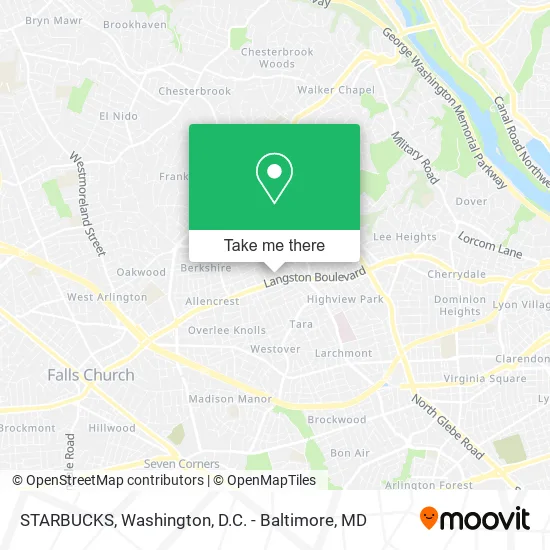
See STARBUCKS, Arlington County, on the map
Public Transit to STARBUCKS in Arlington County
Wondering how to get to STARBUCKS in Arlington County? Moovit helps you find the best way to get to STARBUCKS with step-by-step directions from the nearest public transit station.
Moovit provides free maps and live directions to help you navigate through your city. View schedules, routes, timetables, and find out how long does it take to get to STARBUCKS in real time.
Looking for the nearest stop or station to STARBUCKS? Check out this list of stops closest to your destination: Rt 29 Lee Hwy & Harrison St; N Harrison St Nb @ Langston Blvd Ns; N George Mason Dr Nb @ Langston Blvd FS; West Falls Church-Vt; East Falls Church.
Bus: 55, 51, 52.Metro: ORANGE, SILVER.
Want to see if there’s another route that gets you there at an earlier time? Moovit helps you find alternative routes or times. Get directions from and directions to STARBUCKS easily from the Moovit App or Website.
We make riding to STARBUCKS easy, which is why over 1.5 million users, including users in Arlington County, trust Moovit as the best app for public transit. You don’t need to download an individual bus app or train app, Moovit is your all-in-one transit app that helps you find the best bus time or train time available.
For information on prices of bus and metro, costs and ride fares to STARBUCKS, please check the Moovit app.
Use the app to navigate to popular places including to the airport, hospital, stadium, grocery store, mall, coffee shop, school, college, and university.
STARBUCKS Address: 2500 N Harrison St Arlington, VA 22207 street in Arlington County
- Amazon Locker-Cowabunga,
- Coinstar - Bitcoin ATM,
- Mechanic 7 Days Auto Repair,
- CMR Insurance Agency,
- Duck Donuts,
- Pet Sitting,
- Asian Massage,
- Ask1expert,
- Sila Heating, Air Conditioning & Plumbing,
- Mika Spa,
- Hair Cuttery,
- Lee Harrison Shopping Center,
- BD Organic Eats,
- Arlington Lee Highway Branch,
- Petco,
- bp,
- Kimberly Renee' Muzinski,
- Vista Medical Center - North Arlington,
- Liberty Petrol Station,
- Centurion Properties Inc
Places Near STARBUCKS (Arlington County)
- Camden Yards, Baltimore,
- Museum Of The Bible, Washington,
- Washington DC VA Medical Center, Washington,
- Capital One Arena, Washington,
- National Museum of African American History and Culture, Washington,
- Washington National Cathedral, Washington,
- Warner Theatre, Washington,
- Marriott Marquis Washington, DC, Washington,
- Sibley Memorial Hospital, Washington,
- The Anthem, Washington,
- National Zoo, Washington,
- Georgetown, Washington,
- Rock Creek Tennis Center, Washington,
- PG Mall, Prince George's County,
- Amazon Hq2, Arlington County,
- Westfield Montgomery Mall, Montgomery County,
- Basilica of the National Shrine, Washington,
- National Mall, Washington,
- Pennsylvania Ave NW (3rd st and pennsylvania), Washington,
- M&T Bank Stadium, Baltimore
How to get to popular places in Washington, D.C. - Baltimore, MD with public transit
Get around Arlington County by public transit!
Traveling around Arlington County has never been so easy. See step by step directions as you travel to any attraction, street or major public transit station. View bus and train schedules, arrival times, service alerts and detailed routes on a map, so you know exactly how to get to anywhere in Arlington County.
When traveling to any destination around Arlington County use Moovit's Live Directions with Get Off Notifications to know exactly where and how far to walk, how long to wait for your line, and how many stops are left. Moovit will alert you when it's time to get off — no need to constantly re-check whether yours is the next stop.
Wondering how to use public transit in Arlington County or how to pay for public transit in Arlington County? Moovit public transit app can help you navigate your way with public transit easily, and at minimum cost. It includes public transit fees, ticket prices, and costs. Looking for a map of Arlington County public transit lines? Moovit public transit app shows all public transit maps in Arlington County with all Bus, Train, Metro, Light Rail and Ferry routes and stops on an interactive map.
Washington, D.C. - Baltimore, MD has 5 transit type(s), including: Bus, Train, Metro, Light Rail and Ferry, operated by several transit agencies, including WMATA, Montgomery County Ride On, Fairfax Connector, TheBus, PRTC, DASH - Alexandria, Arlington Transit (ART), RTA of Central Maryland, MDOT MTA, MDOT MTA Light RailLink, MDOT MTA Commuter Bus, MDOT MTA Local Bus, FXBGO!, Virginia Railway Express (VRE) and MARC